A long hike to the "Eastern Alps" and uncover the beauty of Siguniang
Preface
The day I approached the Fourth Sister, I discovered that gentleness is beautiful, as is pride. This beauty materializes into beautiful peaks, beautiful ravines, beautiful flowing clouds, and beautiful streams. Like a graceful young woman, yet also like a heroic warrior, she stands between heaven and earth.
And I, traveling through this world and mountains, became a person in the painting.
A quick look at Mount Siguniang
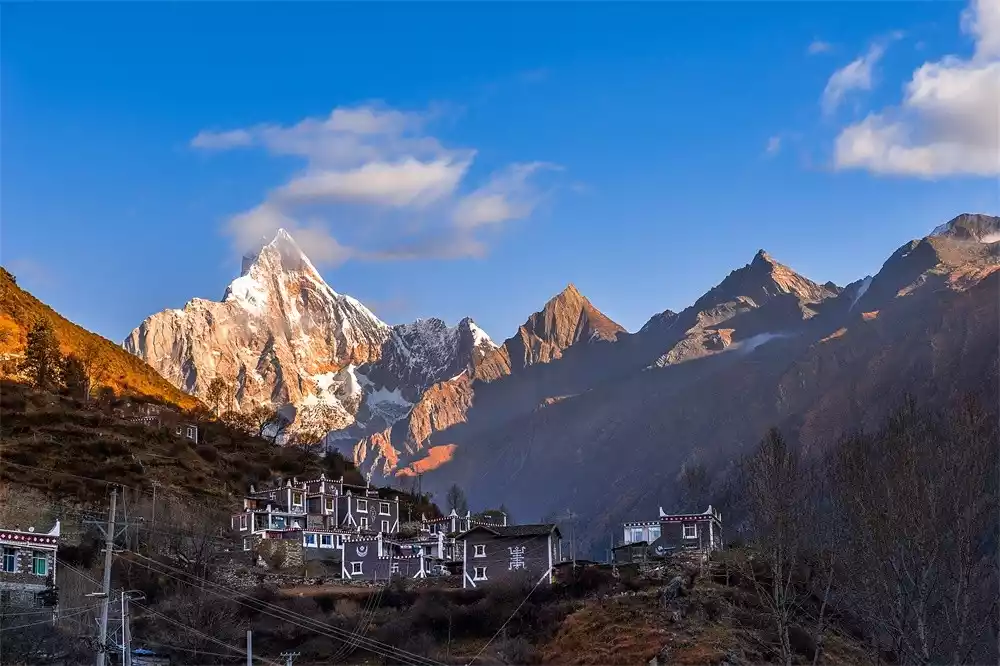
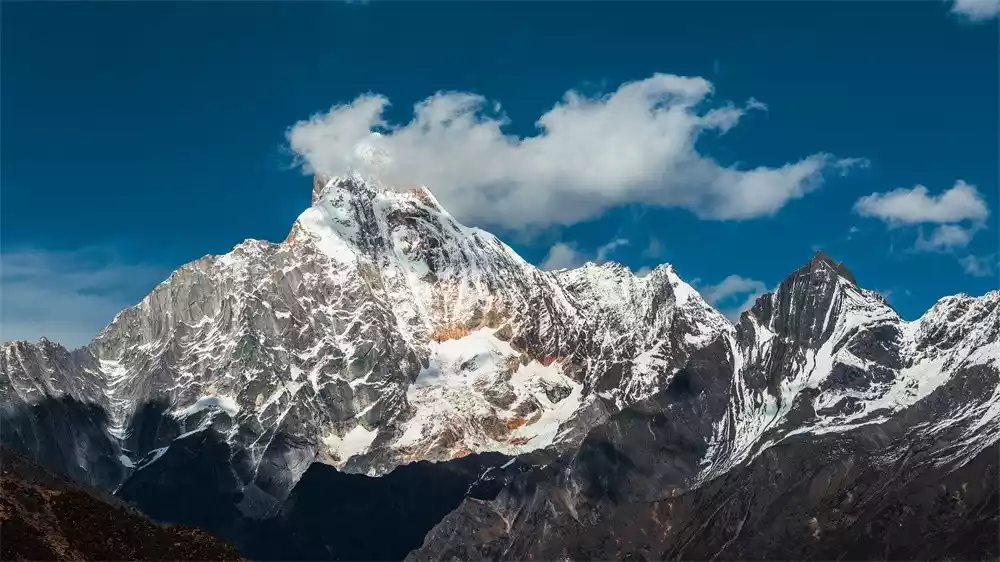
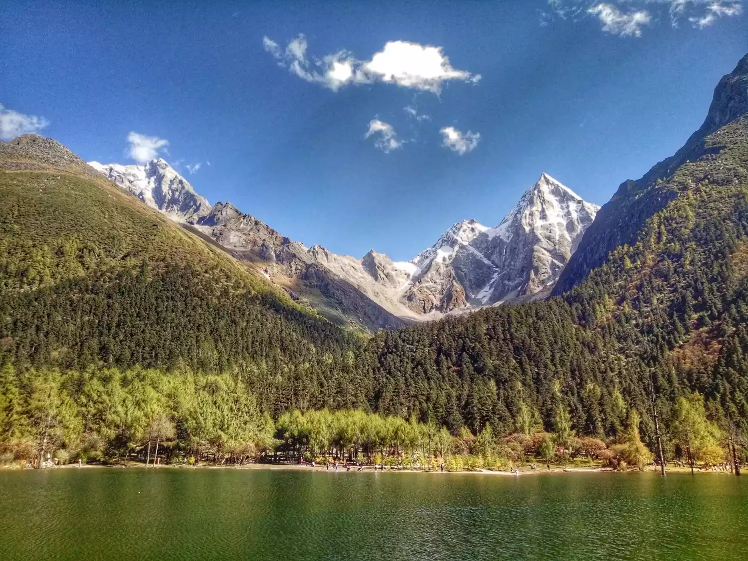
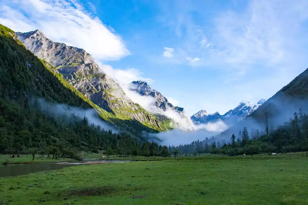
Siguniang Mountain is located in Aba Prefecture, Sichuan Province. It consists of four consecutive peaks in the Hengduan Mountains. The four peaks in the picture above are Yaomei Mountain with an altitude of 6,250 meters, Sanguniang Mountain with an altitude of 5,664 meters, Erguniang Mountain with an altitude of 5,454 meters, and Daguniang Mountain with an altitude of 5,355 meters.
According to local Tibetan legend, the mountain was transformed from four beautiful girls, hence the name. The four peaks are aligned and are covered with white snow all year round, just like beautiful girls wearing white gauze.
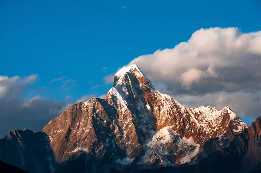

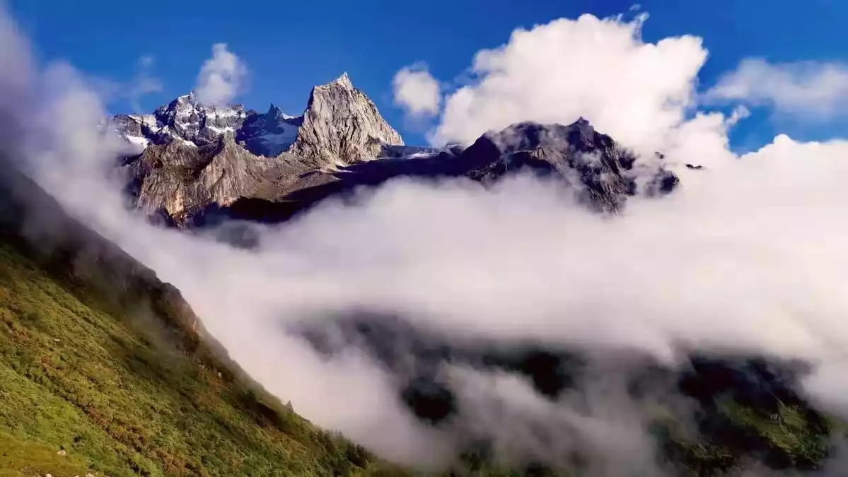
"After Shushan" Yaomei @Xura
Among them, Siguniang Yaomei Peak is the highest peak in Aba Prefecture and the second highest peak in Sichuan. The mountain is steep and points to the blue sky. Covered with ice and snow, it shines with silver light. It is known as the "Queen of Sichuan Mountains" (Gongga is the "King of Sichuan Mountains").
There is snow here all year round and the foothills are covered with dense forests. Western mountaineers and rock climbers call it the "Eastern Alps". It is an ideal place for outdoor sports such as mountaineering.
The Siguniang Mountain Scenic Area covers an area of more than 2,000 square kilometers and consists of Siguniang Mountain, Balang Mountain, Shuangqiao Valley, Changping Valley, Haizi Valley and other parts.
Changpinggou, with a total length of 29 kilometers and an area of approximately 100 square kilometers, is a long, gentle canyon. Siguniang Mountain is located 16 kilometers into the gorge. Only some sections of the road in the gorge are accessible to vehicles, while most of the rest can only be accessed on foot or by horseback.
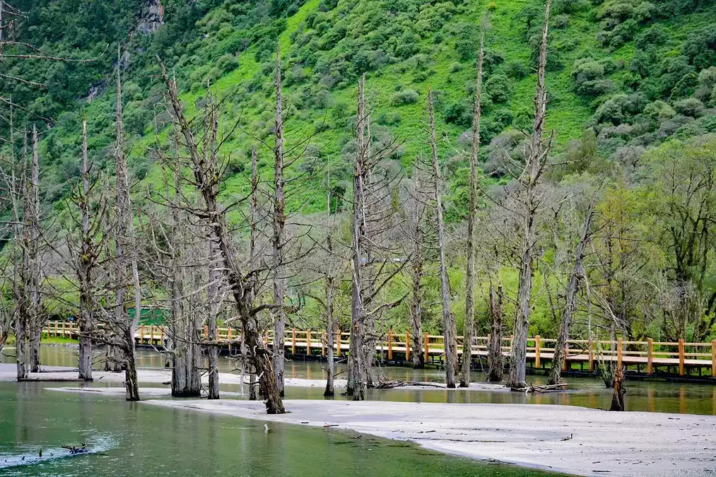
The main attractions include Zhangmu Tibetan Village, Lama Temple, Ancient Cypress Path, Dead Tree Beach, Jingxin Cave, Bathing Pool, Leigu Stone, Jinji Ridge, etc. You can reach Bipenggou by passing Changpinggou and bypassing Siguniang Mountain.
Bipenggou is located in Li County, Aba Tibetan and Qiang Autonomous Prefecture, on the back of Mount Siguniang. People often call it the back view of Mount Siguniang. Mount Siguniang is exceptionally beautiful, and its back view also has a unique charm!
The unique charm of long wear
Entering from Changpinggou and exiting from Bipenggou, the two scenic spots are connected in one go, which is called Changpinggou Crossing Bipenggou, or simply "Changchuanbi". This route is also known by many outdoor enthusiasts as "The Kiss of Sigla - Crossing the Eastern Alps".
1. One of China's top ten classic hiking routes
The Long Traverse is ranked sixth among China's most popular hiking routes. Some say that if you haven't been to the Alps, you absolutely must hike the Long Traverse. Walking at the foot of the snow-capped mountains, the most breathtaking sights are the snow-capped peaks beside you, the grasslands beneath your feet, and the alpine lakes before you. Experience the charm of the "Eastern Alps."
2. Plateau Hiking Entry Route
After trekking through many mountainous terrains in East China, including the Wugong Mountains in the south and the Taihang Mountains in the north, I decided one day that it was time to head out for a hike on the plateau. So I asked a group leader friend where I should go for my first plateau hike.
A friend said: "It's either heaven, rain and collapse, or it's long and thick."
One is Yunnan and the other is Sichuan.
After searching for information, doing homework, and rolling the dice, I finally chose the fourth girl.

As a newbie in the plateau, I suffered from altitude sickness in the camp on the first night of hiking. I felt a little dizzy and weak, but I insisted on not taking oxygen. Fortunately, I adapted after a night of adjustment, and crossed the pass at an altitude of over 4,700 meters on the third day without any problems.
The 3-day hike covered about 40 km, with a cumulative ascent of about 1,500 meters. From my personal experience, this intensity is the best choice for first-time plateau hikers, and my original choice was not wrong.
3. An adventure full of surprises
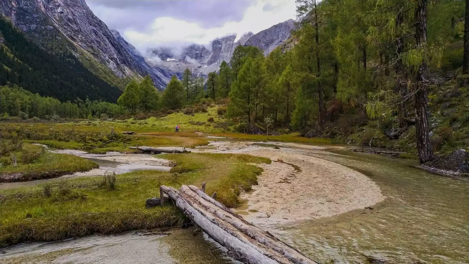
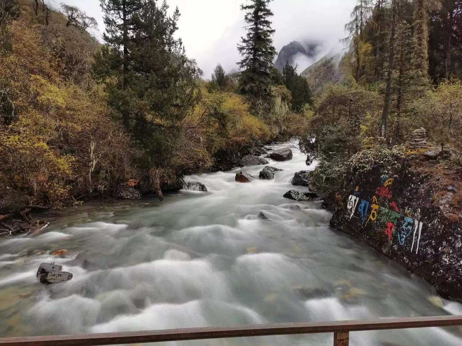
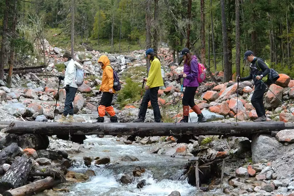
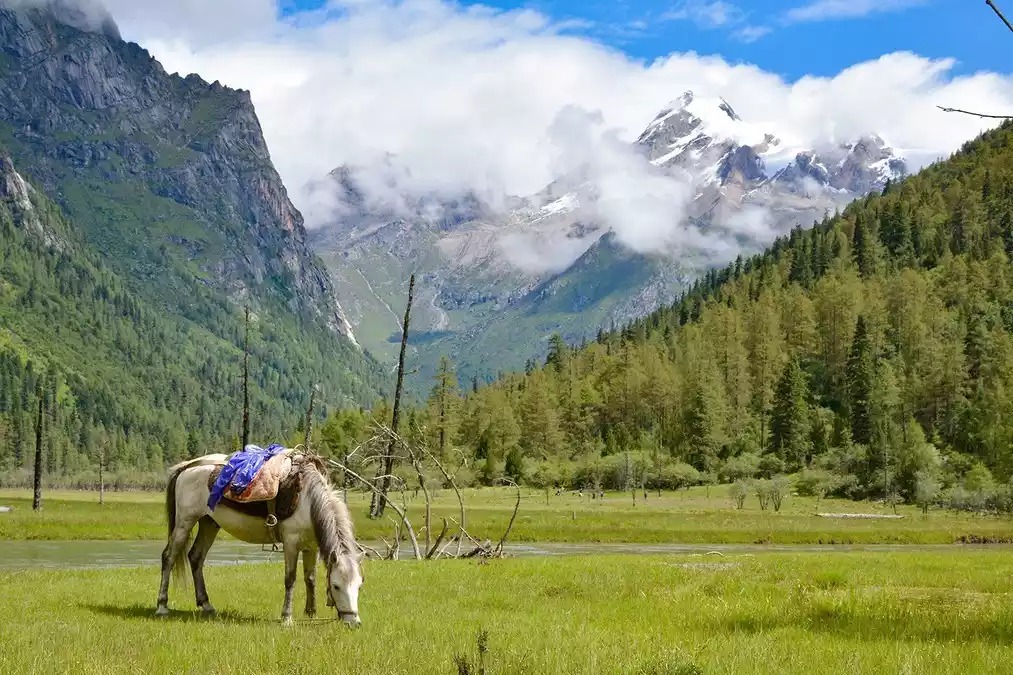
From cement roads to wooden plank paths, gravel to mud, pine needle-paved paths, swamps, riverbanks, and wading paths... the ever-changing path beneath your feet excites you. Quiet springs, cascading waterfalls, lush forests, towering glaciers... the ever-changing scenery before your eyes invites you to explore a new round of mysteries. Each of the mountains here has its own unique characteristics, captivating you and inviting you to quietly admire them, unwilling to disturb the tranquility.
Crossing itinerary
Travel route at a glance
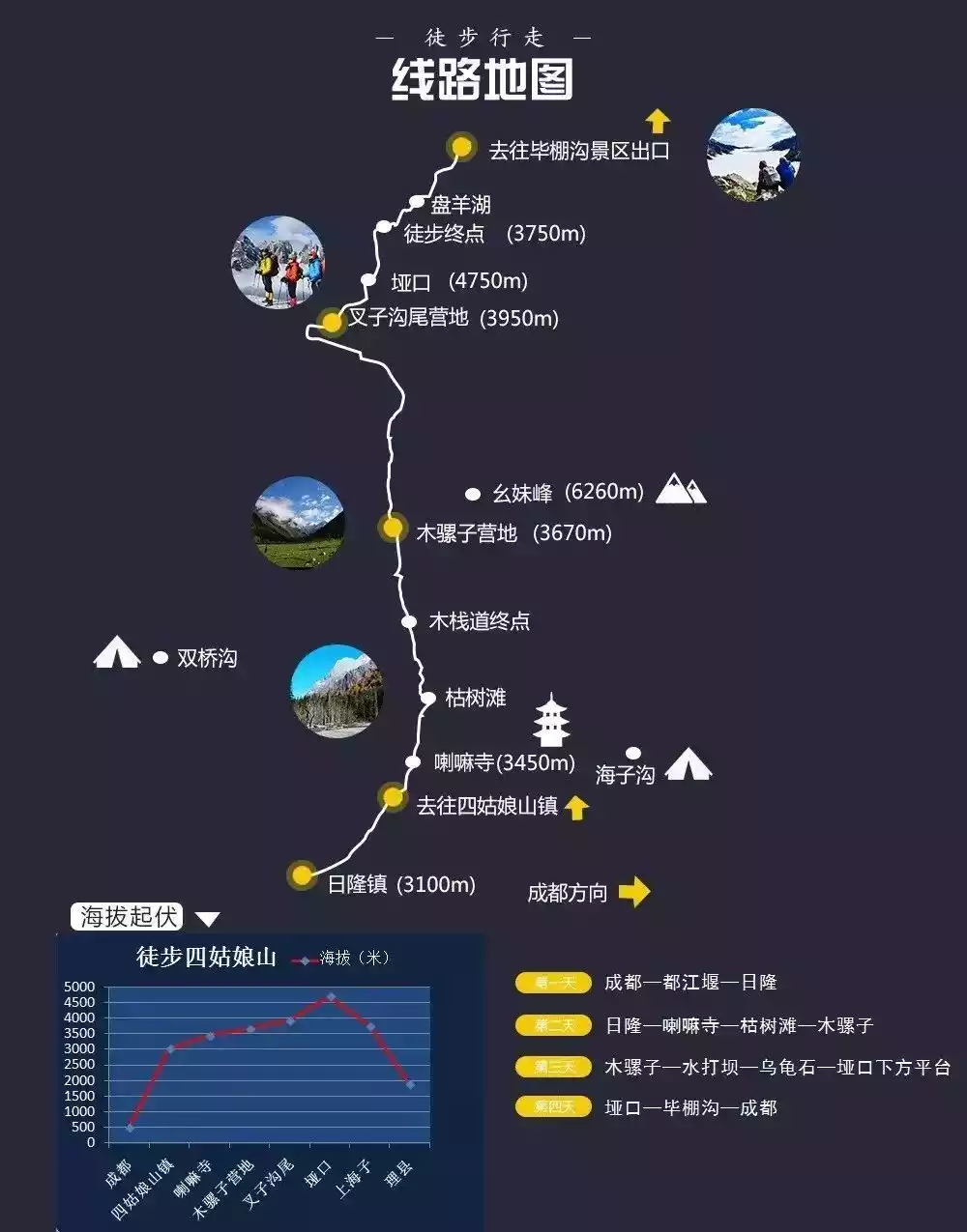
Itinerary Details
The route from Changpinggou to Bipinggou is about 40km long. Generally, you need to arrive at Rilong Town from Chengdu one day in advance. If you come to Chengdu from other places, the whole journey takes 5 days, of which the hike is divided into 3 days and 2 nights. The difficulty increases gradually every day. The end point on the first day is Mumulizi Camp, the end point on the second day is Chazigouwei Camp, and you reach Bipinggou on the third day.
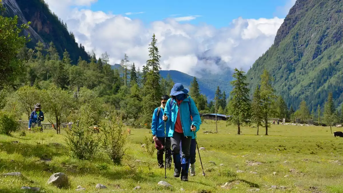
Day 1 Rilong (3100m) - Lama Temple - 5km Dead Tree Beach - 7km Mumulizi Camp (3670m)
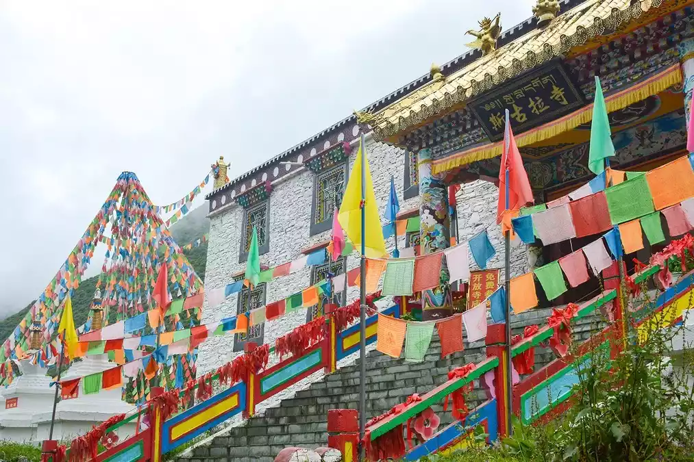
After having breakfast in Rilong, we took the Changpinggou sightseeing bus to the Lama Temple, and the hiking trip officially began.
You can hand over the big bag to the groom and travel light. First, you will pass a 5km scenic wooden plank road to reach the Dead Wood Beach. After passing the Dead Wood Beach, you will enter the mountain forest and alpine meadow crossing route where there is no mobile phone signal.
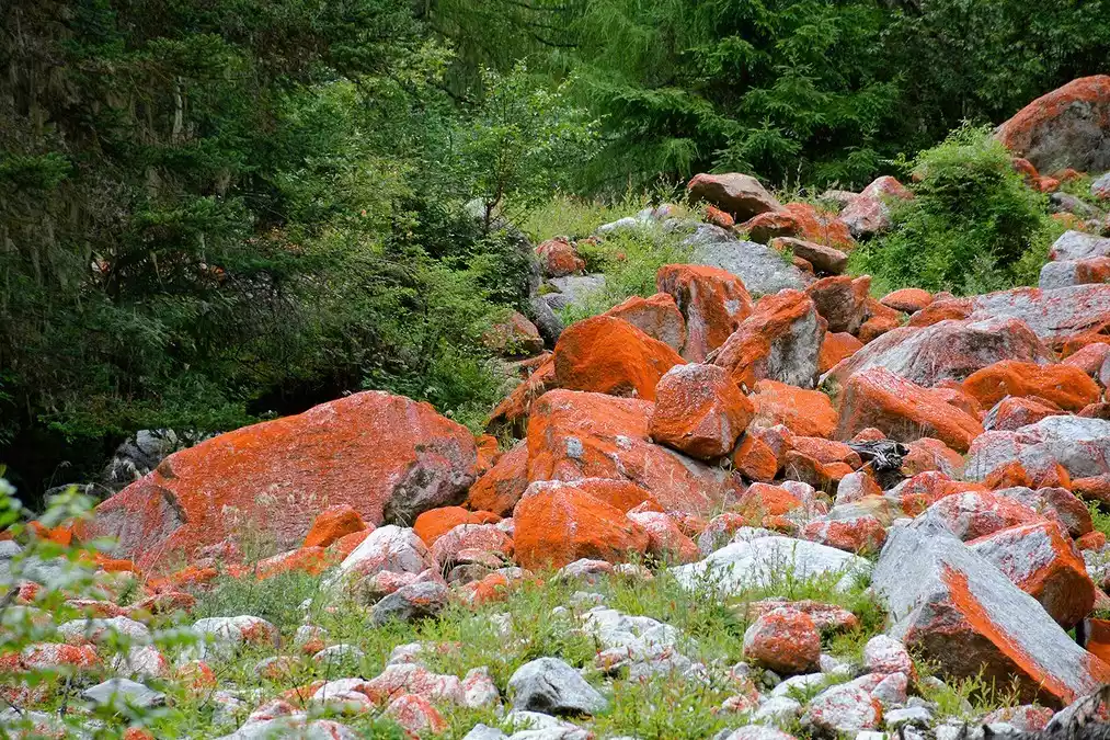
Scenic spots along the way: Ancient cypress path, waterfalls and springs, Zhangmu Tibetan village, red stone beach, and dry lake.
Tips:
Today's hike lasts about 6 hours;
Breakfast: Simple breakfast in Rilong Town
Lunch: Road meal
Dinner: Cooked at the Wooden Mule Camp
Day 2 Mumulizi Campsite - 8km Shuida Dam - 6km Chazigouwei Campsite (3950m)
After the previous day's hike, my body was basically acclimatized. Today's hike was still 14 kilometers, but I felt relatively relaxed. We passed Shuidaba, Turtle Rock, and Yangmantai in order and arrived at the Chazigouwei camp.
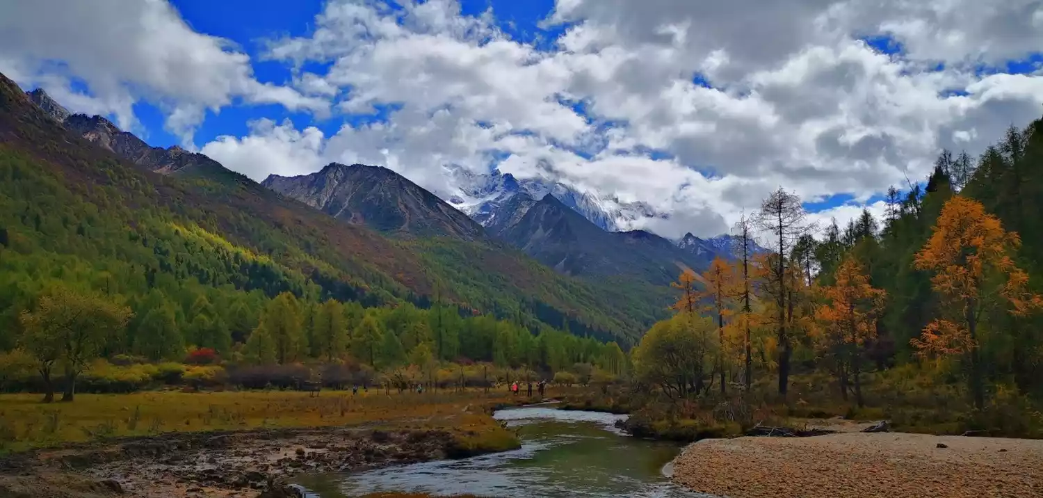
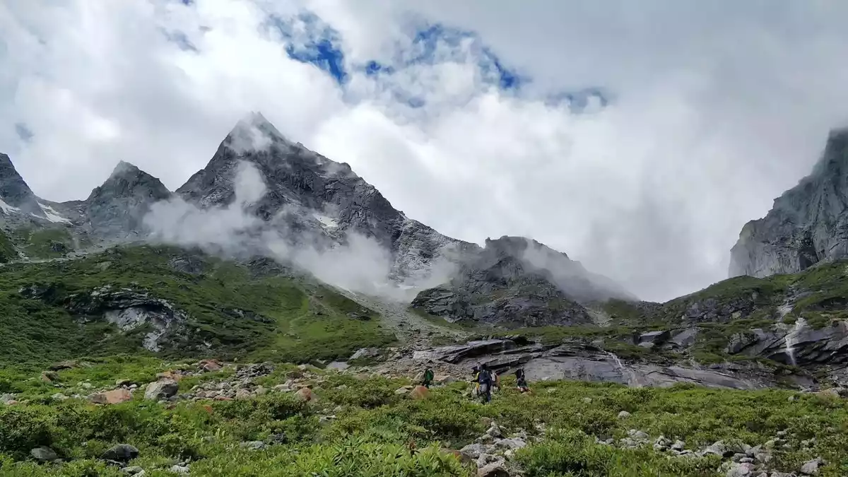
Scenic spots along the way: Going deep into the Siguniang Mountain Nature Reserve, you can feel the beauty of the original ecology, snow-capped mountains, yak herds, forests, canyons, rivers, and camping in the sea of flowers. Perhaps this is the joy of hiking.
Tips:
Today's hike will take 6-7 hours.
Breakfast: Simple meal at the Mule Camp
Lunch: Dry food on the road
Dinner: Cooked at the Fork Valley Camp
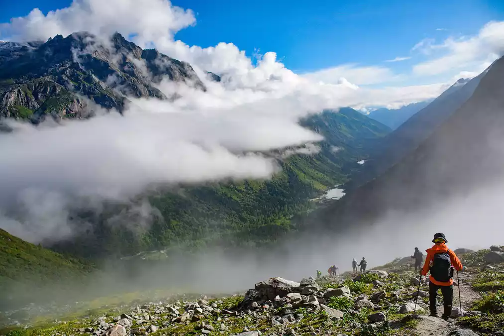
Day 3: Chazigouwei Campsite - 6km Pass (4750m) - 6km Three Trees Campsite (3750m) - 2km Argali Lake

Today is the most difficult day of hiking and requires a lot of physical strength, so you must get enough rest the night before.
If you want to return to Chengdu today, you have to get up at two in the morning and set off at three in the morning under the starry sky. This is when a headlamp comes in handy.
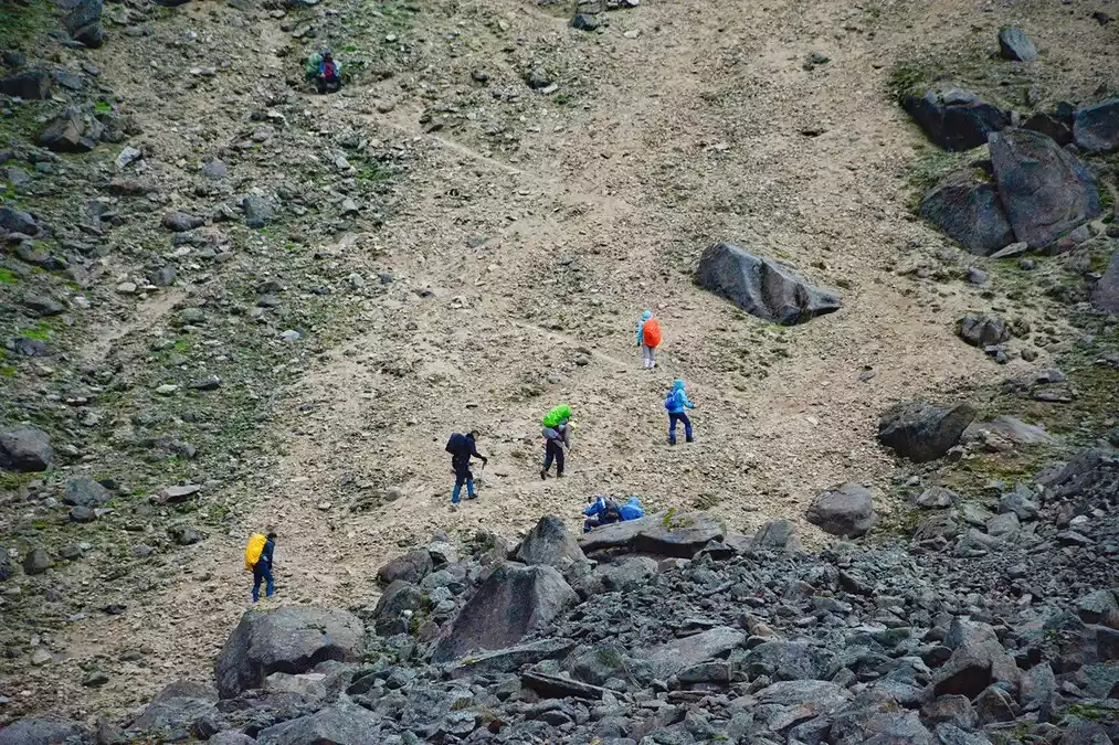
The distance from the camp to the pass is about 6 km. The first section is very steep, and it is dark, so be extra careful. The trail becomes slightly flatter later, and after passing a large platform, the pass is right in front of you.
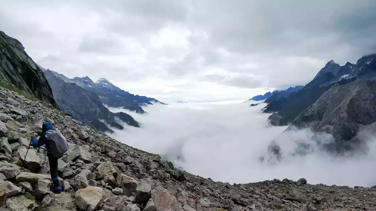
The pass is 4750m above sea level, which is the highest point of the Changchuanbi route. There is a high probability that you can see a very magnificent sea of clouds. Of course, the wind is generally very strong.
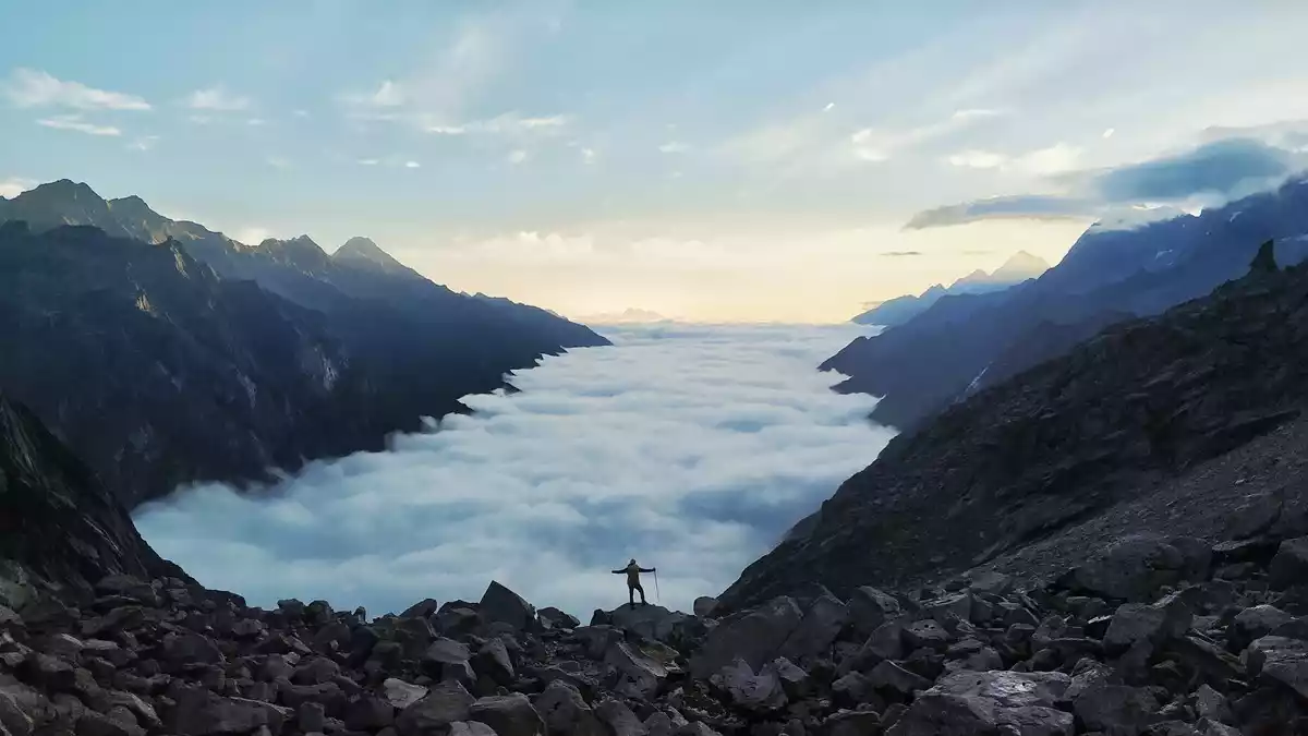
After crossing the pass, continue downhill to the Three Trees Camp in Bipenggou, then hike to Argali Lake. Congratulations, you've successfully completed the Siguniang Long Crossing. You can take a shuttle bus to the ticket office, then transfer to the scenic bus to the parking lot. Return to Chengdu by any means you choose.
Tips:
Note: Horses cannot cross the pass. Today we need to reload and hike. There are porters along the way. I forgot the price, but it's about 600 yuan per day.
Today's hike lasts about 10 hours;
Breakfast: Simple meal at Fork Valley Camp
Lunch: Dry food for the journey
Dinner: Lixian or Chengdu
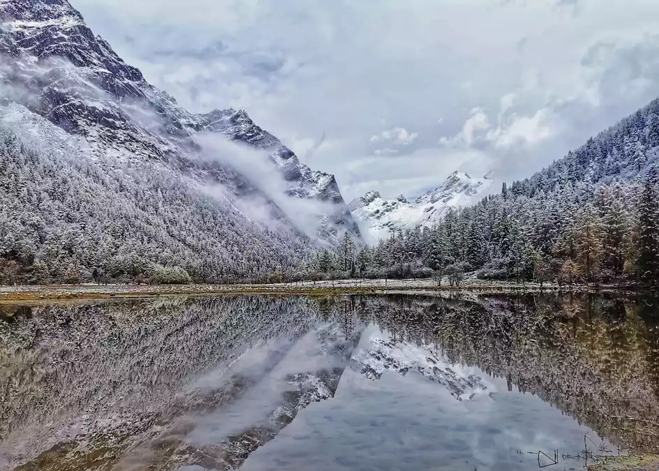
The scenery of late autumn and early winter @Hamburger
Pre-trip checklist
1. Clothing preparation
(1) Tops: quick-drying underwear + fleece + jacket in spring and autumn. If the temperature difference between morning and evening is large, bring a thin down jacket. In summer, quick-drying long-sleeved T-shirt or hiking shirt + jacket;
(2) Pants: quick-drying pants + combat pants in spring and autumn; quick-drying pants or combat pants in summer;
(3) Shoes: mid-high waterproof hiking shoes;
(4) Socks: Coolmax quick-drying socks are recommended;
(5) Hat: A quick-drying baseball cap or an outdoor bucket hat is fine;
(6) Others: 2~3 sets of underwear and socks, and some toiletries
2. Equipment preparation
(1) Backpack: 30L carry-on backpack + 60L pannier bag;
(2) Hiking equipment: trekking poles + snow glove + crampons + warm knee pads + headlamp;
(3) Camping equipment: tent + sleeping bag with a temperature below -10 degrees Celsius + moisture-proof mat + tableware
(4) Personal belongings: 1L insulated water bottle or kettle + waterproof bag + sunscreen + fruit + power bank, beef sticks, chocolate and other energy supplies;
(5) Documents: A small amount of cash + ID card
(6) Medicines: cold medicine, digestive medicine, Band-Aids, Fengyoujing, Rhodiola rosea

FAQs
1. Is the long wear very strenuous? Will it make it difficult to walk?
Answer: The Long Crossing is a mountain hike at an altitude of 3000-4700m. The whole journey is 40km, with a cumulative climb of 1600m. It is completed in 3 days. It is a medium-intensity hiking route. Participants need to regularly participate in outdoor activities or physical exercise and have multi-day hiking experience.
2. Will I experience altitude sickness? What should I do if I do?
A: The highest elevation along the way reached over 4,700 meters. If this is your first time in a high-altitude area, there's a 50% chance of experiencing altitude sickness. Altitude sickness typically occurs before bedtime, with symptoms including headaches, drowsiness, nausea, and fatigue. Don't be afraid of altitude sickness; most people can adapt to it.
Drinking more water and eating more fruits during hiking, maintaining a good attitude and getting enough rest can effectively prevent altitude sickness.
3. How to exercise before hiking?
Keep running or low-altitude mountaineering for a month (preferably long-term) before departure to build up your energy and strengthen your cardiopulmonary function. Reduce your exercise a week before departure to ensure adequate rest.
4. Are there any supply points along the way?
Answer: Water will be sold on the first day of hiking. Hot water will be supplied at each campsite. You need to bring your own dry food, fruits and other food.
5.Which season is the best for long wear?
A: Spring, summer, and autumn are all suitable, each with its own unique beauty. In spring, flowers bloom, while in summer, the grass is green and oxygen-rich. However, there is a lot of rain, and the Siguniang Mountain area begins to turn yellow in mid-September. In October, it enters late autumn and may begin to snow, making hiking more difficult.