Live Your Best Lives
Sichuan, Yunnan, Qinghai, and Tibet offer many hidden gems, while the Hengduan Mountains reveal Shambhala (Part 1) – South of the Colorful Clouds (Yunnan)
Introduction:
1. Wonders along the geographical dividing line. Wang Anshi's observation that "magnificent and extraordinary sights often lie in remote and dangerous locations" is truly true. China's famous mountains and rivers, World Heritage sites, 5A scenic spots, and diverse ethnic groups are highly concentrated along the dividing line between the three major terrain terraces. The first terrace, above 4,000 meters above sea level, is dominated by plateaus – bounded by the Kunlun Mountains, the Qilian Mountains, and the Hengduan Mountains. The second terrace, between 1,000 and 2,000 meters above sea level, is dominated by plateaus and basins – bounded by the Greater Khingan Range, the Taihang Mountains, the Wushan Mountains, and the Xuefeng Mountains. The third terrace, below 500 meters, is dominated by plains and hills. 2. Hengduan Mountains.
A Qing Dynasty official named Huang Maocai was dispatched to Tibet by Ding Baozhen, the Governor-General of Sichuan. Gazing westward at the rolling hills, he couldn't help but exclaim, "This is truly the Hengduan Mountains!" Perhaps this is the origin of the name.
Sixty-five million years ago, the Indian Plate violently collided with the Eurasian Plate from south to north, causing a dramatic uplift of the Qinghai-Tibet Plateau and releasing pressure to its east and west ends. To the east, it encountered stubborn resistance from the Yangtze Plate. Where the two plates collided, the land squeezed and contracted, forming large-scale folds and faults, which gave rise to the Hengduan Mountains.
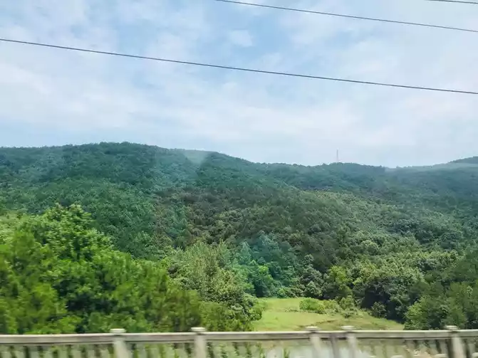
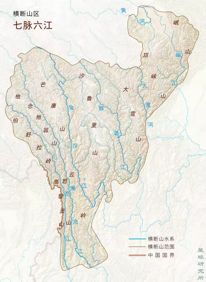
Mountain ranges usually extend in a certain direction, which we call the direction of the mountain range. Among the many mountain ranges in my country, the east-west and northeast-southwest direction are the most numerous, with three groups of mountain ranges each. The east-west direction mountain ranges include the Tianshan-Yinshan, Kunlun-Qinling, and Nanling groups; the northeast-southwest direction mountain ranges include the Greater Khingan Range-Taihang-Wushan-Xuefeng, Changbai-Wuyi, and Taiwan Mountain groups. In addition to the two types of mountain ranges mentioned above, my country also has north-south direction mountain ranges, the most important of which is the Hengduan Mountains located in the southwest of my country. The Hengduan Mountain area includes seven north-south direction mountain ranges (from west to east): Boshula Mountains-Gaoligong Mountains, Tanianthawong Mountains-Nu Mountains, Mangkang Mountains-Yunling Mountains, Shaluli Mountains, Daxue Mountains, Qionglai Mountains, and Min Mountains, which we call the "Seven Hengduan Mountains." It also includes six rivers flowing parallel north to south (from west to east): the Nu, Lancang, Jinsha, Yalong, Dadu, and Min rivers, collectively known as the "Six Hengduan Rivers." Some scholars believe the Hengduan Mountains are bounded to the east by the Min Mountains, to the west by the Boshula Mountains and Gaoligong Mountains, to the south by the Baoshan-Dali-Lijiang-Xichang line, and to the north by the Shiqu-Zoigê line. The Hengduan Mountains are home to one of the areas with the highest concentration of our secrets.
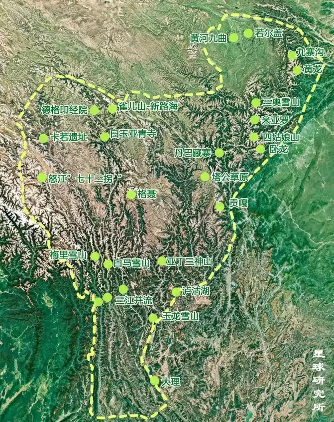
The World Heritage Sites include: Mount Emei, a branch of the Qionglai Mountains; Dujiangyan Irrigation System, where the Minjiang River flows out of the mountains; Mount Qingcheng, a branch of the Qionglai Mountains; Huanglong Valley; Jiuzhaigou Valley; the Giant Panda Sanctuary; the Old Town of Lijiang; and the Three Parallel Rivers. Four of the ten most beautiful mountains are listed: Meili Snow Mountain, Sanshen Mountain, Mount Gongga, and Mount Emei. Four of the ten most beautiful canyons are listed: Tiger Leaping Gorge on the Jinsha River, Meili Grand Canyon on the Lancang River, Nujiang Grand Canyon, and Jinkou Grand Canyon on the Dadu River. Two of the most beautiful ancient villages and towns are listed: Danba Tibetan Village and Dayan Ancient Town. One of the ten most beautiful waterfalls is Nuorilang Waterfall. One of the most beautiful glaciers: Hailuogou Glacier. One of the most beautiful forests: Baima Snow Mountain's alpine rhododendron forest. One of the most beautiful wetlands: Ruoergai. One of the most beautiful grasslands: Western Sichuan's alpine grassland. (The most beautiful are all referenced in "National Geographic China: Beauty China")
1. Lijiang
In the summer of 2012, I took a Sichuan Airlines flight from Chengdu, about 40 minutes, to Lijiang Airport.
Transferred to a tourist bus to Lijiang City. The moon was full, the sky was clear, and the breeze was gentle.
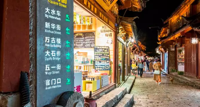
Walked into Lijiang Old Town. It was late at night, but the lights were bright and the music was incessant. My companion, Brother Liu, couldn't help but sigh, "I thought I was late, but it's still early." Still a little tired from the journey, we checked into an old house B&B for the night.
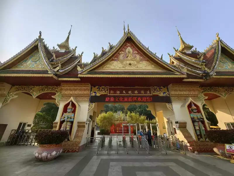
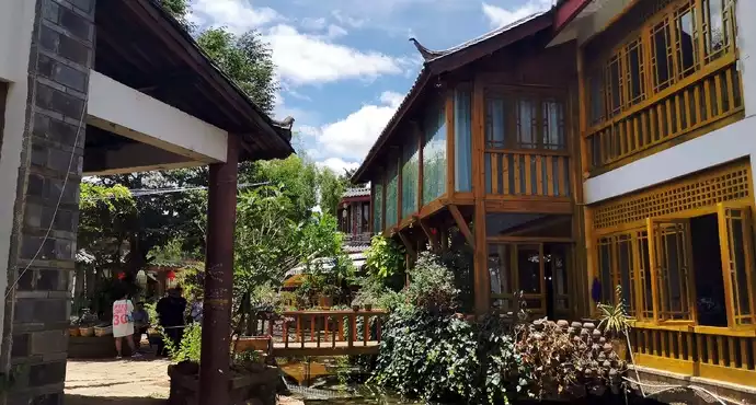
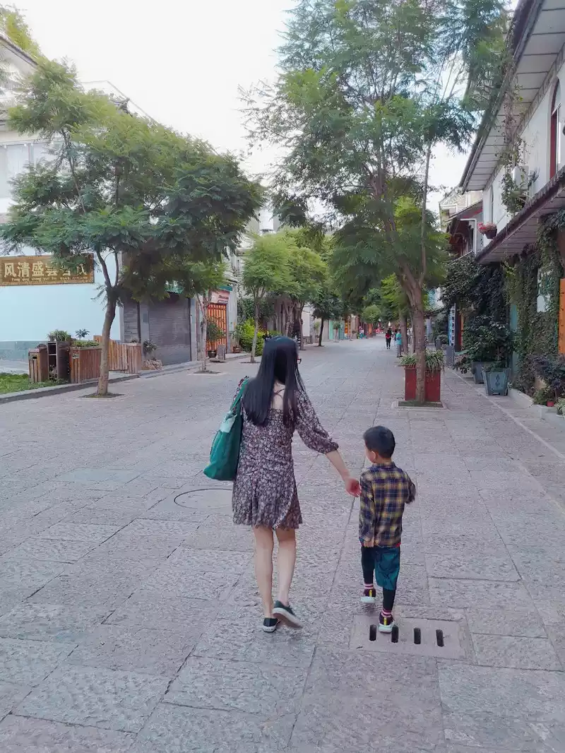
The next day, we went to Lashi Lake near Lijiang. Perhaps it was the dry season, so there was no plateau lake, only a wetland, nothing memorable. From Lashi Lake, we returned to Shuhe Ancient Town. Shuhe Ancient Town, known as "Shaowu" in the Naxi language, is named after the Jubao Mountain behind the village, which resembles a stacked peak. The name evolved from the mountain, meaning "village beneath the peak." It is a well-preserved and important market town on the Ancient Tea-Horse Road. The Ancient Tea-Horse Road refers to a popular international trade route in southwest China, primarily transported by horse caravans. It served as a corridor for economic and cultural exchange among the country's ethnic groups. It was divided into three major routes: the Shaanxi-Gansu, the Shaanxi-Kangxi-Tibet, and the Yunnan-Tibet routes. The Yunnan-Tibet Tea-Horse Road was established around the late sixth century AD. It began in Simao and Pu'er, Yunnan's main tea-producing areas, in the south, passing through present-day Dali Bai Autonomous Prefecture, Lijiang Prefecture, and Shangri-La, before entering Tibet and reaching Lhasa. Shuhe Ancient Town, nestled against Jubao Mountain and leaning against Lashi Lake, lies adjacent to Dayan Ancient Town, with a gurgling stream flowing through the town. On both sides of the stream, Naxi dwellings, taverns, guesthouses, and shops, all with their distinctive Naxi ethnic characteristics, feature winding corridors and high eaves, each embracing the terrain and brimming with intrigue. The bluestone streets, trodden by horse caravans and pedestrians for years, are patinated by time and gleam with a faint, clear light. The shops here are small, yet they display a dazzling array of goods, dazzling the eyes of visitors.
Shuhe Ancient Town offers no blaring music, no shouting vendors, and no throngs of tour groups. The occasional neighing and jingling of bronze bells from the horses of Sifang Street fills the air. Life here is slow and leisurely, as if each ray of sunshine brings a new lease of life.
When the last ray of sunlight sets, Shuhe Ancient Town prepares for sleep...
When the last ray of sunlight sets, Dayan Ancient Town awakens...
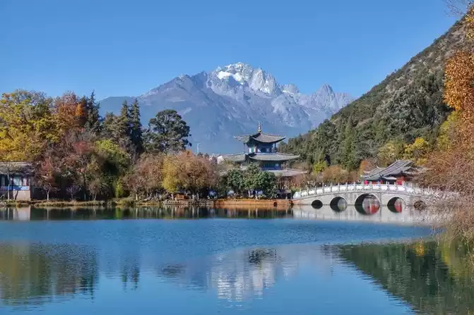
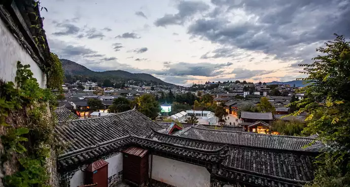
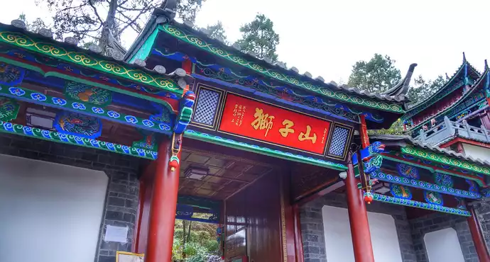
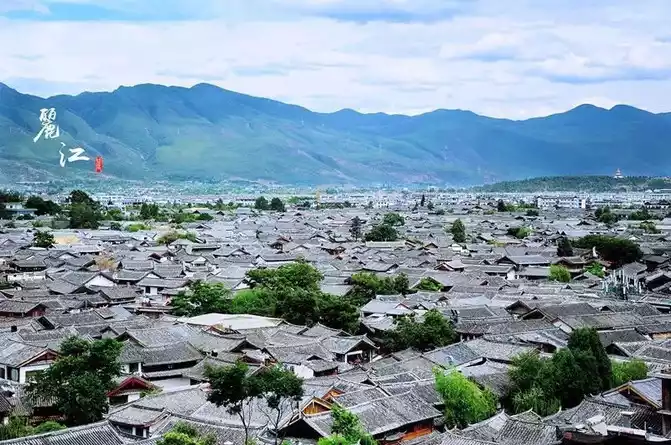
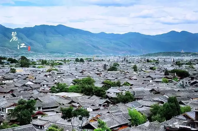
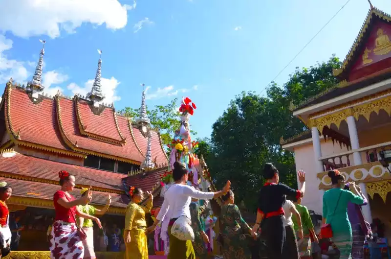
Dayan Ancient Town is what we often refer to as Lijiang Old Town. Today's Lijiang City consists of the Old Town and the New Town. The Old Town is Dayan Ancient Town. Meltwater from Jade Dragon Snow Mountain nourishes the Lijiang Basin, making it a rich and productive hub for goods distribution. The Naxi people living there have always revered Jade Dragon Snow Mountain as a sacred mountain. In the 15th year of the Hongwu reign of the Ming Dynasty (1382), Ajia Ade, the prefect of Tong'an Prefecture, surrendered to the Ming Dynasty, which established the Lijiang Military and Civilian Office. Zhu Yuanzhang bestowed the surname Mu on Ajia Ade and appointed him hereditary prefect. Consequently, Lijiang remained under the control of the Mu clan chieftains for a long time. In the 16th year of the Hongwu reign of the Ming Dynasty (1383), Mu De built the "Lijiang Military and Civilian Office" at the foot of Lion Mountain. The Qing Dynasty abolished the Mu clan chieftainship system with the "Reform of the Natives into Officials" policy, and central government officials were sent to administer the Mu clan. The "Mu clan" we see today is a modern replica and lacks any historical or cultural value.
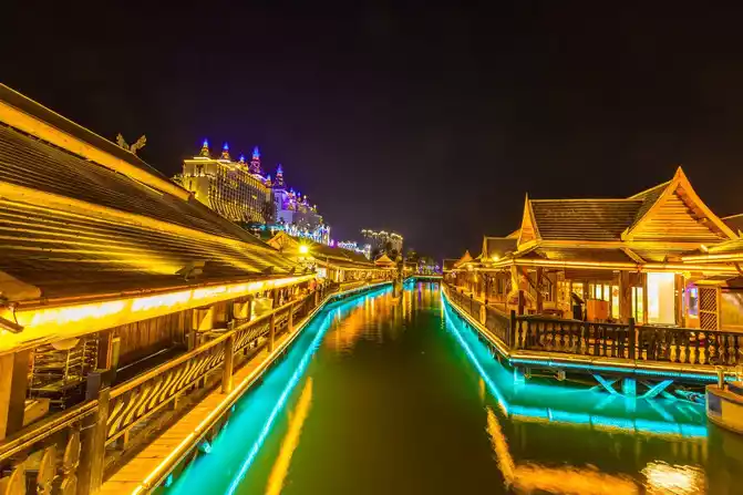
Darkness fell over Dayan Ancient Town, its lights gradually lighting up, and people from all directions began to arrive and gather. The ancient town gradually became lively, crowded, and seething, reaching a climax around eight or nine o'clock in the evening. As the people on the streets gradually left, the ancient town's taverns remained awake, people chatting quietly, and singers sang country songs. As the wine flowed, they gradually became dazed by the colorful lights, and the music became faster and faster, becoming more and more rock and roll. At some point, the singer had left the stage, and the man with a voice thick with alcohol and smoke hysterically released his grief and indignation at the world. ...
The night continued until they were drunk. This is the charm of Lijiang. 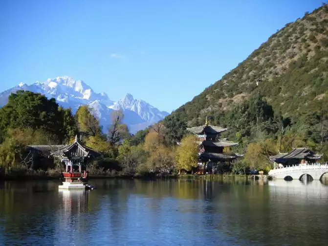
Second Turn
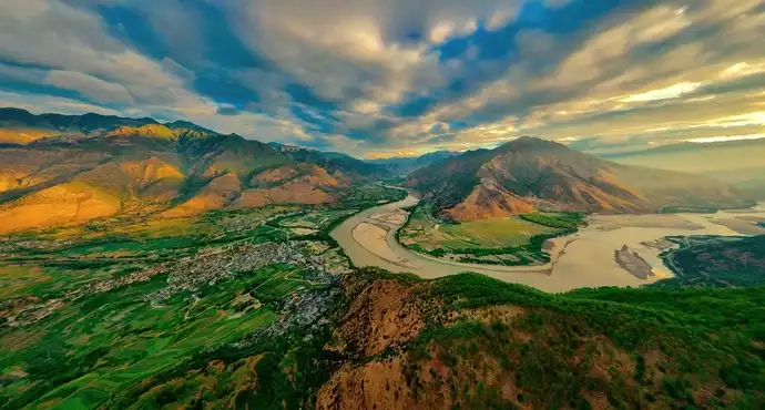
The journey from Lijiang to Shangri-La City involves crossing mountains and hills. The bus ride takes about two hours to the First Bend of the Yangtze River.
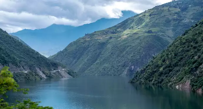
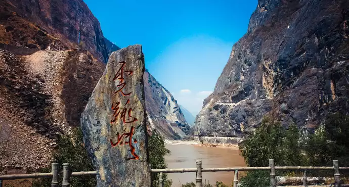
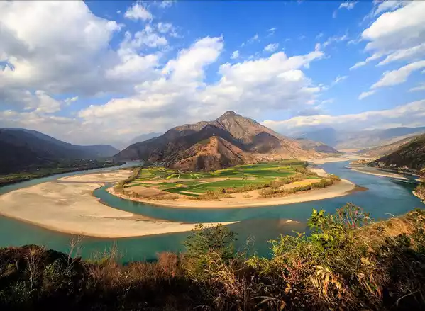
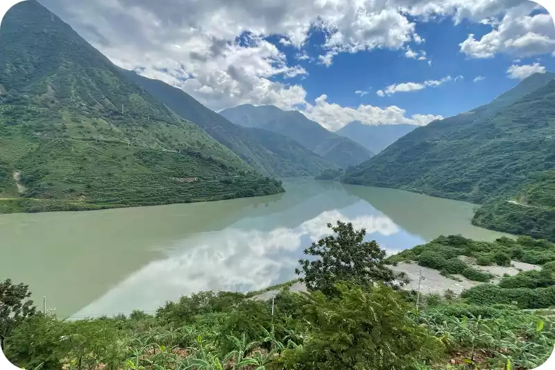
The First Bend of the Yangtze River is located between Shigu Town in Lijiang City in northwestern Yunnan Province and Shasongbi Village in southern Shangri-La County, at an altitude of approximately 1,850 meters. The Yangtze River originates from the Nyainqentanglha Mountains in Qinghai Province. Its main source is the Tuotuo River, its northern source is the Chumar River, and its southern source is the Xingxiu Lake in Dangqu. The Jinsha River, the upper reaches of the Yangtze River, becomes the Yangtze River after its confluence with the Minjiang River in Yibin. During the Song Dynasty, the river was rich in alluvial gold, and the saying "Gold is born in Lishui" was popular. Due to the large number of gold prospectors, the name Lishui was renamed the Jinsha River. After field research, the Ming Dynasty geographer Xu Xiake proposed that "the source of the Yangtze River must be traced back to the Jinsha River," correcting a long-held misconception. Folk legend tells of a journey by three sisters: the Nujiang, Lancangjiang, and Jinshajiang rivers. A dispute arose midway. The eldest and second sisters stubbornly headed south, while the Jinsha girl, determined to seek light and love in the east, where the sun rises. Upon reaching Gugu, she bid farewell to her sisters and resolutely turned east. The point where the Jinsha girl turned back formed the first bend of the Yangtze River.
Looking at the map, the Jinsha River turns at Shigu Town, ending the Three Parallel Rivers pattern, flowing northeast through Tiger Leaping Gorge before turning south to form the later "Mother River" Yangtze River. Otherwise, like the Lancang and Nu Rivers, it would have flowed out of the country, heading to Southeast Asia, marrying off to foreign countries.
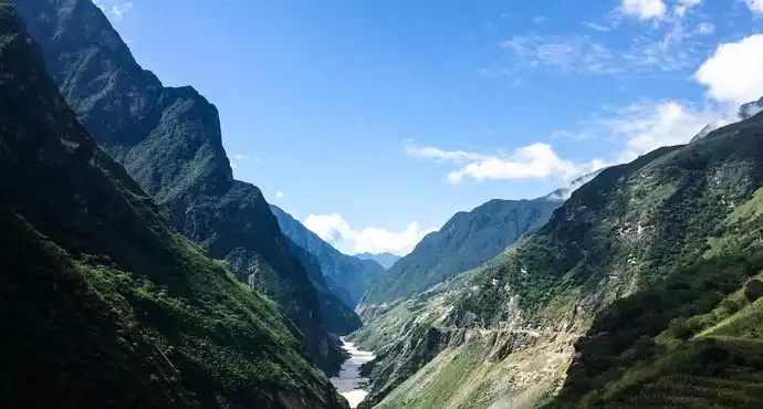
3. Tiger Leaping Gorge
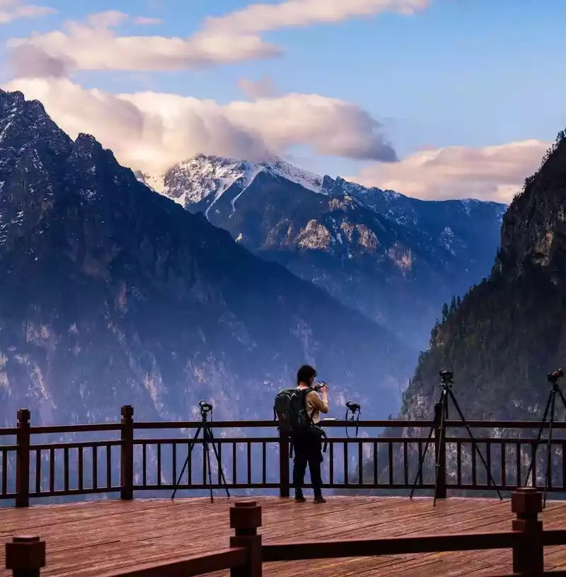
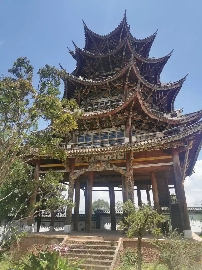
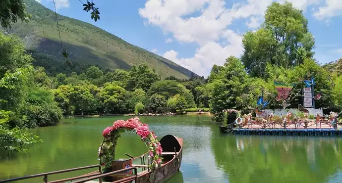
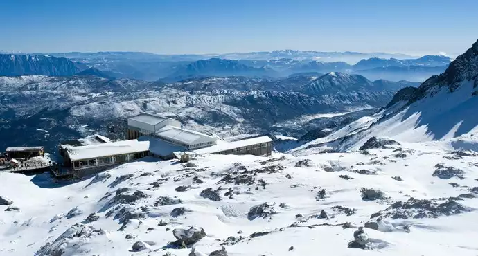
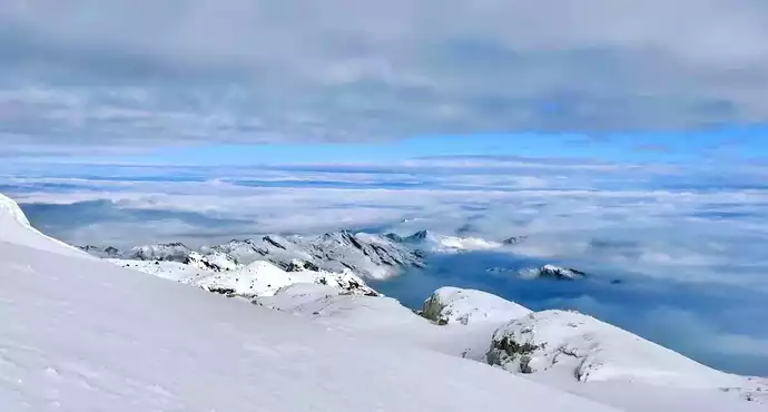
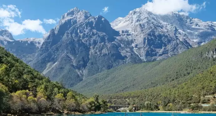
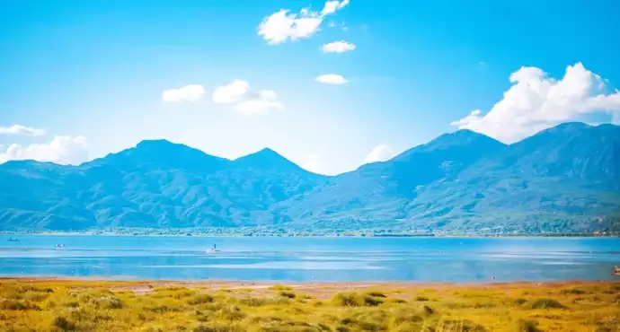
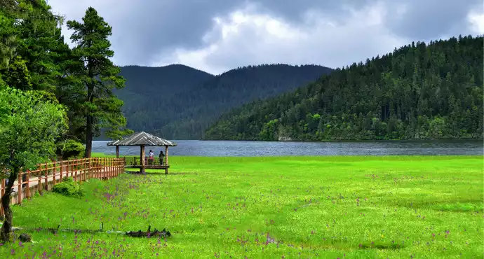
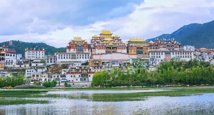
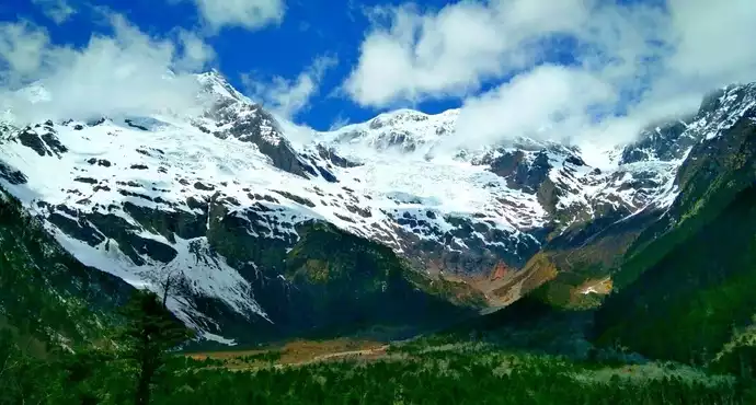
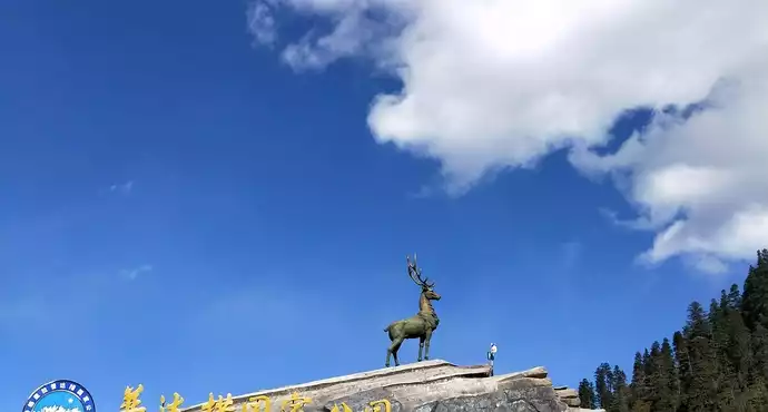
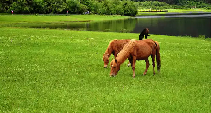
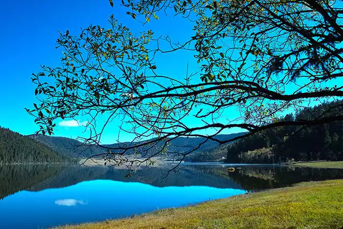
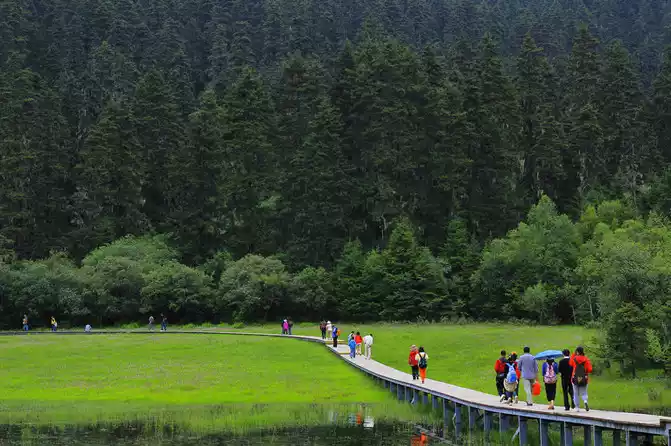
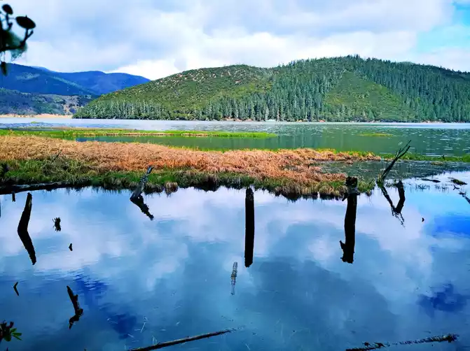
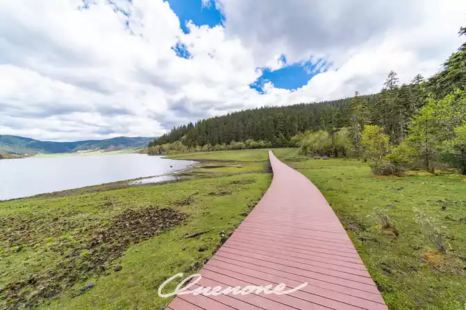
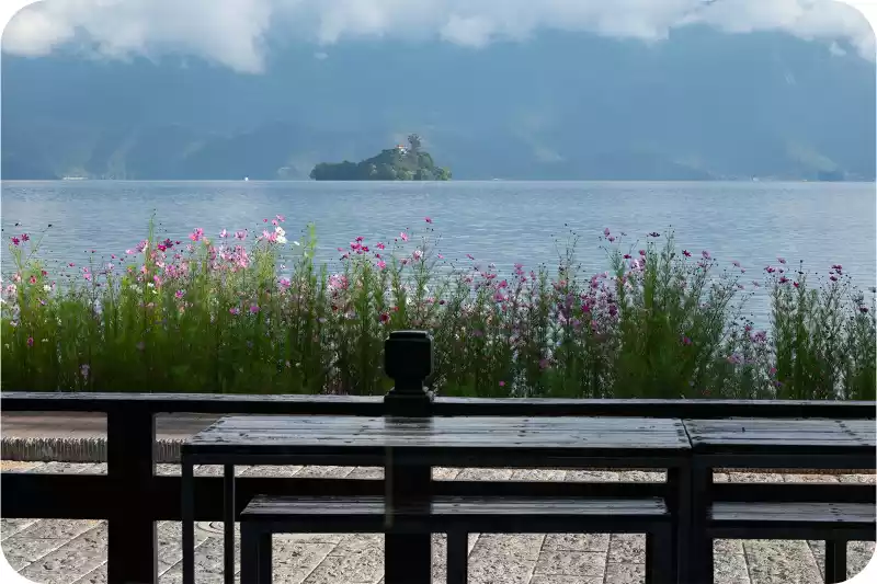
Another half hour to Tiger Leaping Gorge. Tiger Leaping Gorge, located in Tiger Leaping Gorge Town, Shangri-La City, is divided into three sections: Upper Tiger Leaping, Middle Tiger Leaping, and Lower Tiger Leaping. The winding road stretches 25 kilometers. Flanked by Jade Dragon Snow Mountain to the east and Haba Snow Mountain to the west, the gorge boasts a vertical drop of over 3,900 meters, making it one of the deepest canyons in the world. I only saw the Upper Tiger Leaping Gorge. From the Tiger Leaping Gorge Visitor Center parking lot, descending to the Jinsha River, the previously wide channel narrows to about 30 meters. The unruly Jinsha River had no room for such a stranglehold, suddenly erupting in fury, its torrents surging and its roar deafening. A reef in the middle of the river, like a thorn in its throat, crashed against it, sending the previously turbulent water soaring several meters into the air, creating a breathtaking spectacle. Legend has it that someone saw a tiger leap from the opposite bank onto the reef in the middle of the river, then leap back across. Hence the name "Tiger Leaping Gorge." Yao Maoshu, a late resident of Leshan, was known as the "First Yangtze River Rafting Man." He rafted approximately 1,270 kilometers along the Jinsha River before perishing in Tiger Leaping Gorge on July 24, 1985, ultimately failing to fulfill his long-cherished dream of rafting down the Yangtze. It's said he waited for days in Shigu Town before finally losing patience and taking the plunge, leading to this tragic event. Viewing Tiger Leaping Gorge today, I can't help but sigh in regret at the insignificance of humanity in the face of nature. Across the gorge, a path meanders along the mountainside; this is the ancient Tea-Horse Road. Looking up, I see steep mountains, jagged boulders, towering into the clouds. Amidst the mist, a mysterious, conical snow-capped peak looms and emerges: Haba Snow Mountain. As the saying goes, "A mountain looks different from the side, a peak from the front; different heights and distances." Tiger Leaping Gorge in Haba Snow Mountain is steep on one side but gently sloping on the other, making it a great place for beginner climbers to practice. Driving through the canyon, the mountains are high and the valleys are narrow, with rocks occasionally rolling down and piling up on the roadside, a truly eerie sight. In the early 20th century, American explorer Joseph Rock conducted an in-depth survey of the Hengduan Mountains in southwest China. He was struck by the snow-capped mountains, forests, grasslands, lakes, rivers, pastures, and local customs. He published his articles and photographs in National Geographic magazine, calling this region "Shambhala," a Buddhist Pure Land. In 1933, James Hilton, drawing on Locke's description, first described "Shangri-La," a place of eternal peace and tranquility nestled among the towering mountains of the East, in his novel "Lost Horizon." During World War II, people trapped in the war yearned for a peaceful and tranquil life, longing for a world like "Shangri-La," and the legend of "Shangri-La" spread throughout the world. Yunnan's Diqing Prefecture, fueled by the rapid development of its tourism industry, announced that they had found Hilton's "Shangri-La," which is now Diqing Prefecture. In 2001, Diqing Prefecture was renamed Shangri-La City, and its fame has since soared. Lhasong Tseling Monastery, located not far from the city, is the largest Tibetan Buddhist temple complex in Yunnan and the center of the Yellow Sect in the Sichuan-Yunnan region. Built into the mountainside, the temple resembles an ancient castle and embodies the epitome of Tibetan plastic arts, earning it the nickname "Tibetan Art Museum." Pudacuo National Forest Park is Shangri-La City's most iconic attraction. At 6 a.m., in the dark and freezing cold, we boarded a tour bus to the Pudacuo Visitor Center. We stopped at a clothing rental shop along the way before continuing on our journey. As daylight gradually brightened, the grasslands along the road were dotted with beautiful Tibetan dwellings. Cattle and sheep were still in their pens, and the green grass was shrouded in a hazy mist. From the Pudacuo Visitor Center, we took a convenient shuttle bus, with stops along the way. Our first stop was Shudu Lake. Located at an altitude of 3,705 meters and containing 15 square kilometers of water, Shudu Lake is vast, surrounded by towering mountains, and its waters are deep blue and pure. A solid wood walking path has been constructed along the lake, providing a comfortable footpath. Strolling along the lakeside, we were greeted by the gentle breeze, the sight of squirrels flitting across the water, the sight of parasol mushrooms, the sight of forests, grasslands, and the occasional encounter with azaleas...it was a dazzling journey filled with surprises. The towering, verdant alpine pines and wildflower-filled mountain meadows complement the cool, expansive Shudu Lake. Mountain birds chirp sweetly, and white and brown horses graze leisurely on the lakeside meadows. Nature has orchestrated such a perfect match, a miracle. At 3,705 meters, walking along the lakeside, I experienced no altitude sickness or shortness of breath, but instead felt refreshed, as if brimming with oxygen and energy. Is it really 3,705 meters? To this day, I still doubt it. I can't quite recall where our second stop was; I missed Bita Lake. We returned to the visitor center around noon, enjoying the alpine meadow scenery along the way. For someone experiencing this kind of scenery for the first time, I was overwhelmed with joy and didn't want to leave. Unfortunately, I had to turn back.
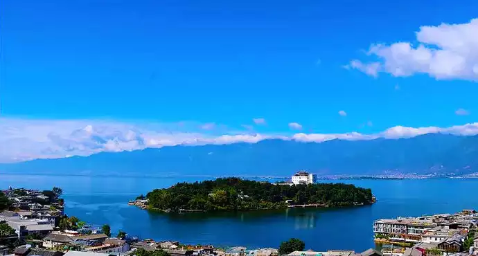
 4. Dali
In the 8th century AD, the ancestors of the Bai people established the Nanzhao Kingdom in the Erhai Lake area. The Nanzhao Kingdom maintained friendly relations with the Tang Dynasty and, with Tang support, unified the Six Zhaos (a term referring to tribes). After the fall of Nanzhao, three short-lived dynasties emerged in the Erhai Lake area. After establishing his regime, the founding emperor of the Dali Kingdom, Duan Siping, implemented new policies, reformed the old system, and promoted a rule based on rituals. He named the kingdom "Dali," meaning to regulate all aspects of society to accommodate the development of production. The Dali Kingdom lasted for 316 years and passed through 22 successive rulers. Dali was long the political, economic, and cultural center of Yunnan. It wasn't until the Yuan Dynasty, when the Yuan government established Kunming as the capital of Yunnan Province, that Kunming gradually replaced Dali's position.
Dali: The greater the expectations, the greater the disappointment.
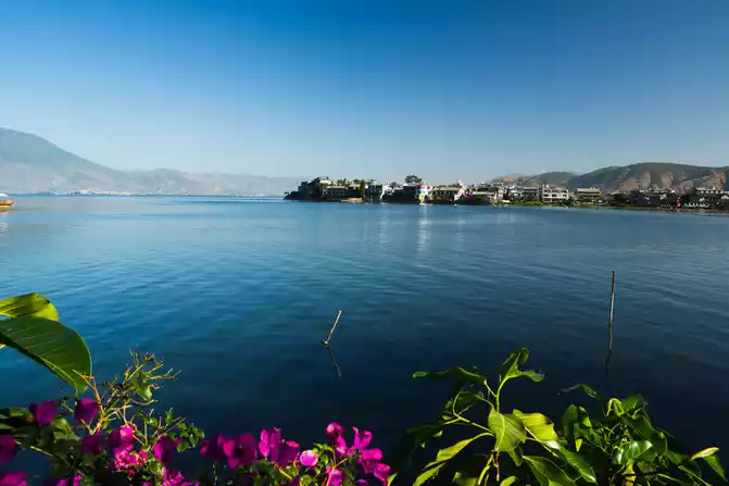
Dali's extraordinary beauty is summed up in this proverb: "Flowers at Shangguan, winds at Xiaguan, snow on Cangshan Mountain, moon over Erhai Lake."
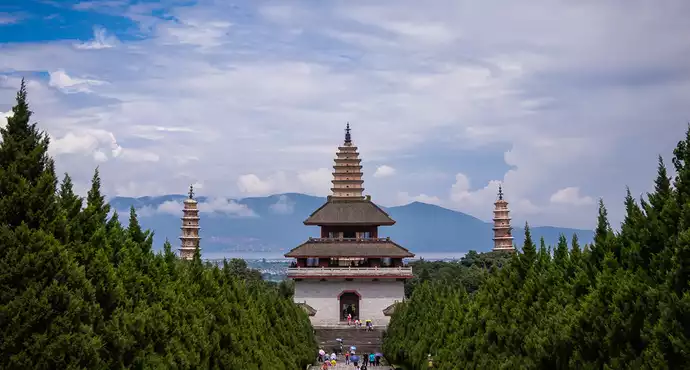
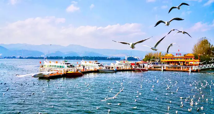
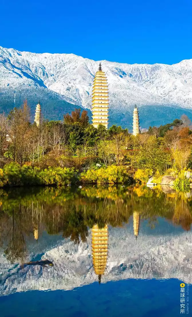
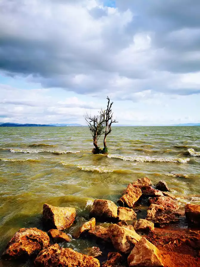
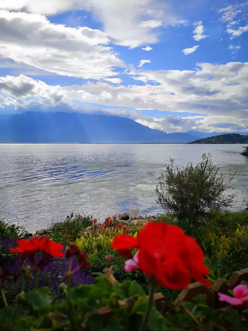
There are no flowers at Shangguan. Butterfly Spring is in Dali's Shangguan. I expected butterfly flowers, but sadly, there weren't any. Perhaps, just like there's no wife in a wife cake. Xiaguan seems to be located in a windy spot. We arrived in the evening, and the wind blew relentlessly, with no telling when it would stop. It was the Torch Festival approaching, and many villagers were selling wooden torches on the street, creating a festive atmosphere. In early August, the height of summer, the dog days of summer, Dali's evenings were quite cool. The breeze from Xiaguan would have been even more pleasant. Unfortunately, there was absolutely no snow on Cangshan Mountain. The deep blue mountains, surrounding Erhai Lake, echoed with the water, creating a charming scene. Although Erhai Lake ranks last among the "Four Scenic Spots of Dali," it is undoubtedly the star attraction. The lake covers an area of approximately 246 square kilometers and holds approximately 2.95 billion cubic meters of water. It is long and narrow, stretching 40 kilometers from north to south, stretching from the southern tip of Eryuan County in the north to Xiaguan in Dali City in the south. It is the second largest lake in Yunnan after Dianchi Lake and the seventh largest freshwater lake in China, with an elevation of 1,972 meters. We took a boat from Shangguan to Xiaguan to tour Erhai Lake. From the lakeside, the vast expanse of mist and waves truly felt like an ocean. The clear blue sky, picturesque Cangshan Mountains, and the jade-like Erhai Lake, along with the refreshing climate, were a truly relaxing experience. A friend remarked that a few years ago, when they visited Erhai Lake, the water was crystal clear, with clearly visible aquatic plants. But now, seeing the lake, it's dark blue with a faint stench, suggesting severe pollution, which was quite disappointing. While Dali's rapid tourism development has brought tremendous wealth to the city, it has also led to severe environmental pollution, making Erhai Lake less than a scenic beauty. I visited Erhai Lake in early August 2012, and I'm writing this to commemorate the success of its management. Chongsheng Temple, facing Erhai Lake to the east and Cangshan Mountain to the west, is the "Tianlong Temple" featured in Jin Yong's novel "The Demi-Gods and Semi-Devils." It served as the royal temple of the Dali Kingdom, where the king of Dali became a monk and retired. It holds a significant historical significance in Dali. Despite its long history, the temple's ancient architecture has been largely destroyed, with only three pagodas remaining. The Three Pagodas of Chongsheng Temple in Dali were built during the Kaiyuan reign of Emperor Xuanzong of the Tang Dynasty. The main pagoda, named Qianxun Pagoda, stands 69.13 meters tall, with a base depth of 9.9 meters. It boasts 16 stories and is a typical hollow square brick pagoda with dense eaves in the Dali area. The smaller pagodas to the north and south, each 10 stories high, stand 42.17 meters tall and are octagonal hollow brick pagodas with dense eaves. The three pagodas, with two wings, form a harmonious whole, a truly breathtaking work of art, truly a symbol of "three towers of scenic beauty, a pagoda of divine craftsmanship."
From Dali, I returned to Lijiang, and then took a Sichuan Airlines flight from Lijiang back to Chengdu. After a week of travel, I gained a lot, so I'm recording it here.
Number of days: 1 day, Average cost: 150 yuan, Updated: 2020.06.17

Number of days:7 days, Average cost: 4999 yuan, Updated: 2020-05-18 18:58
Number of days:5 days, Average cost: 1800 yuan, Updated: 2021-08-16 17:29


Number of days:6 days, Average cost: 6,000 yuan, Updated: 2021.06.11
Number of days: 5 days, Average cost: 6000 yuan, Updated: 2020.09.25
Number of days: 14 days, Average cost: 20,000 yuan, Updated: 2022.11.06