Live Your Best Lives
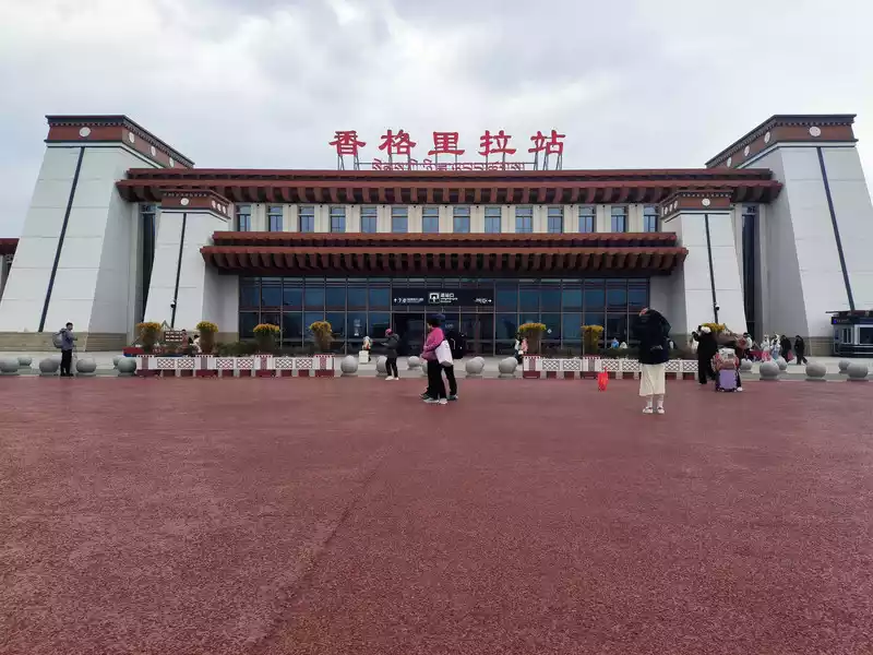 Shangri-La Railway Station
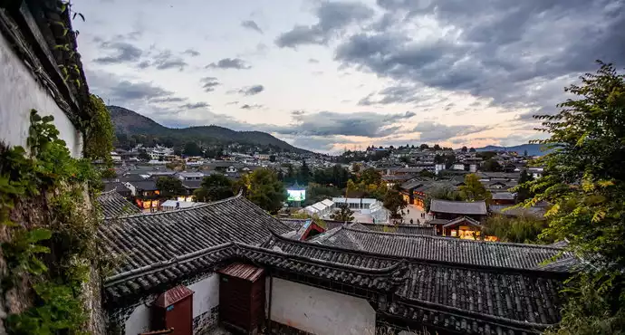
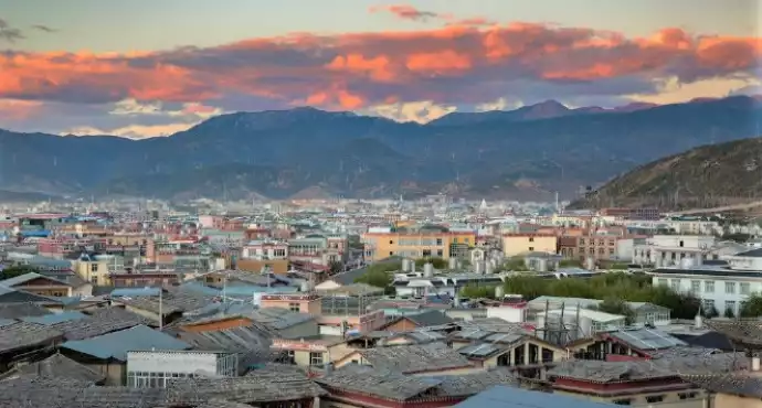
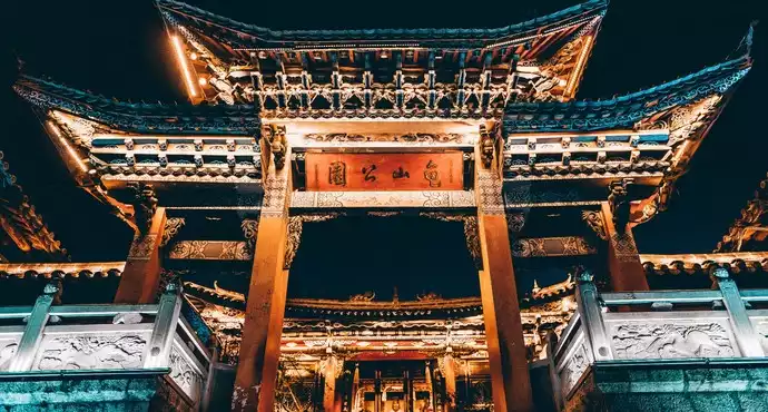
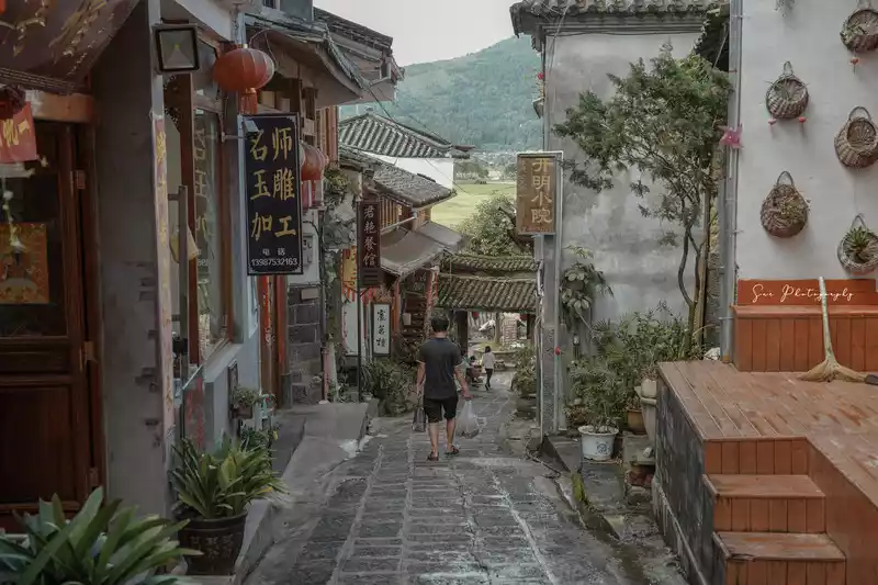
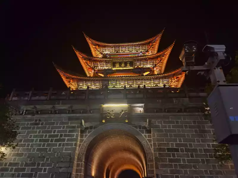
We plan to stay here for 4 days. The order of visiting attractions is ancient first, then modern, near first, then far. After getting off the train, we will head to the nearby Dukezong Ancient Town. The tourist distribution center next to the starting point of Bus No. 1 can store luggage for free. Dukezong Ancient Town, located in the south of the city, is one of the main historical sites of Shangri-La and the best-preserved and largest ancient town with Tibetan inhabitants in China, with a history of more than 1,300 years. Dukezong means "Moonlight City" in Tibetan, where "Duke" refers to white (symbolizing the moon) and "Zong" refers to castle. In the Tang Dynasty (676-679 AD), Tubo established the Shenchuan Governor's Office here, laying the foundation for the ancient city. In the Ming Dynasty, Zhongdian was occupied twice by the Mu chieftains of Lijiang. In the 27th year of Emperor Kangxi's reign in the Qing Dynasty (1688 AD), the Dalai Lama requested to trade on the Jinsha River. The Qing court approved the establishment of a market in Zhongdian. Dukezong became an important market for Yunnan-Tibet trade and an important hub of the Yunnan-Tibet Ancient Tea-Horse Road and the Yunnan-Tibet Highway. During the reigns of Emperors Yongzheng and Qianlong, business here was prosperous, and Sifang Street was crowded with merchants. We visited Dukezong Ancient Town 20 years ago, and the most impressive thing was the extra-large prayer wheel on Turtle Mountain.
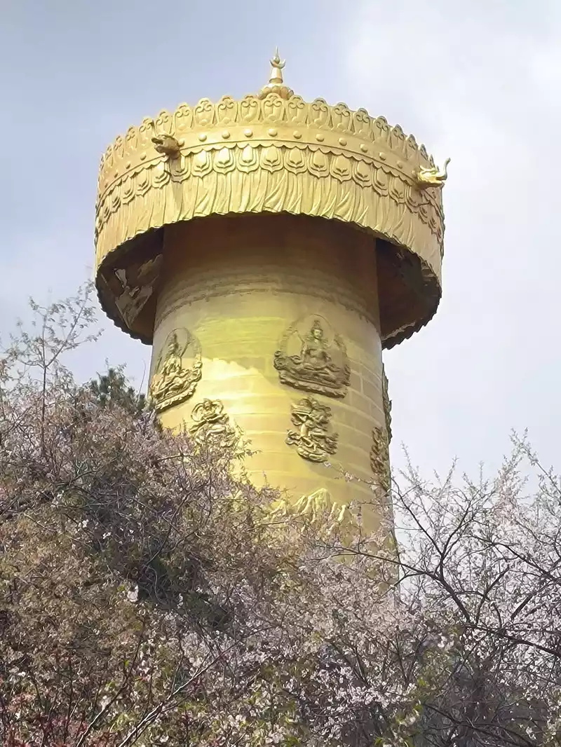 The huge prayer wheel on Turtle Mountain
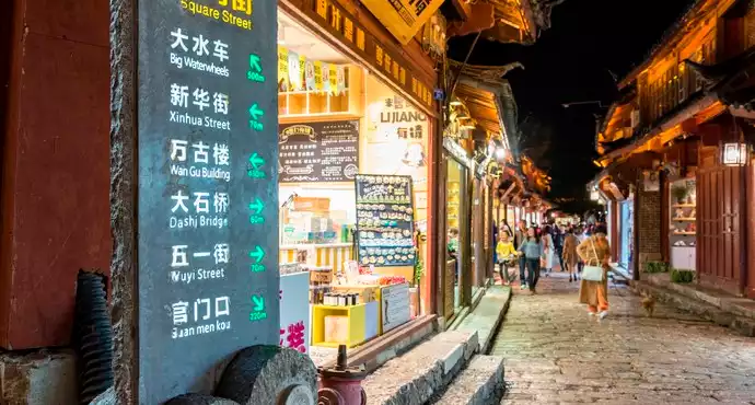
At 10:30 am, we entered the ancient city from the north gate and walked around the central area. Most of the shops were various shops and B&Bs. It lacked ancient charm and was similar to Lijiang Old Town. There was also a Square Street here. Many shops were not open yet and there were not many tourists. However, the wood carvings on the storefronts were very delicate and had some characteristics.
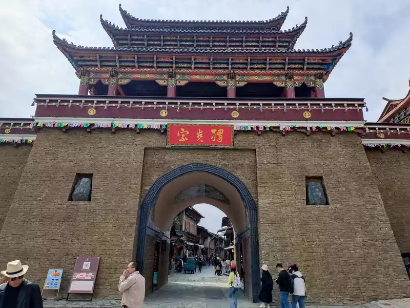 The north gate of Dukezong Ancient City
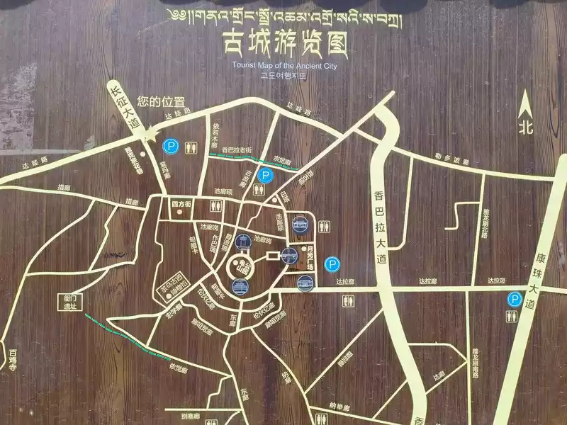 Schematic diagram of the streets of Dukezong Ancient Town
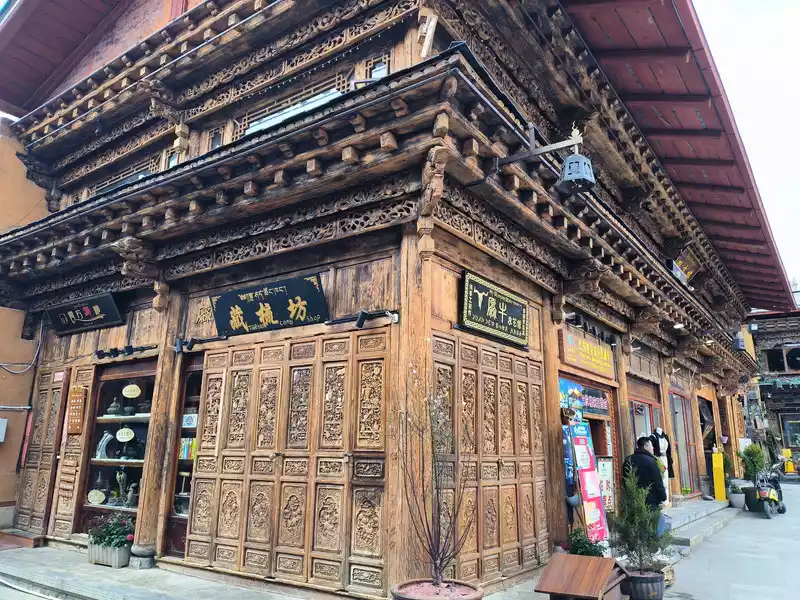 Dukezong Sifang Street
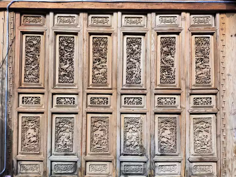 Shop door wood carvings
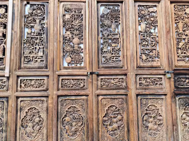 Shop door wood carving
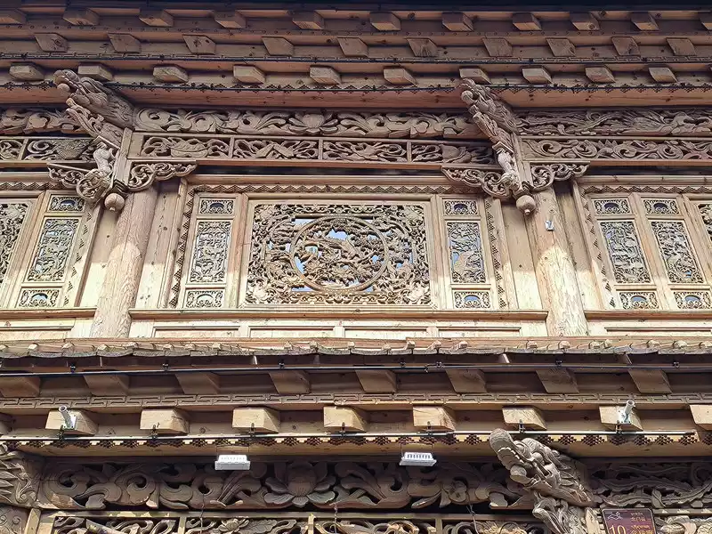 Shop door wood carving
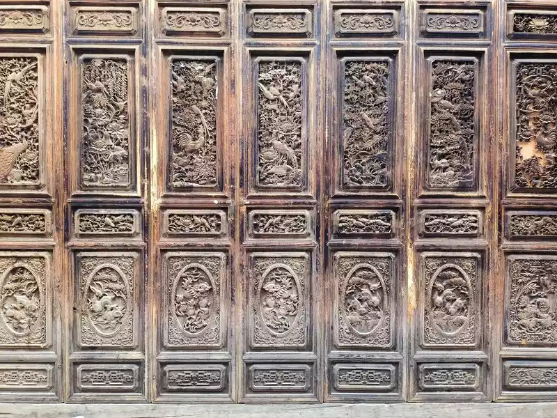 Shop door wood carving
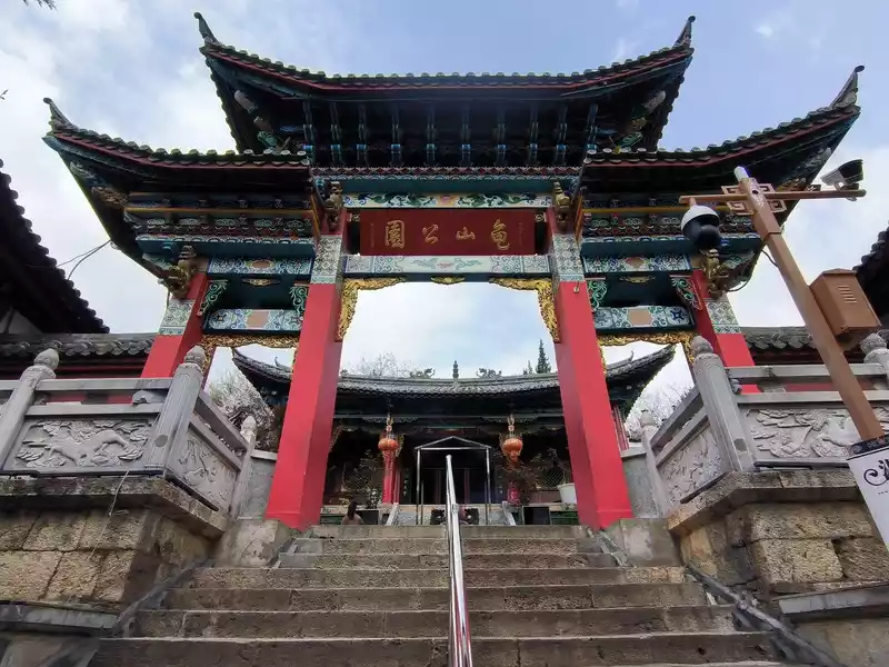 Guishan Park
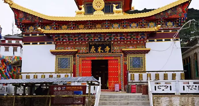
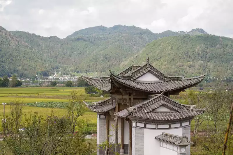
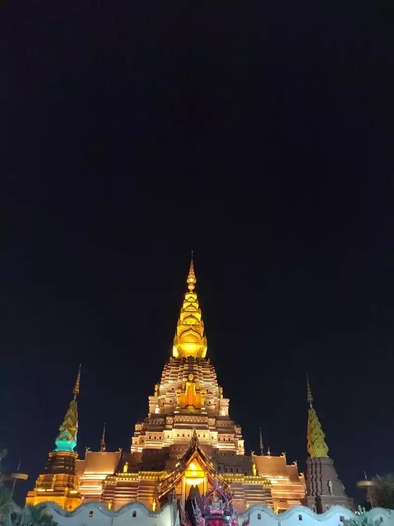
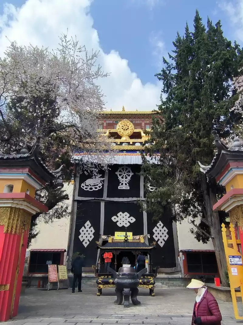 Big Buddha Temple
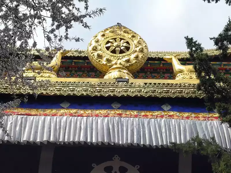 Big Buddha Temple src="https://dimg04.c-ctrip.com/images/1mf3812000kx4yxpxE567_R_800_10000_Q90.jpg?proc=autoorient" /> Diamond Hall
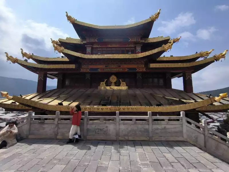 Diamond Hall
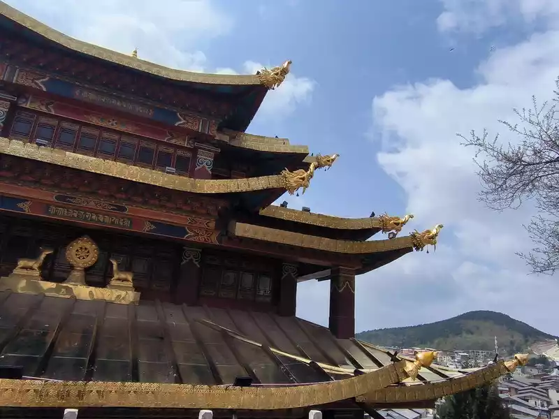 Diamond Hall
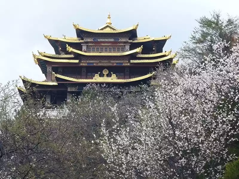 The Vajra Temple among the flowers
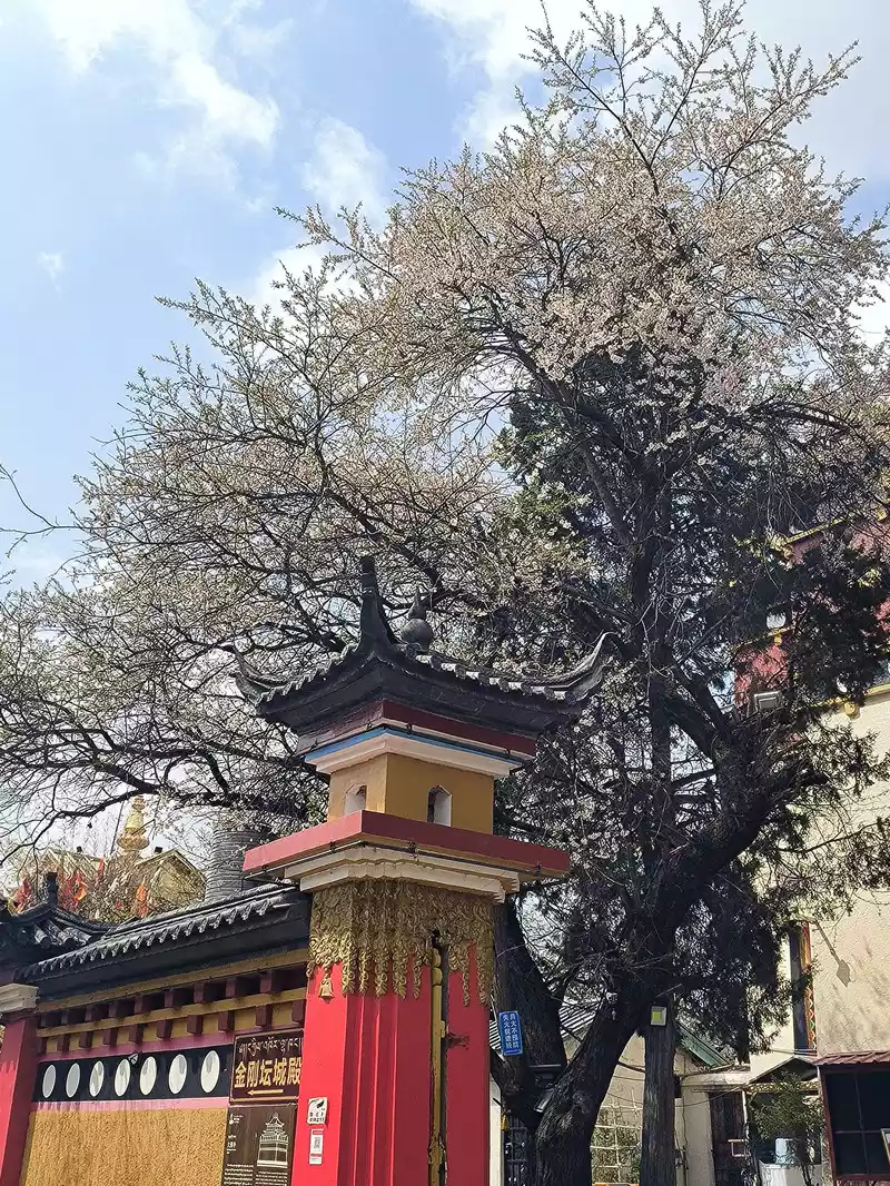 Peach blossoms in full bloom
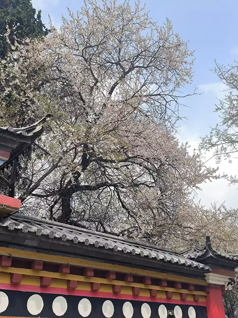 Peach blossoms in full bloom
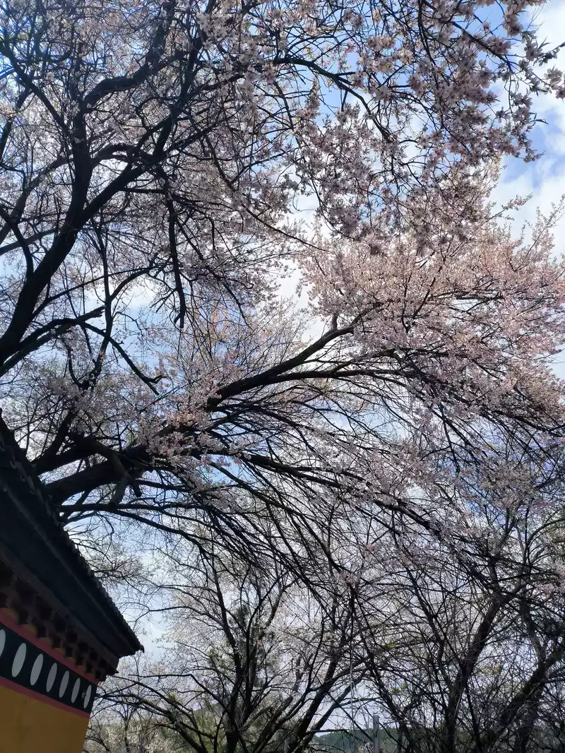 Peach Blossoms in Full Bloom
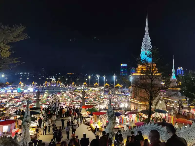
 The most eye-catching feature is the world's largest pure copper and gold-plated prayer wheel, standing 21 meters tall and weighing 60 tons. It requires the combined strength of more than a dozen people to rotate, reportedly costing over 90 million yuan and taking three years to complete. The walls are adorned with relief carvings of the four great bodhisattvas—Manjusri, Samantabhadra, Guanyin, and Ksitigarbha—as well as the Eight Treasures of Buddhism. Encased within it are 1.24 million mantras and 16 tons of Buddhist treasures. One rotation is equivalent to chanting 1.24 million Buddha's names. Three consecutive rotations are said to ward off disasters and bring blessings. Standing on Guishan Mountain, one can take in the panoramic views of the ancient city and the urban area. Later, we discovered that the area outside the ancient city's east gate is a tourist hub, home to numerous hotels and guesthouses, and bus stops.
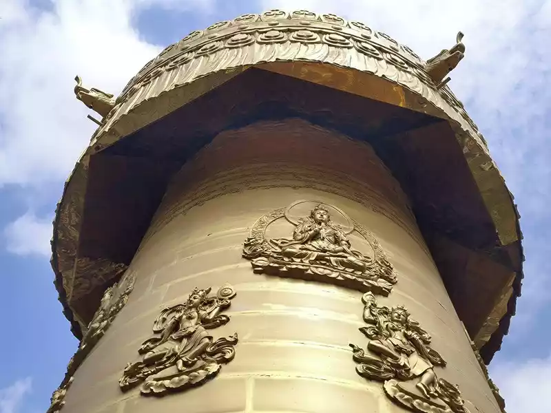 Giant prayer wheel
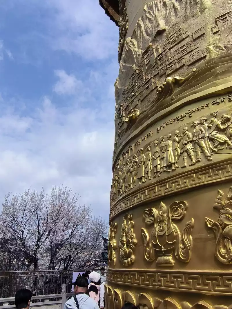 Giant prayer wheel
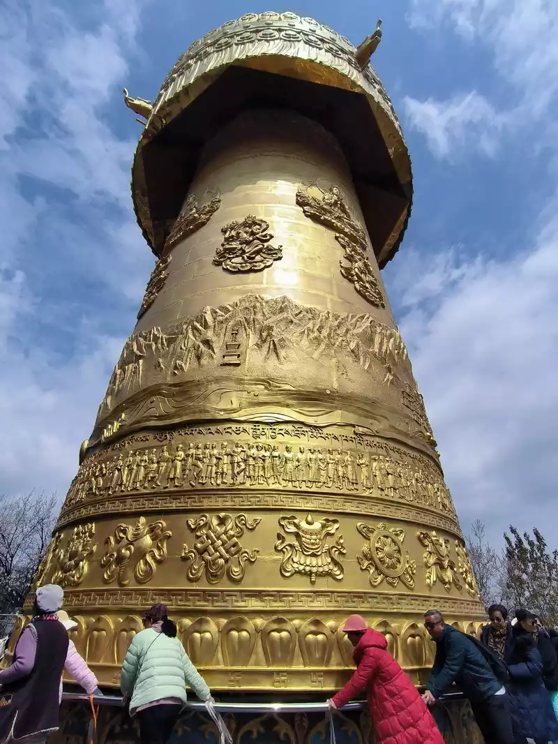 Giant prayer wheel
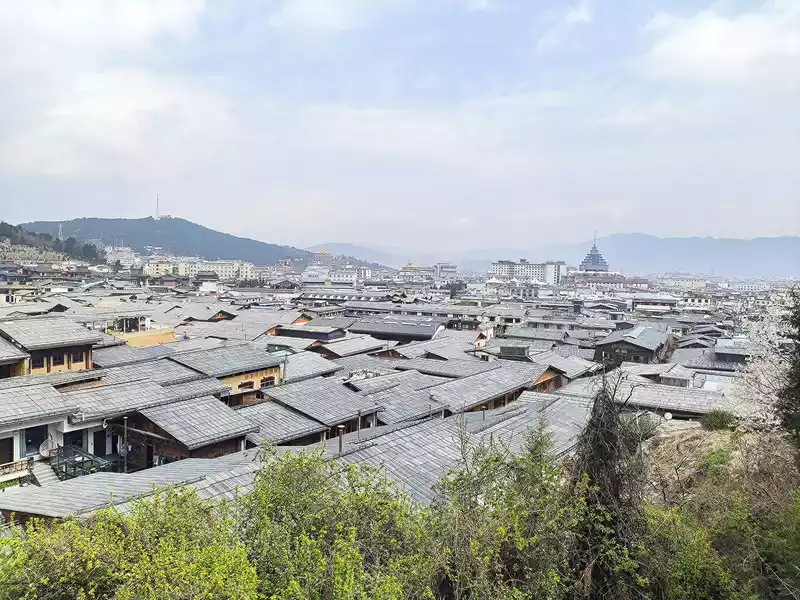 Panoramic view of the city
&n &nbs p;Songzanlin Temple
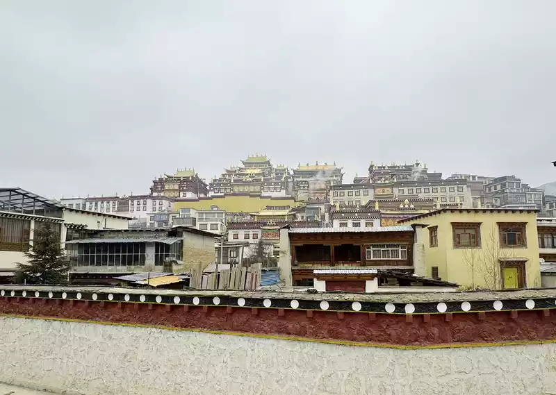
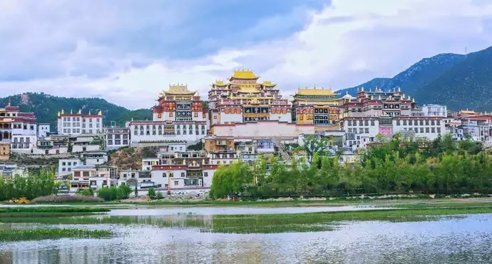
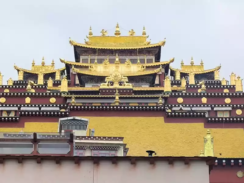
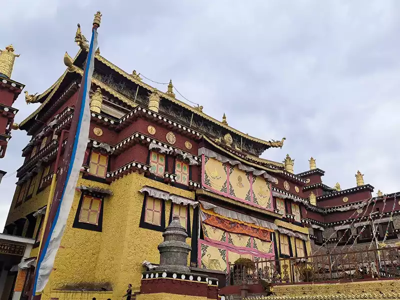
We then took bus No. 1 into the city to stay overnight. In the afternoon, we headed to Songzanlin Monastery in the north of the city, a spot we hadn't visited when we first arrived 20 years ago. Looking at pictures online, it looks majestic and mysterious, reflected by the lake. Nestled against the mountain and facing the lake, Songzanlin Monastery is a magnificent sight. It is the highest institution of the region's theocratic system, known as the "Little Potala Palace." It is the largest Tibetan Buddhist monastery in Yunnan and a sacred site for the "Three Treasures" of Buddhism, Dharma, and Sangha in the Yunnan, Tibet, and Sichuan regions. Pilgrims flock to the monastery year-round, and the incense is incredibly popular. Songzanlin Monastery was built in 1679, the 18th year of the reign of Emperor Kangxi of the Qing Dynasty. Legend has it that the temple's site was chosen by the Fifth Dalai Lama through divination, and the temple's name was also bestowed by him. "Songzan" refers to the roaming abode of the three celestial gods, Indra, Mahasthamaprapta, and Lousu, and "Lin" means "temple." The Qing Dynasty bestowed the name "Guihua Temple." The buildings, predominantly white, follow the slope of the mountain, forming a complex of Tibetan and Han temple styles. An oval wall surrounds the temple, and within it are over 300 buildings. From left to right on the mountaintop are the Tsongkhapa Hall, the Dratsang Hall, and the Sakyamuni Hall, representing the Three Jewels of Sangha, Dharma, and Buddha. The three main halls on the mountaintop are majestic and magnificent. The murals within are vibrant and delicately painted, depicting historical events and promoting Buddhist teachings. Tsongkhapa's name is "Jikang" in Tibetan, so the Tsongkhapa Hall is also known as the Jikang Hall. The three main temples—Zhacang, Jikang, and Sakyamuni Hall—are located at the highest point, at the center of the temple complex. Surrounding them are the eight Kangcan buildings, monks' quarters, and other structures. Their staggered heights and progressive layers create distinct three-dimensional contours, fully highlighting the grandeur of the main building. "Zacang" means monastery in Tibetan. It is a place where monks study scriptures and research doctrines. It is also the core building of Songzanlin Monastery. In front of the main hall stands a bronze statue of the Fifth Dalai Lama, followed by the stupas of the remains of famous monks. The top floor of the main building is a special scripture house and Buddhist hall, which houses the statues of the Fifth Dalai Lama and the Seventh Dalai Lama, as well as palm leaf scriptures, thangkas, and handed down Buddhist instruments. To the south of the Buddhist hall is a towering bell and drum tower, which beats drums to tell time in the early morning, noon and dusk, and the sound can be heard for ten miles.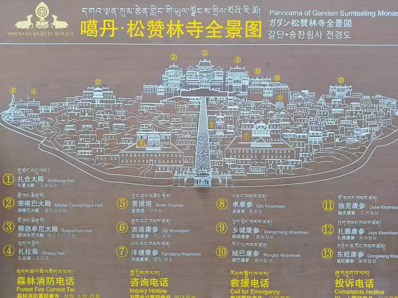 Schematic diagram of Songzanlin Monastery
The subordinate monastic organization of Dratsang is the "Khamtsan," which means "monastic community" in Tibetan. This organization divides the monks of a large monastery into several groups based on their place of origin or origin, forming regional organizations within the diocese. The Khamtsan is presided over by a senior monk and is staffed by staff such as Nianwa and Gegan, who independently manage the administrative, religious, and economic affairs of the diocese. The eight major Khamtsans of Songzanlin Monastery are: Duk, Zhaya, Dongwang, Rongba, Yangduo, Jiedi, Zhuo, and Xiangcheng. Songzanlin Monastery embodies the essence of Tibetan religious culture. Its magnificent architecture features colorful gilded copper tiles and eaves adorned with animal-shaped horns. It represents the epitome of Tibetan plastic arts and is known as the "Tibetan Art Museum." The monastery houses numerous historical treasures, including eight gilded Buddha statues from the reigns of the Fifth and Seventh Dalai Lamas, palm-leaf sutras, thangkas painted in multicolored gold, and golden lamps. In the summer of 1936, when He Long led the Second Red Army through Shangri-La during the Long March, He Long, Xiao Ke, and others visited the monastery, met with the Living Buddha and lamas, and presented it with a brocade scroll inscribed with the words "Prosperity of the Tribes." The monastery also raised over 20,000 kilograms of grain for the Red Army and sent monks as guides to support the army's march northward against the Japanese.
 Zhacang Hall
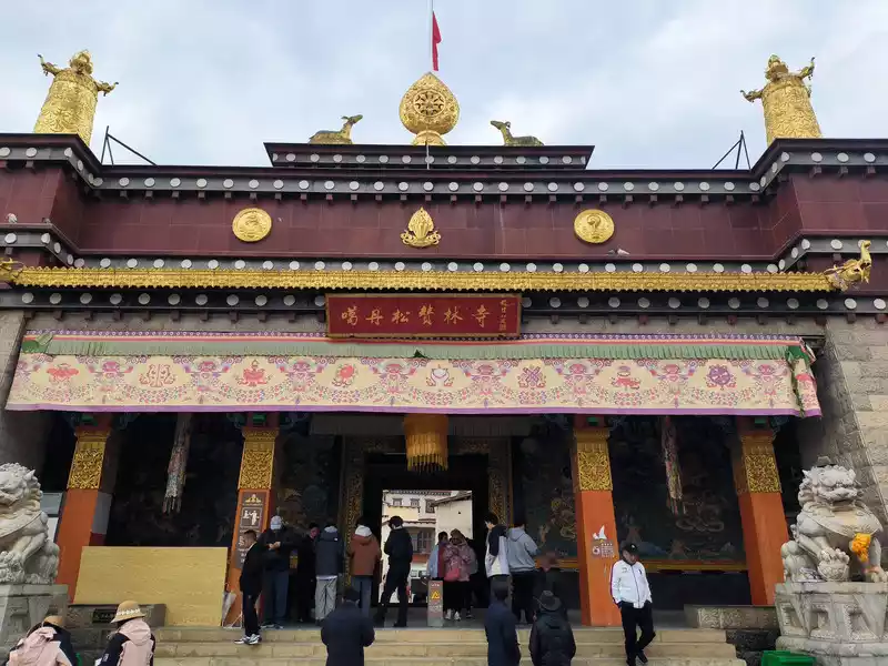
We entered the temple at 3 pm and walked up the steps. There was a large rectangular square on the top of the mountain. The first thing we saw was the Tsongkhapa Hall on the west side, which was slightly lower than the Zhacang Hall. The Zhacang Hall in the middle is the oldest building in Songzanlin Temple. It faces north and south and is a 5-story Tibetan-style carved building.
 The main gate of Songzanlin Temple
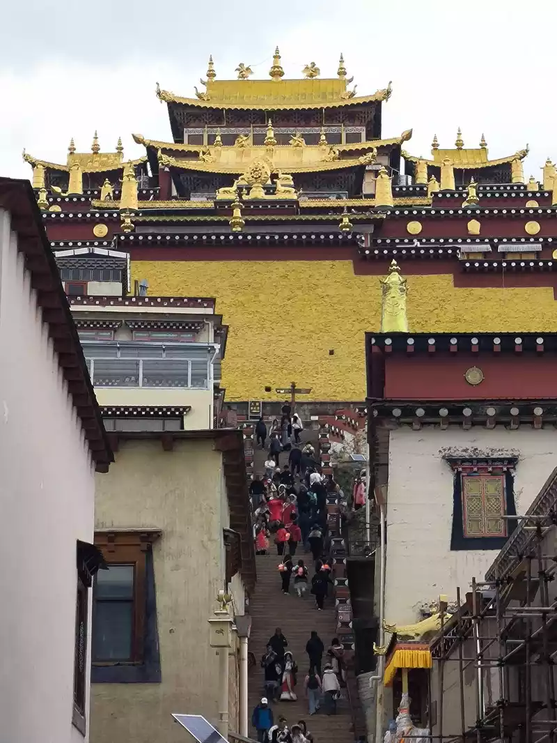 Go up the stairs
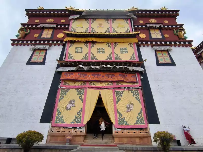 Tsongkhapa Hall
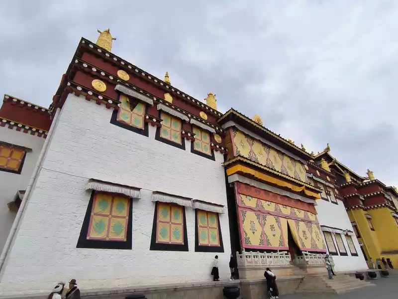 Zhacang Hall
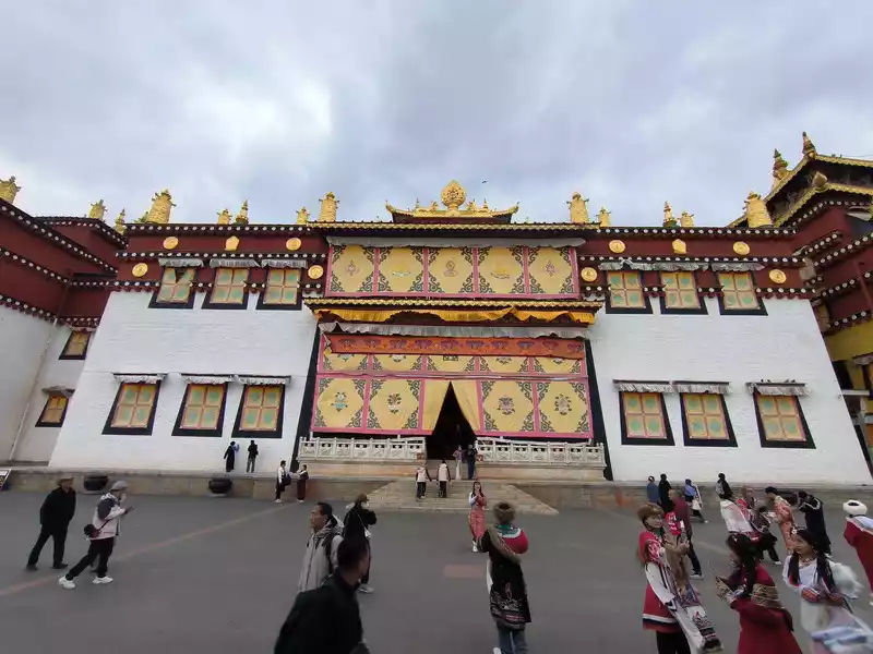 The main hall has gilded copper tiles on the upper floor, and the corners of the hall are decorated with animal-shaped eaves, reflecting the architectural style of Han temples. The lower floor has 108 pillars, representing an auspicious number in Buddhism. The hall can accommodate 1,600 people. The left and right walls are decorated with "ten thousand scroll cabinets" for the Buddhist scriptures. The interior is magnificent and colorful. However, photography is not allowed inside the hall, so we could only take pictures of the front corridor. Zhacang Hall
 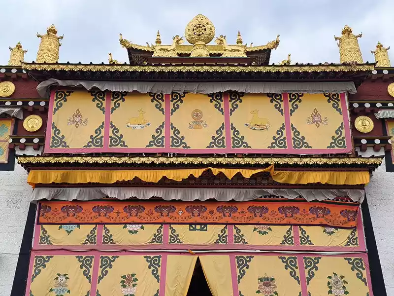 The Zhacang Hall
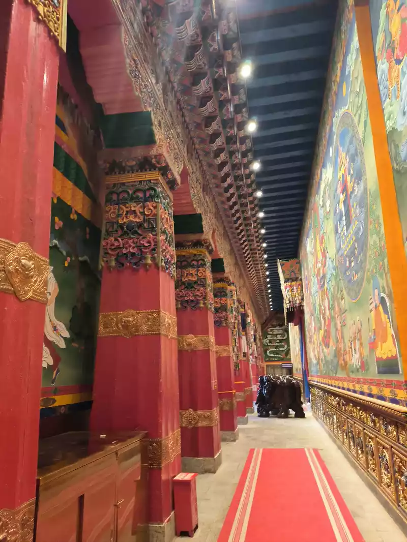 The front corridor of the Zhacang Hall
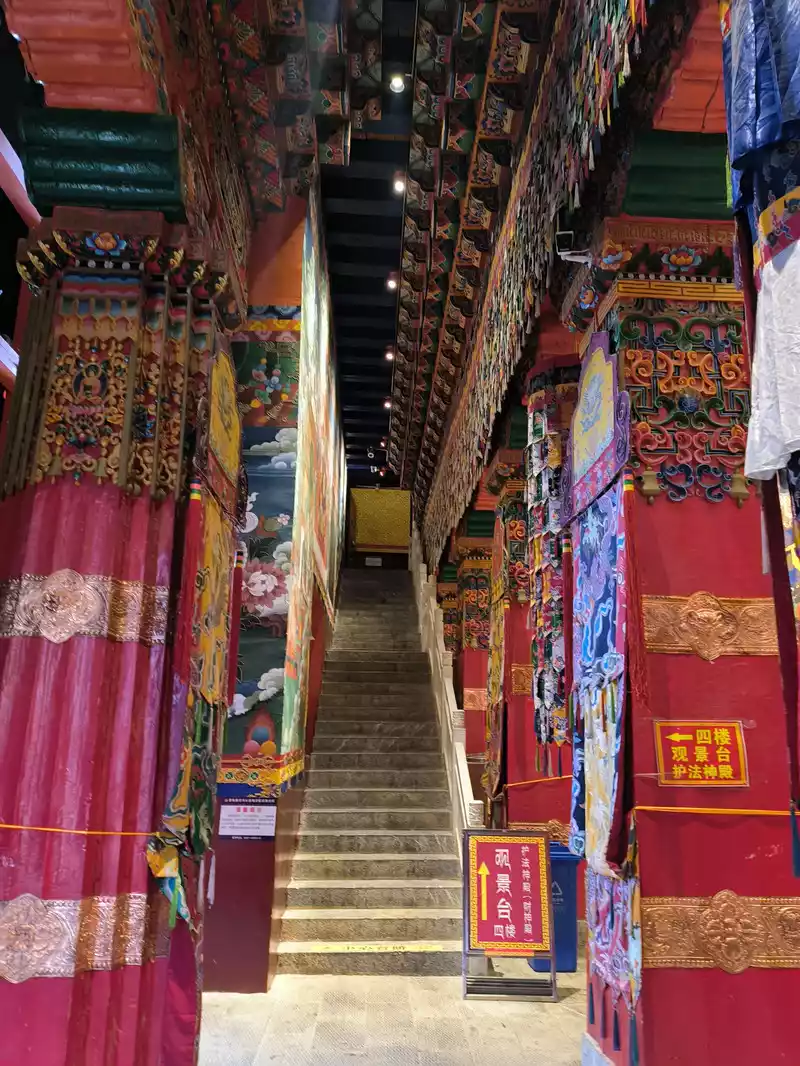 The front corridor of the Zhacang Hall
 The Sakyamuni Hall on the east side is slightly lower than the Jikang Hall. Unlike the white walls of Tsongkhapa and Zhacang Halls, the outer wall of the Sakyamuni Hall is yellow. From a viewing angle, the stacked buildings in the southeast corner are most suitable for photography, but there is almost no written introduction to the Sakyamuni Hall on the Internet.
 Sakyamuni Hall
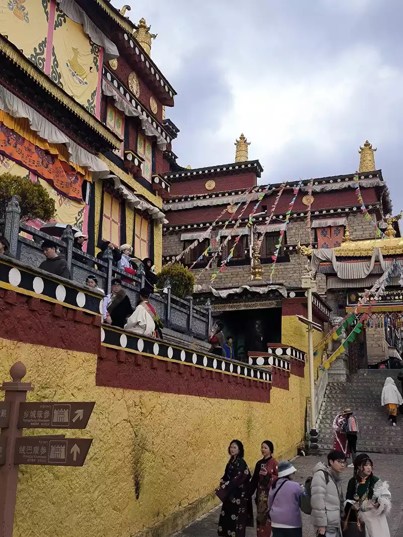 Southeast corner of Songzanlin Temple
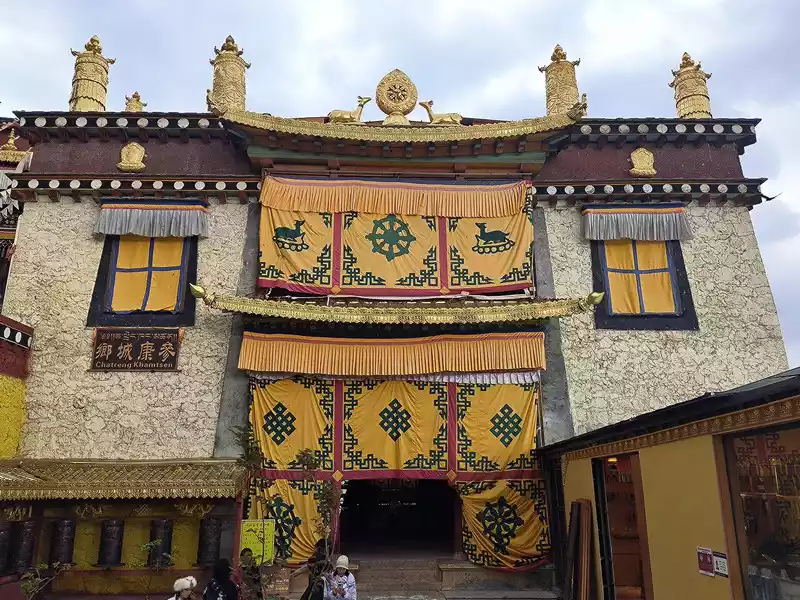 Southeast corner of Songzanlin Temple Southeast corner of Songzanlin Monastery
 An hour later we descended the mountain and climbed the small hill in front of the temple, from where we could take panoramic photos of the temple complex. There were also quite a few people here. Finally, we walked along the wooden plank road of Ramyangcuo Lake to the south bank and took photos of Songzanlin Monastery facing the lake. This is an excellent place to take in the panoramic view of the temple, but there are only a few tourists here. 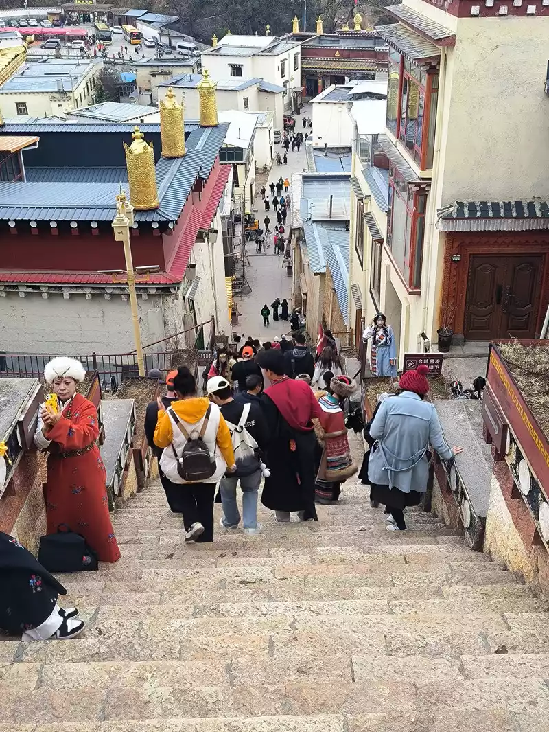 Going down the mountain and leaving the temple
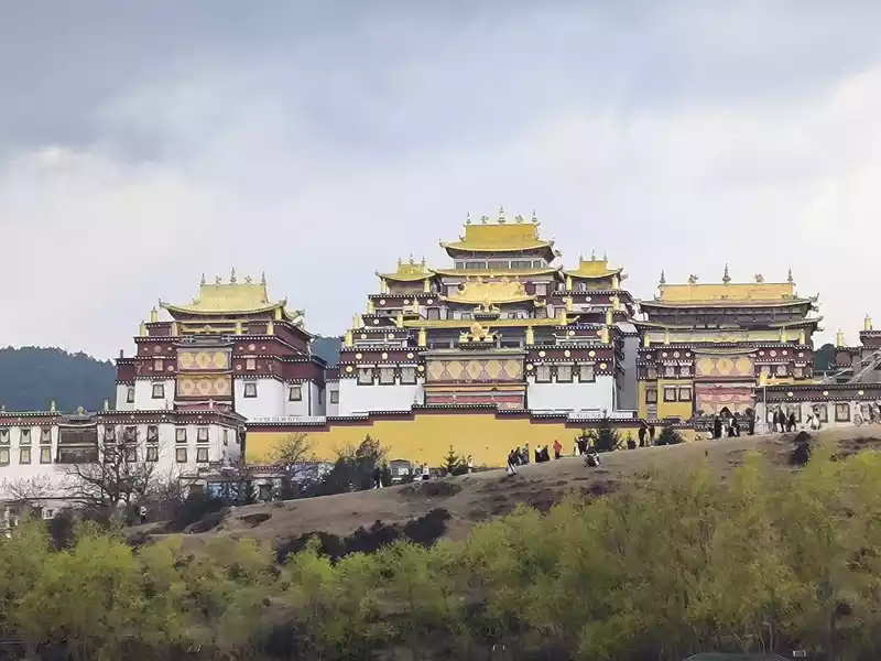 The small hill in front of the temple
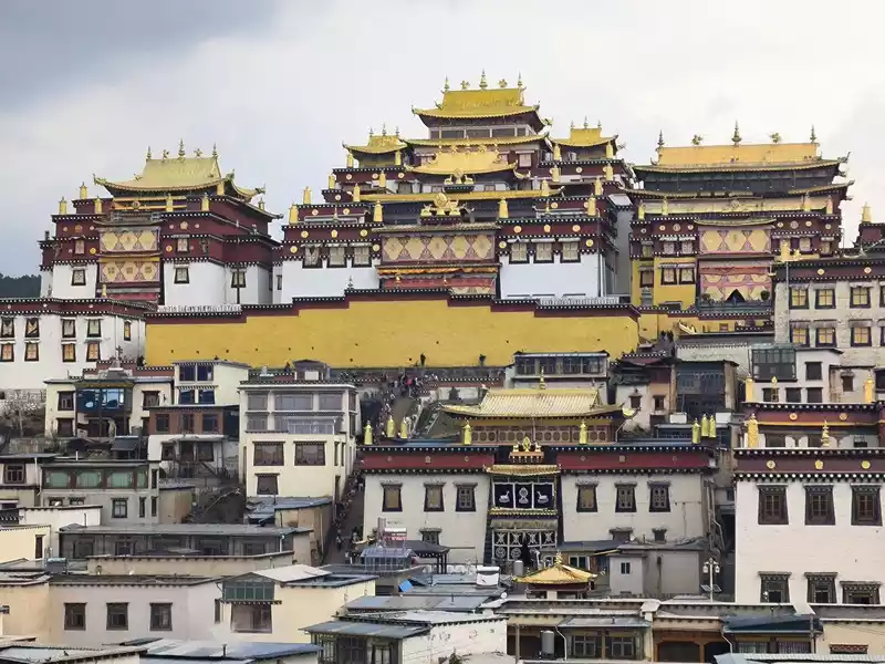 The three main halls
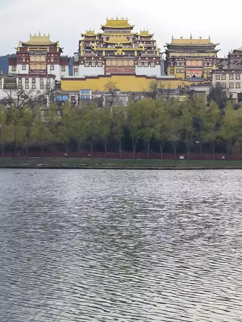 The beautiful scenery of Songzanlin Temple near the lake
p; ;White Water Terrace
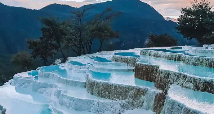
Baishuitai, also known as the "Fairy's Relics Field", is the largest Huaquan terrace in my country, covering an area of about 3 square kilometers. It is a natural wonder formed by the dissolution of calcium carbonate in the spring water. The basic principle is the same as that of Huanglong in Sichuan. When the spring water flows slowly downward, the calcium carbonate is exposed to sunlight, and calcium bicarbonate is formed after the water evaporates. The white sediments gradually settle, and then continue to cover the surface to form the spring Huadi. Over the years, a terrace curtain is formed. From a distance, its shape resembles layers of terraces hidden among green mountains, and some sections look like solidified waterfalls. The scenic area includes the Fairy's Relics Field, the Colorful Yaochi, the Child-Seeking Cave, the Holy Water Source, the Mugao Stone Carvings and other attractions. As early as the Tang and Song Dynasties, it has become a famous tourist attraction in western Yunnan.
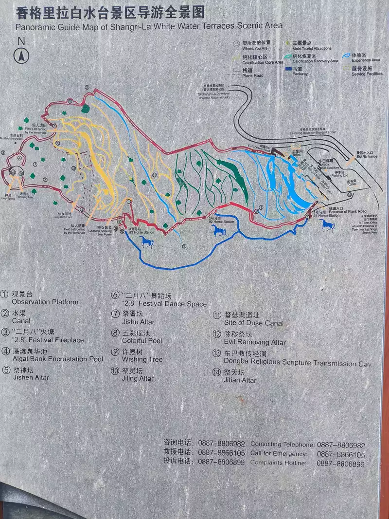 Schematic diagram of Baishuitai Scenic Area
Sanba Township, where Baishuitai is located, is one of the main settlements of the Naxi people in Shangri-La. Although it is only a hundred miles away, it plays a vital role in the entire Naxi Dongba culture. According to research, Baishuitai was originally worshipped as a deity. Legend has it that Dingba Shiluo, the first saint of Dongba religion of the Naxi people, was attracted by the beautiful scenery when he passed by Baishuitai after studying Buddhist scriptures in Tibet. He stayed here and set up an altar to preach. It has become a sacred place for Dongba religion of the Naxi people and the birthplace of Naxi culture. Dongba script was born and created here. It is the only hieroglyphic script still in use. On the eighth day of the second lunar month every year, Naxi residents gather here to dance dragons, sing songs and hold a grand "Chao Baishui" sacrificial ceremony.
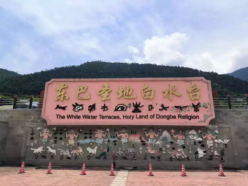 Dongba Holy Land
I knew Baishuitai when I came to Shangri-La 20 years ago, but this attraction was not included in the group tour itinerary, so this time I listed it as the top priority. Baishuitai is about 103 kilometers away from Shangri-La. The bus station sends two buses at 9 o'clock and 14 o'clock every day. We set off on the morning bus. A few years ago, netizens said that the road was long and difficult, and the whole journey would take 3 hours, but now the road conditions are good. We arrived at the scenic area at 11:20. The altitude here is only 2,380 meters, which is 1,000 meters lower than Shangri-La. The history of the formation of the platform is about 200,000 to 300,000 years, and the thickness of the platform is 214 meters.
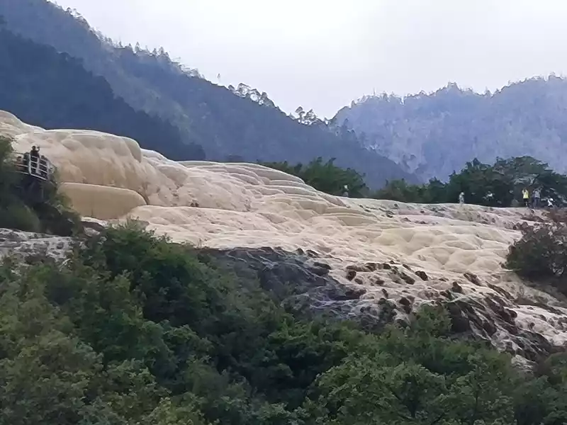 Travertine slope
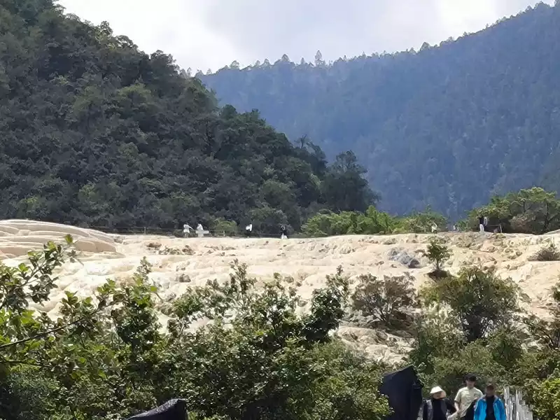 Travertine slope
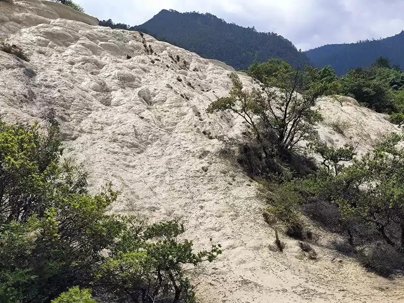 Travertine slope
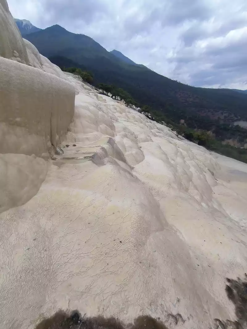 Go up the mountain along the left trail and you will soon arrive at the first scenic spot - the Immortal's Field. On the right, you can see layers of "terraces" and a large travertine slope. On the lower left side of the spring platform, there is a stone dome as white as jade, shaped like a pregnant woman, hence the name "Seeking Child Cave". It is where local people worship the fertility god. Its slope is nearly 90 degrees, with a vertical drop of more than 4 meters. In fact, the formation of the travertine deposit is related to the original steep terrain. Close-up of the travertine slope
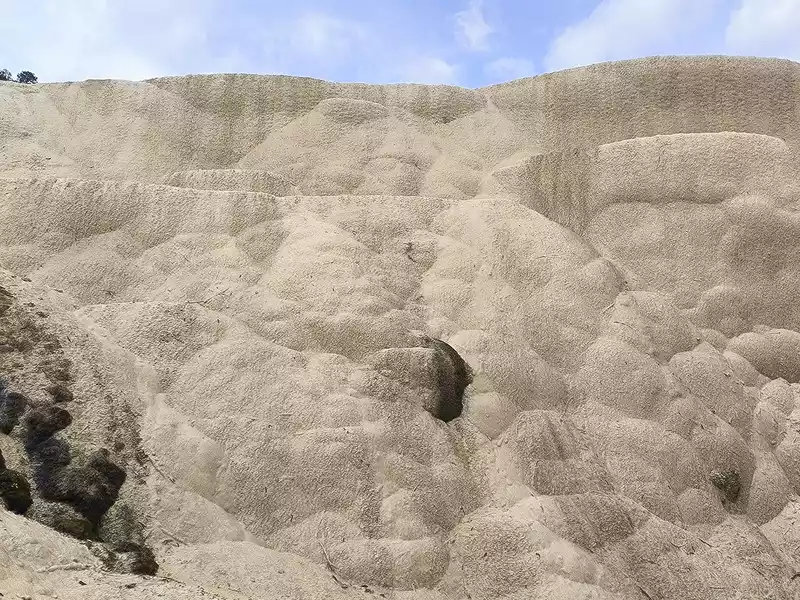 Close-up of the travertine slope
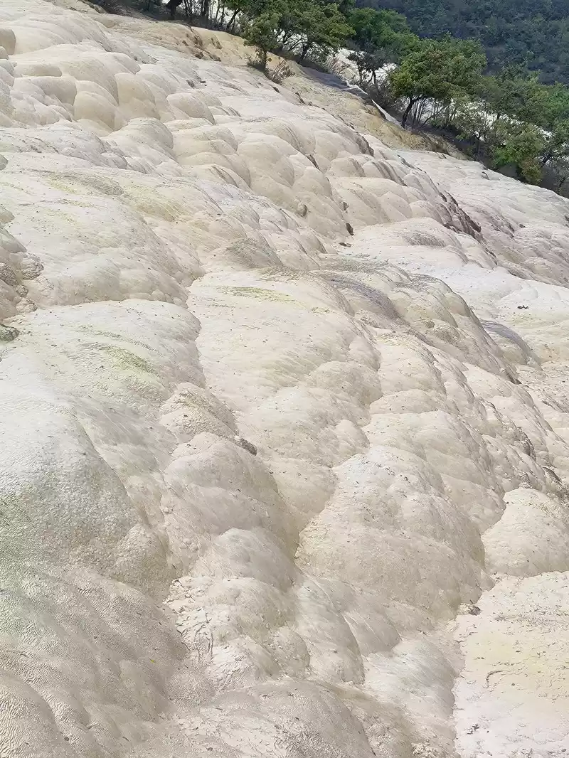 Close-up of the travertine slope
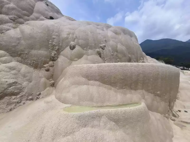 Immortal's Farm
 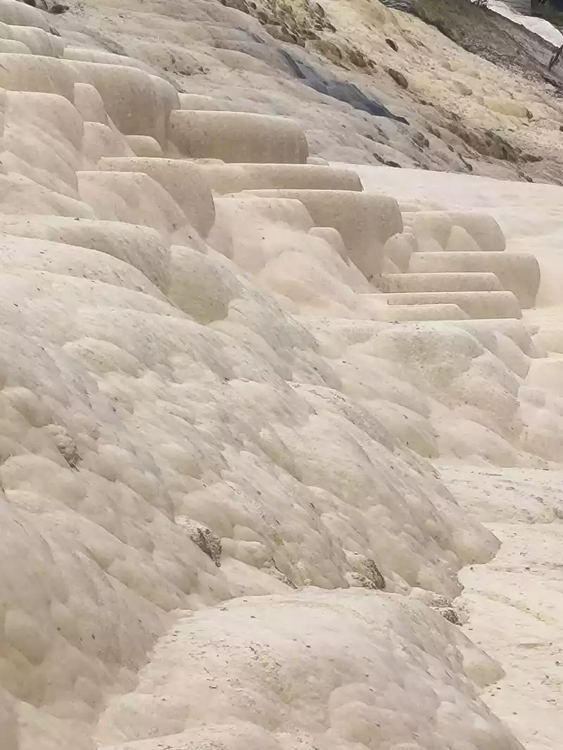 Immortal's Farm
 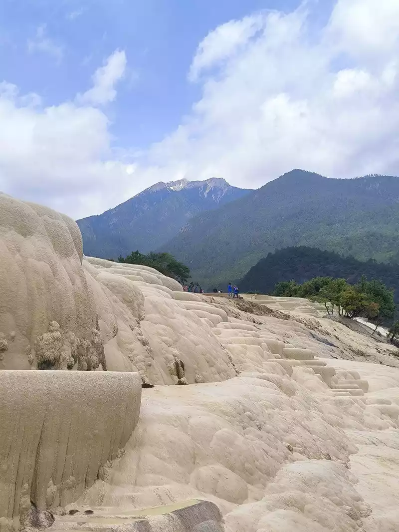 Immortal's Farm
 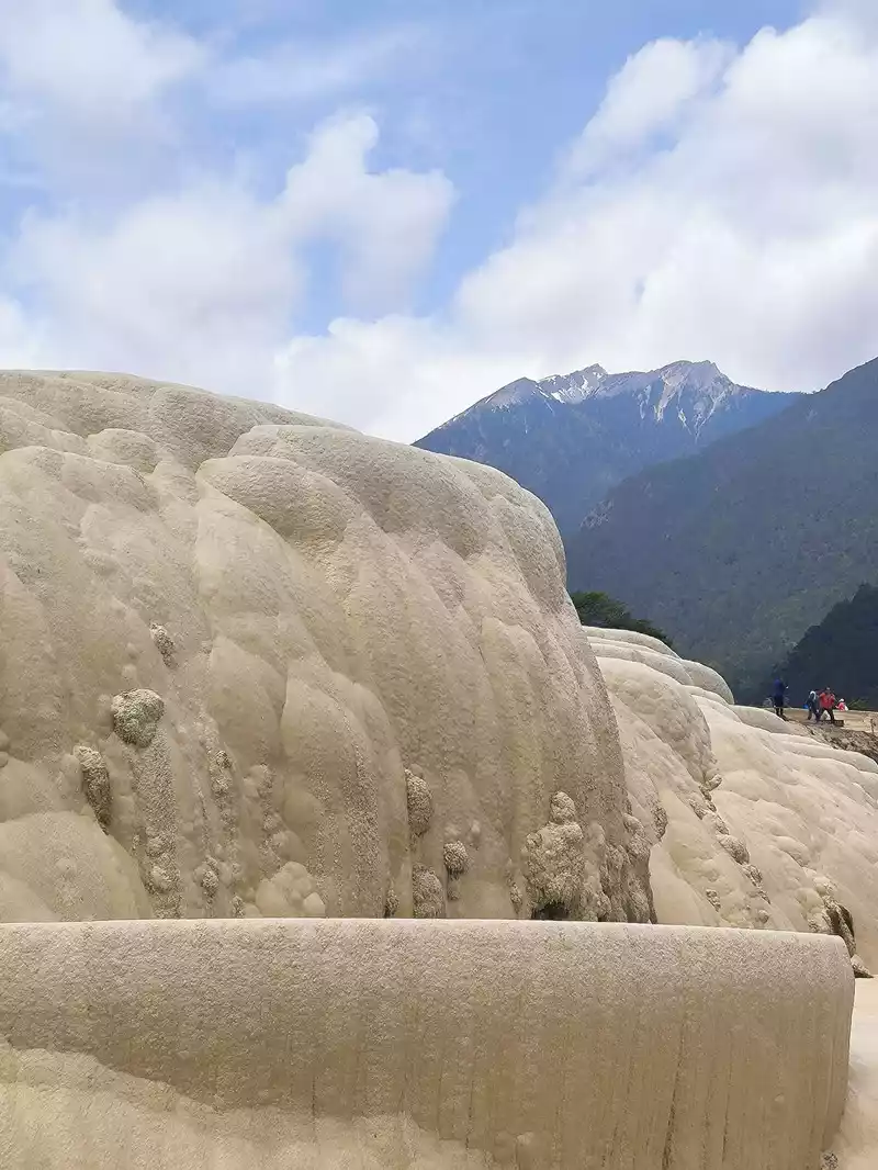 Immortal's Farm
 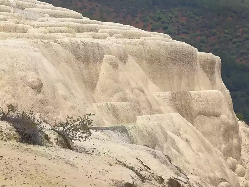 Immortal's Farm
 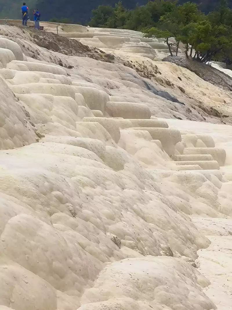 Immortal's Farm
 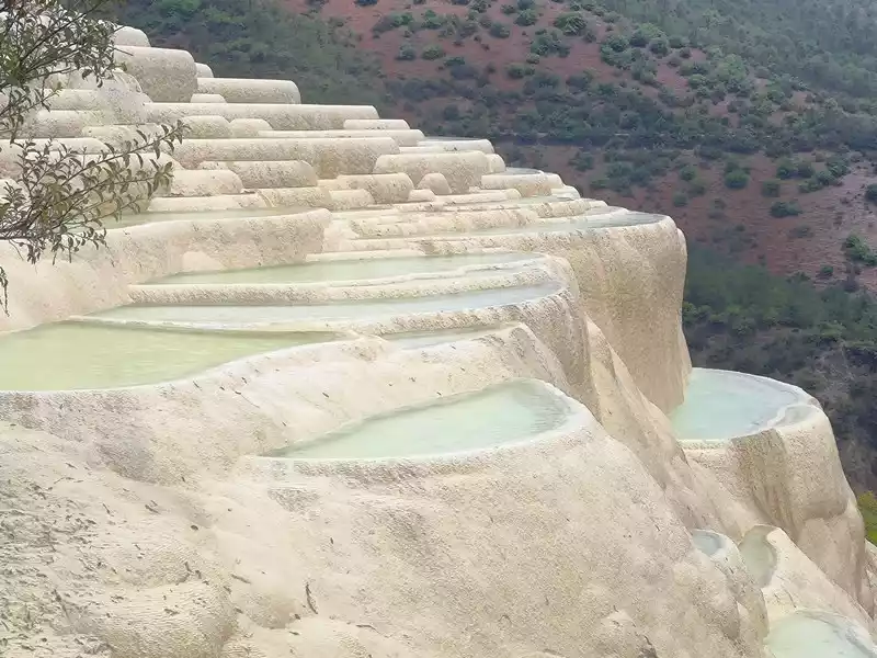 Immortal's Land
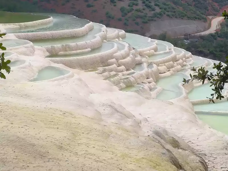
After 20 minutes, you will reach the Five-Colored Fairyland at the top. From above, you can see layers of "terraces", with a height difference of 10-15 cm between each other. From top to bottom, they are stacked layer by layer. It is called the Five-Colored Fairyland, but in fact, the water in this pool is slightly blue and clear to the bottom. This is the most wonderful and essential part of Baishuitai. However, the color of the travertine is yellower than that of Pamukkale in Turkey where we just visited last year. It can barely be called milky white, and the scope of the scenic area is also smaller than that of Pamukkale.
 Five-Colored Yaochi
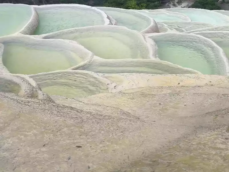 Five-Colored Yaochi
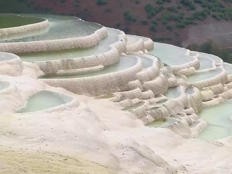 Five-Colored Yaochi Colorful Yaochi
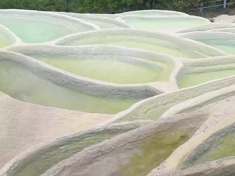 Colorful Yaochi
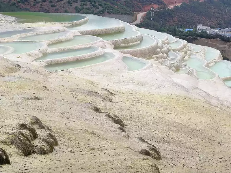 Colorful Yaochi
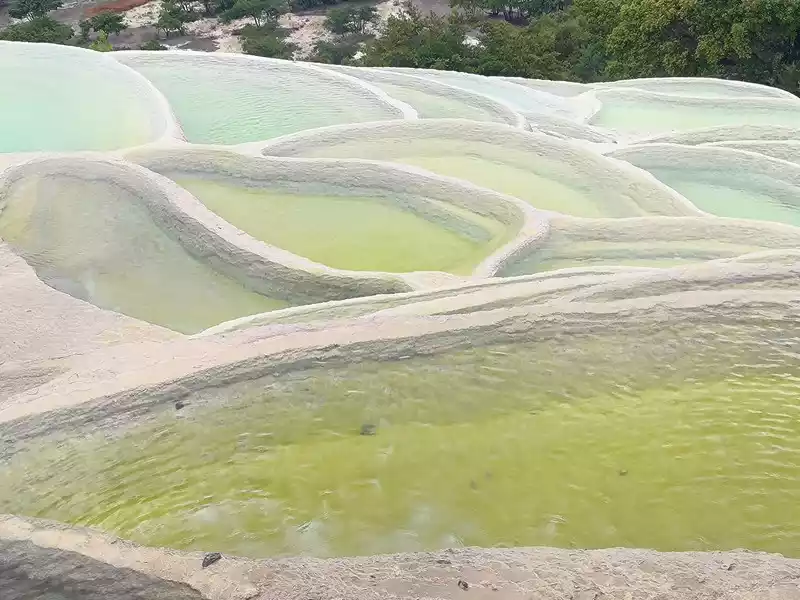 Colorful Yaochi
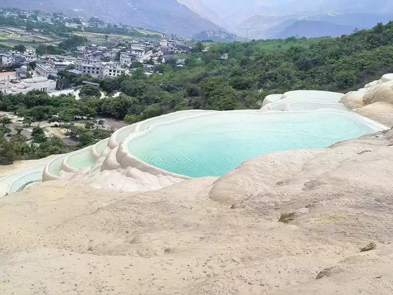 Colorful Yaochi
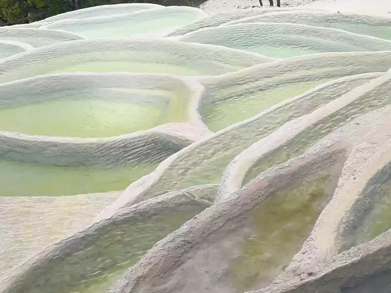 Colorful Yaochi
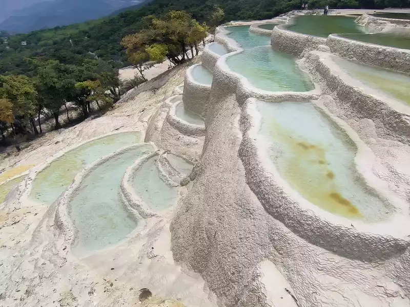 Colorful Yaochi
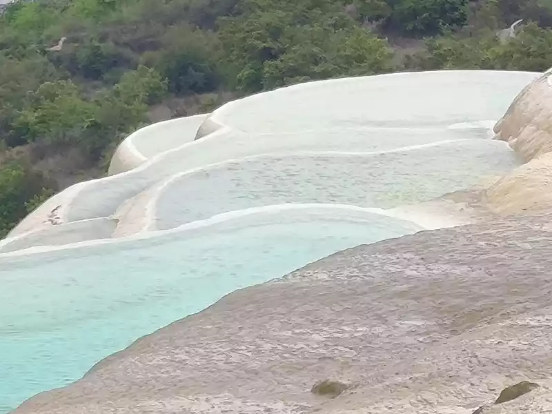 Colorful Yaochi
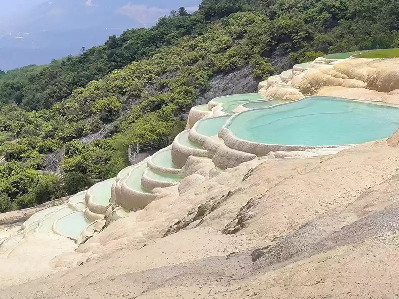 Colorful Yaochi
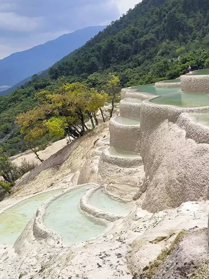 Colorful Yaochi
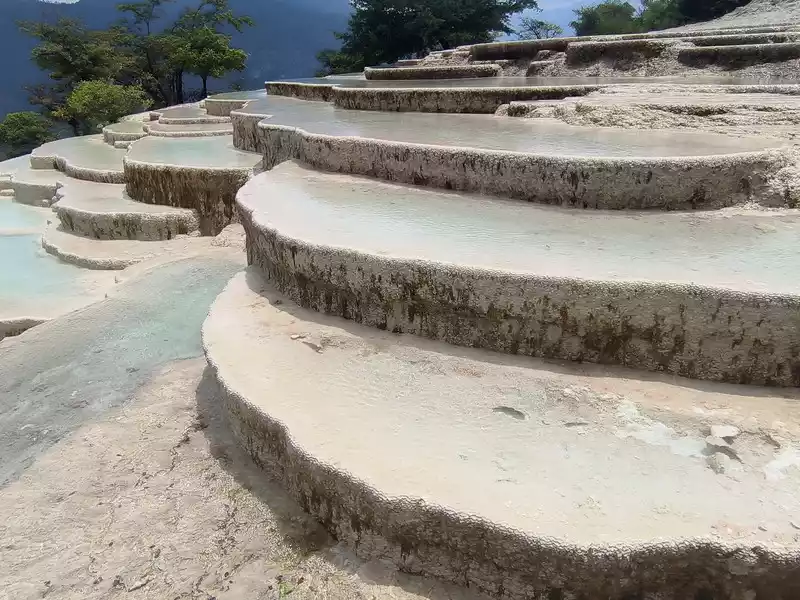 Colorful Yaochi
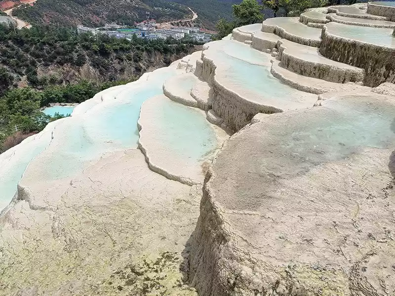 Colorful Yaochi
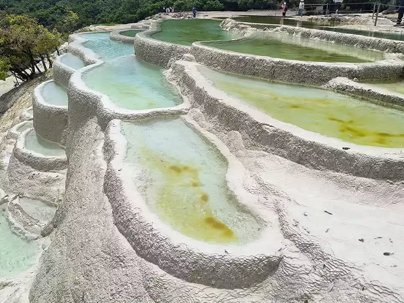 Colorful Yaochi
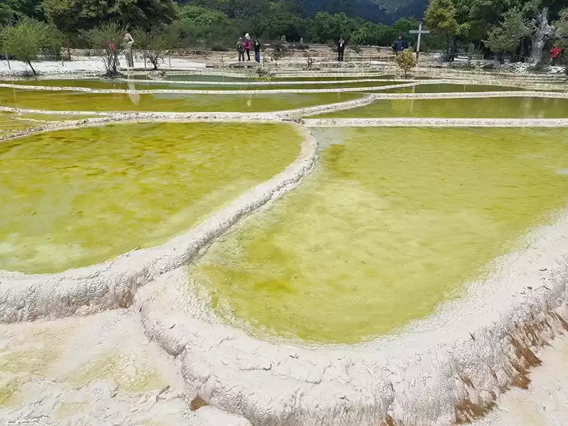 Holy Water Source
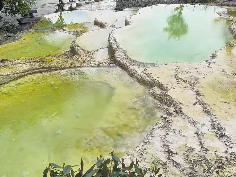 Holy Water Source
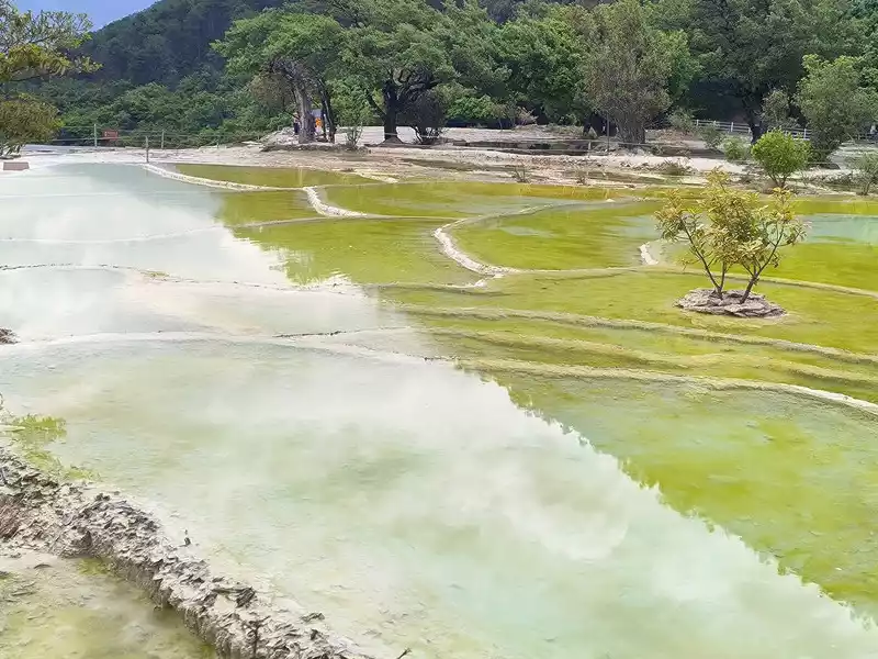 Holy Water Source
 Holy Water Source
 Holy Water Source
 Holy Water Source
 Holy Water Source
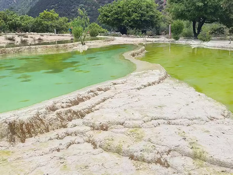 Holy Water Source
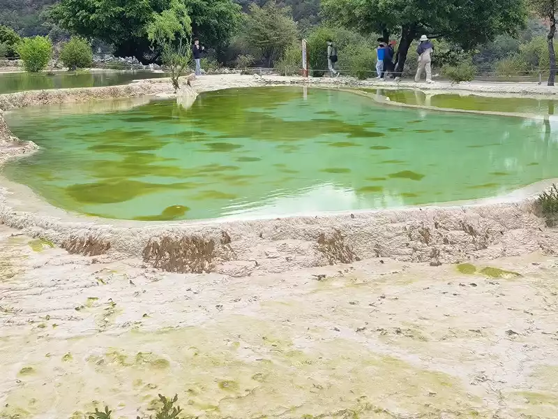 Holy Water Source
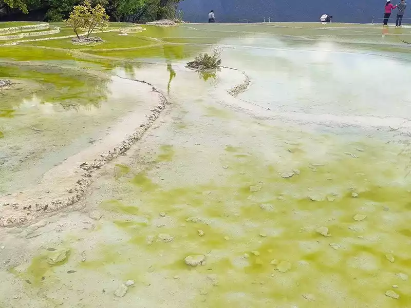 Holy Water Source
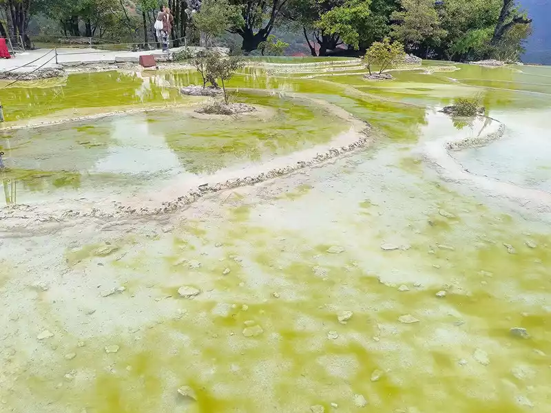 Holy Water Source
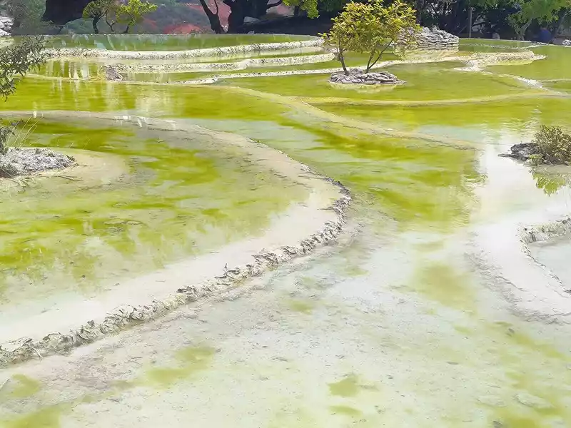 Holy Water Source
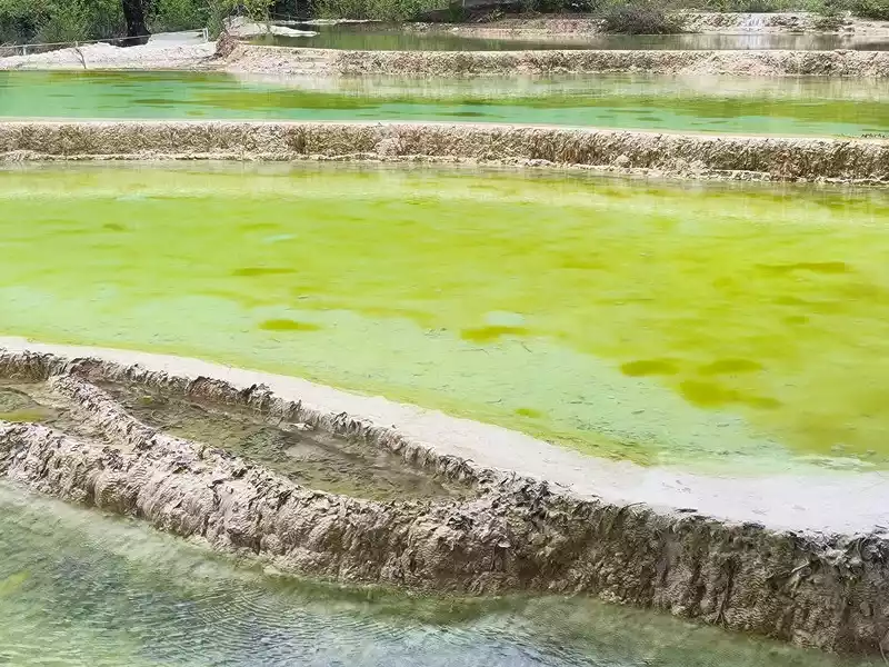 Holy Water Source
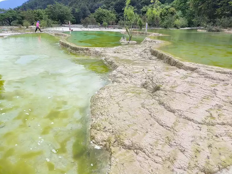 Holy Water Source
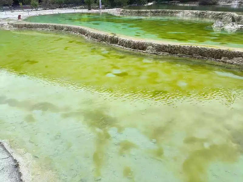 Holy Water Source
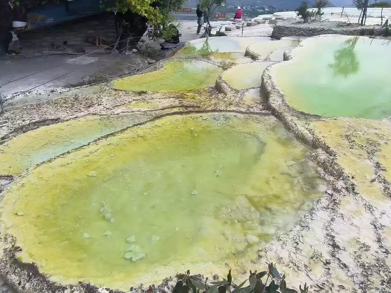 Holy Water Source
The sky was cloudy when we went up the mountain, but it cleared up completely at noon and the sun was shining brightly. At 1 pm, we went down the mountain from the east wooden plank road. On the way, we could see large areas of travertine slopes, but most of them were quite far away. We visited here for more than 2 hours and set off on our return journey at 2:30 pm.
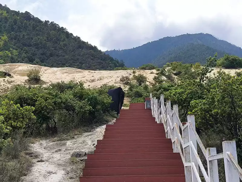 Going down the plank road
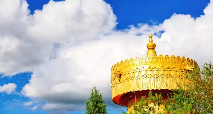
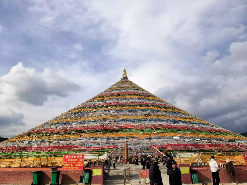
It was still early when we got back to Shangri-La, so we went to the Harmony Tower at the southern end of Shambhala Avenue. Here, you can see the world's largest prayer flag, with a diameter of over 100 meters. Many people come here to check in and take photos, making it another popular check-in spot in Shangri-La. Prayer flags, also known as wind horse flags, are a common and unique landscape in Tibet. They are mostly made of square, angular, or striped cloth. Some are made of linen, silk, and earthen paper. They are usually 10-60 cm long and come in five colors: white, yellow, red, green, and blue.
 Large prayer flags
 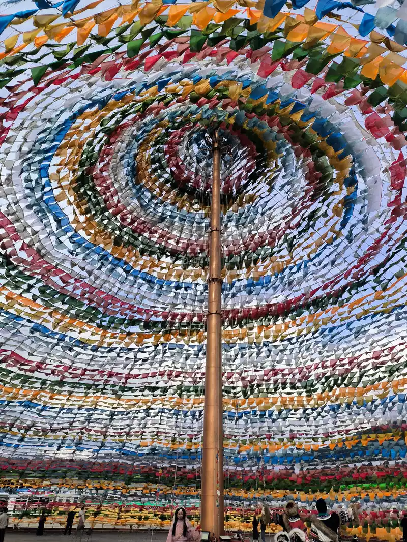 Large prayer flags
 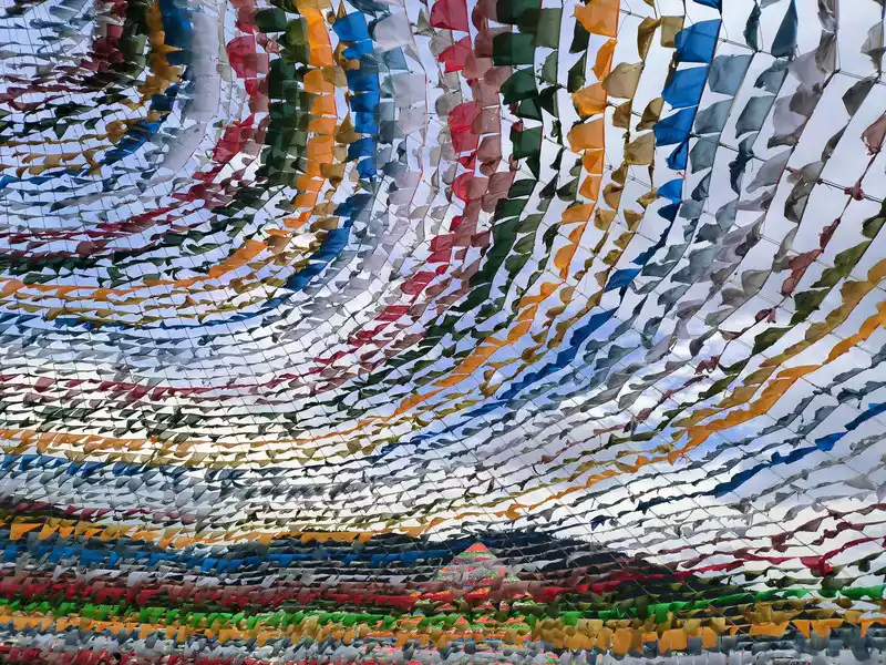 Large prayer flags
 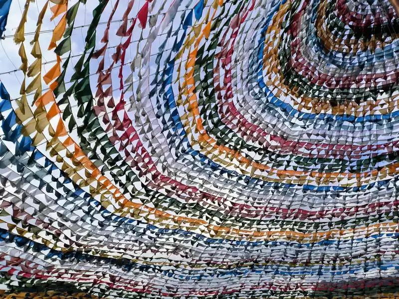 Large prayer flags
 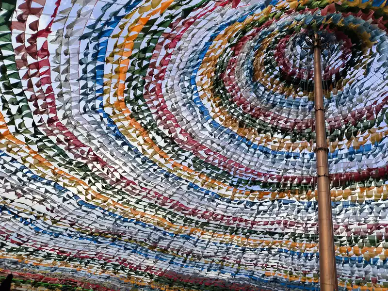 Prayer flags are printed with scriptures, Buddha images, or auspicious designs. Hanging them where the wind blows, each movement of the flags represents a chant, accumulating merit. A female online taxi driver told me that entrance to the large prayer flag area used to be free, but now costs 9 yuan, and that several more large prayer flags are being built nearby. Shangri-La is unique in that many online taxi drivers are female, a rarity in other cities. Large prayer flags
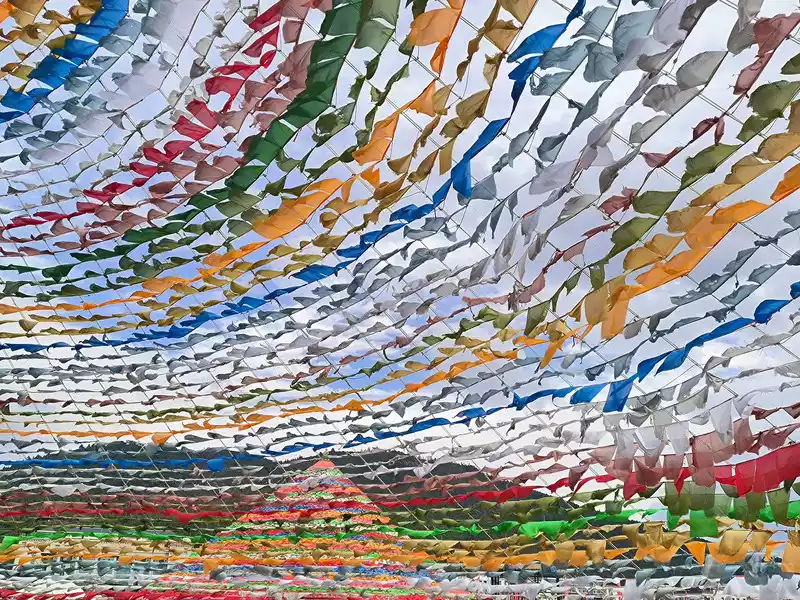 Large prayer flags
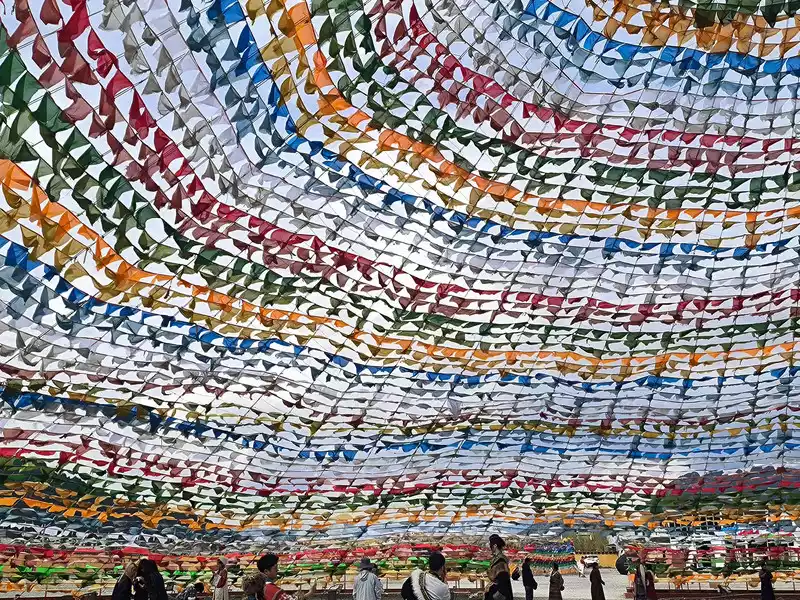 Large prayer flags
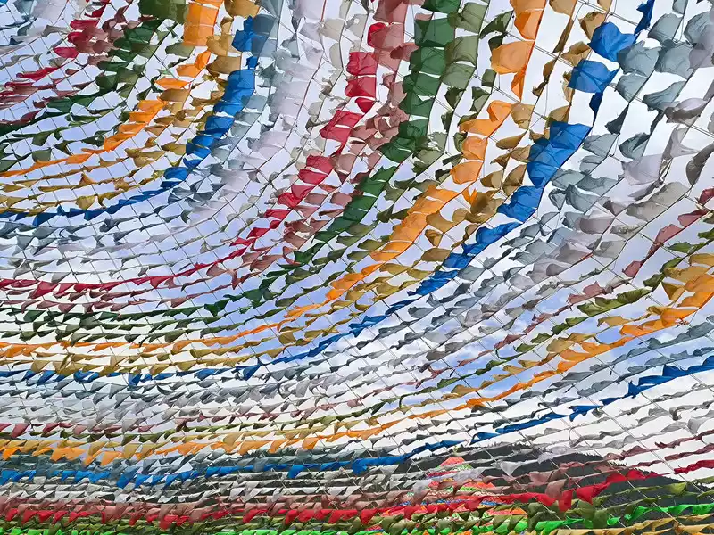 Large prayer flags
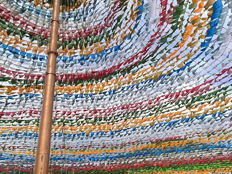 Sutra flag
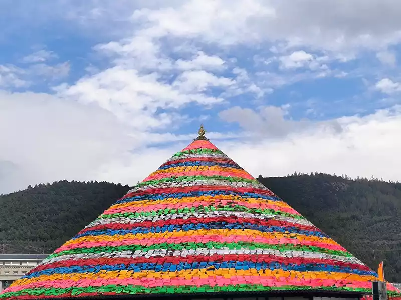 Large prayer flags
&n p; Meili Snow Mountain
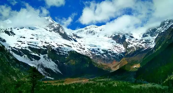
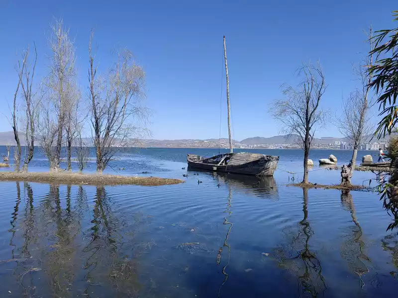
Deqin County is located in the northwest corner of Yunnan Province, at the junction of Yunnan, Tibet and Sichuan provinces. It is located in the "Three Parallel Rivers" area of Jinsha River, Lancang River and Nujiang River. It is the northernmost county in Diqing Prefecture. The Meili Snow Mountain sits on the Yunnan-Tibet border west of Deqin County. Named for the region's abundance of precious medicinal herbs, Meili, a transliteration of the Tibetan word for "Medicine Mountain," is a vast, north-south snow-capped mountain range and Yunnan's most spectacular snow-capped mountain landscape. The Lancang and Nu Rivers flow through the base of the mountains on either side, with the northern section known as the Meili Snow Mountain, the middle section as the Taizi Snow Mountain, and the southern section as the Biluo Snow Mountain. These hundreds of miles of snow-capped peaks cover 34.5% of Deqin County. Thirteen peaks, known as the "Thirteen Peaks of the Prince," rise above 6,000 meters, and the main peak, Kawagebo, rises 6,740 meters. Its towering pyramid-like form is the highest peak in Yunnan. Diqing's terrain is high in the north and low in the south, with its river valleys open to the south. Warm, humid air rising from the valleys meets cold air, making the climate unpredictable. It's said that the Meili Snow Mountain can only be seen a little over 40 days a year, a probability of only one in nine. Meili Snow Mountain is considered one of the four sacred mountains of Tibetan Buddhism, along with Mount Kailash in Tibet, Mount Amnye Machen in Qinghai, and Mount Gaduo Jowo in Qinghai. National Geographic magazine ranked Meili Snow Mountain fourth in its "China Beauty Pageant," a list of the top ten most beautiful mountains. Some online have called it China's most beautiful snow mountain, with Yulong in Lijiang not even half as beautiful. Meili Snow Mountain (Image from the Internet) is ideal for viewing the Meili Snow Mountain during the winter and spring months of October to March, with the best time being in late October when the weather is clear and transparent, and the main peak of Kawagebo is often visible. There are two places to view the Meili Snow Mountain. One is Feilai Temple, 10 kilometers west of the city. This temple was built in the 42nd year of the Wanli reign of the Ming Dynasty (1614 AD), with an altitude of 3,439 meters. The straight-line distance from the main peak of Meili Snow Mountain, Kawagebo, is no more than 6 kilometers. It is the best viewing point closest to the snow mountain and with the widest view. It is famous for its high and far-reaching vision. The platform is wide and has a large capacity. It faces the snow mountain with an unobstructed view. The main peak Kawagebo, Mingyong Glacier and the village at the bottom of the Lancang River Grand Canyon are all in sight; the other is Nongwuding Village, 11 kilometers south of the city, with an altitude of 3,600 meters, slightly higher than Feilai Temple. The vision here is flat and far-reaching, the snow mountain is more majestic, and the peak outline is more obvious. Most tourists come here to see the mountain in winter, but it is 18 kilometers away from the snow mountain, and as its name suggests, the fog here is more frequent and thicker. Feilai Temple and Nongwuding are not far apart in a straight line, but the drive is more than 20 kilometers. Both places have their own advantages and scenic spots, but I found that Shangri-La has a special bus that goes directly to Feilai Temple. For the convenience of transportation, I finally chose the former.
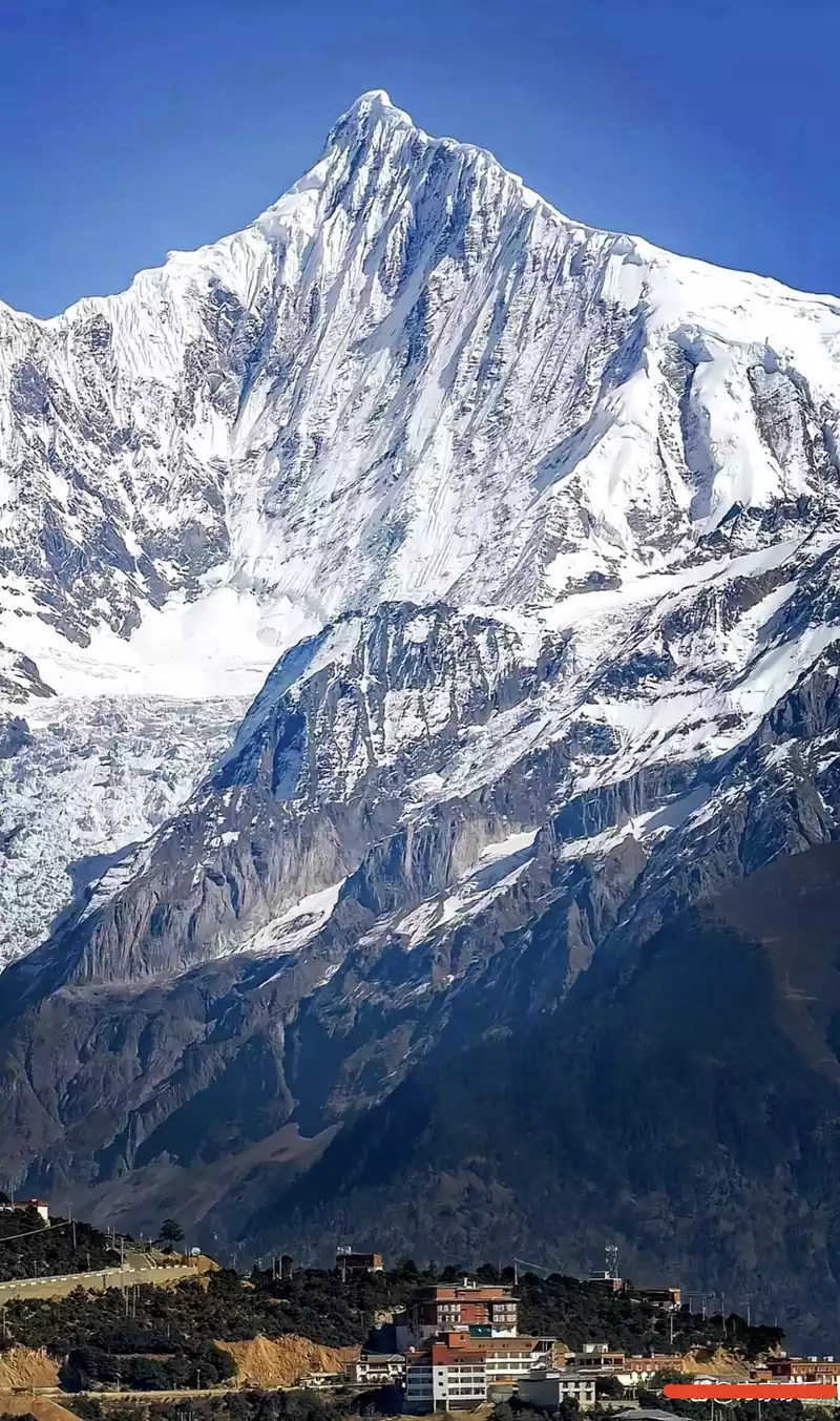 Mount Kawagebo (Internet picture)
 Shangri-La is 180 kilometers away from Feilai Temple. There are many special buses going there every day, which take National Highway 214. The drive takes nearly 4 hours, but there are 3 scenic spots to see along the way: one is He Long Bridge. In May 1936, He Long and Ren Bishi led the Second Corps of the Red Army from Yunnan to Sichuan. They encountered armed resistance from local reactionary forces here. After the victory of the battle, He Long climbed to the Zhanaya Pass and said that when the revolution was victorious in the future, he would build a bridge here to connect the two places. In 1958, the local government built an 85-meter-long steel frame bridge with a span of 75 meters, named the Helong Bridge. The bridge is now abandoned and inaccessible to pedestrians and vehicles. However, the rock military flag on the cliff covers an area of 1,936.6 square meters and has been officially certified by the World Records as the "largest flag built on rock." Helong Bridge
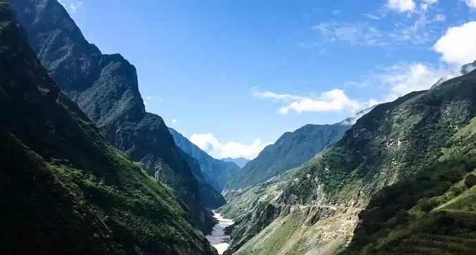
The second is the Jinsha River Bay. The mighty Jinsha River comes from the hinterland of the Tibetan area through mountains and valleys. Here it turns a perfect "Ω" shape around Rizui Peak, creating the symbol of the World Heritage "Three Parallel Rivers" The most beautiful landscape - the first bay of Jinsha River, which is 22 kilometers long and has a 270-degree corner. There are observation decks and rest stops here. Special bus drivers will stop here for 20 minutes to allow tourists to rest conveniently and take photos;
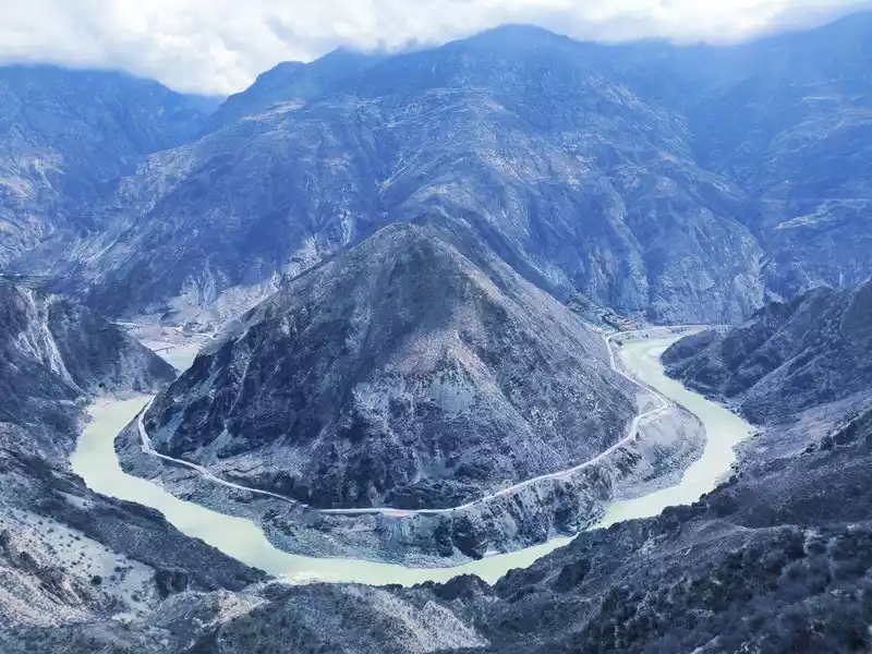 Jinshajiang Dawan
The third is Baima Snow Mountain, with continuous peaks and white snow. Looking from a distance, the main peak covered with snow all year round looks like a galloping white horse, hence the name "Baima Snow Mountain". There are 20 peaks above 5,000 meters above sea level along the route. The main peak, Baima Snow Mountain, is 5,430 meters above sea level, with a relative height difference of more than 3,000 meters. It is now a national nature reserve. Cheli passed by the three-way intersection of Deqin County, where many people got off and went to Yubeng Village.
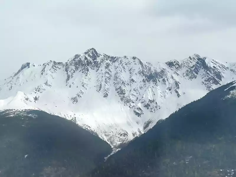 Baima Snow Mountain
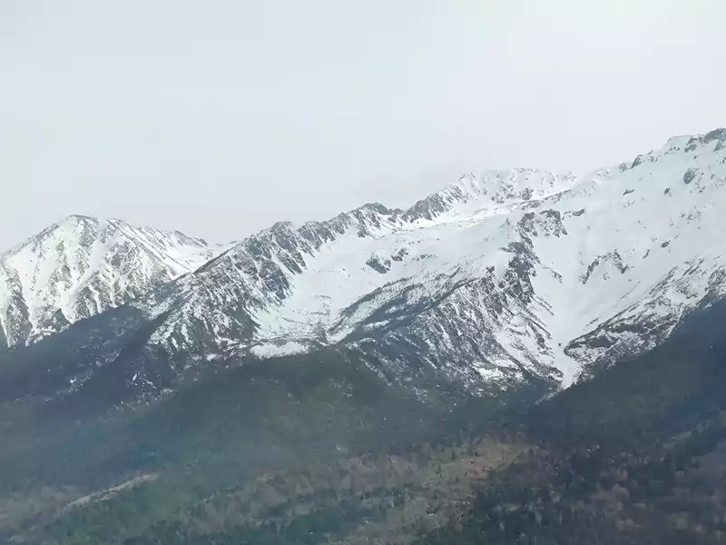 White Horse Snow Mountain
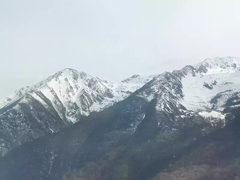 Baima Snow Mountain
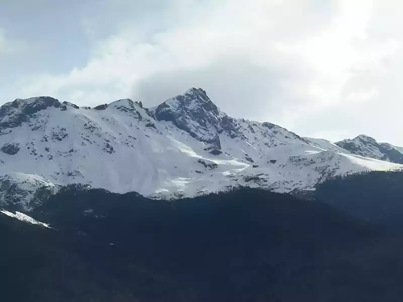 Baima Snow Mountain
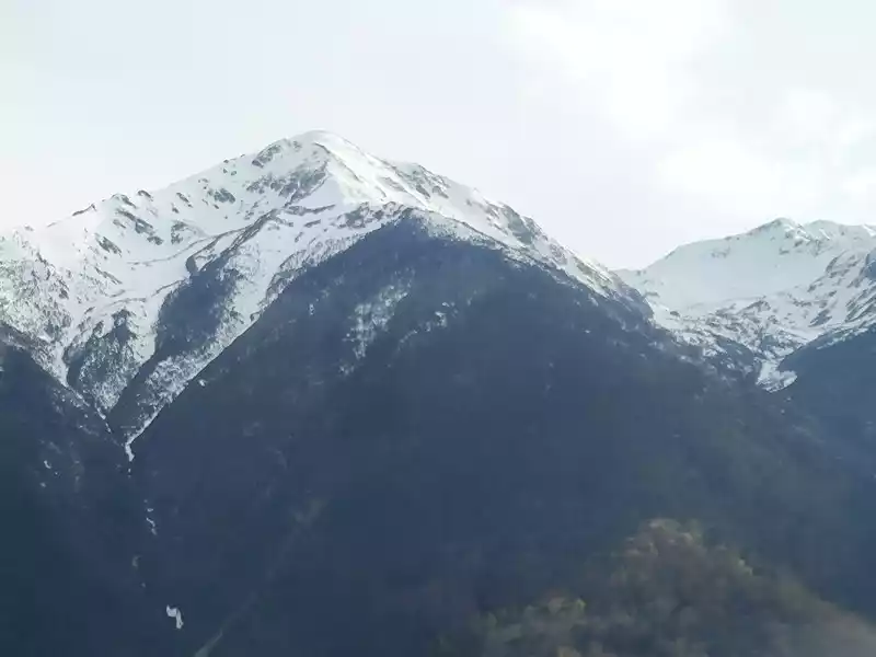 White Horse Snow Mountain
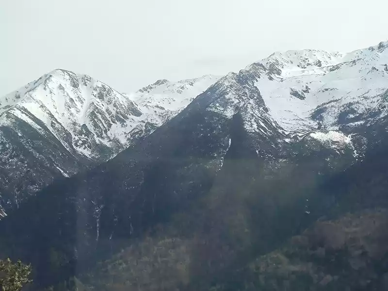 White Horse Snow Mountain
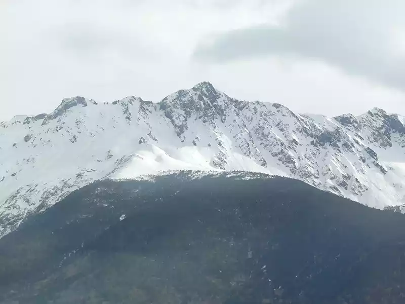 Baima Snow Mountain
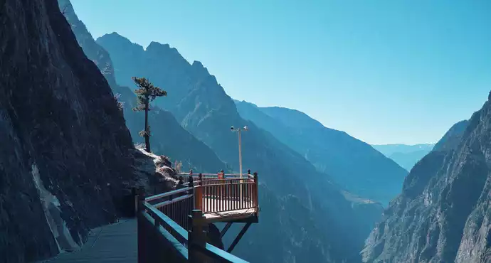
We arrived at Feilai Temple at 1 pm. This is a free attraction. We can see the 8 peaks of Meili Snow Mountain from south to north, 5 of which are above 6000 meters above sea level and the other 3 are between 5000 and 6000 meters. Therefore, there are 8 white pagodas on the large viewing platform. Below is the Lancang River Grand Canyon. Villages at the bottom of the valley are vaguely visible. However, Feilai Temple looks relatively ordinary. It seems to be just a tin house, and tourists are not allowed to enter.
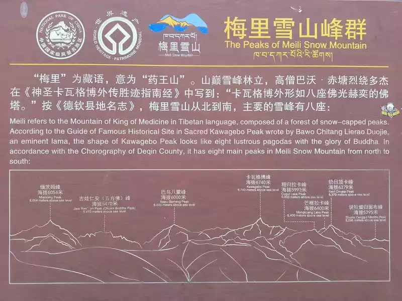 Introduction to the 8 Peaks of Meili Snow Mountain from the Observation Deck
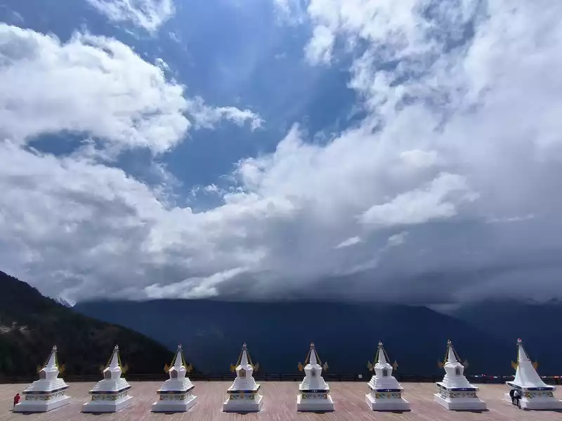 8 white towers on the observation deck
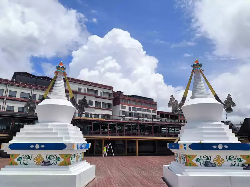 White Tower at the Observation Deck
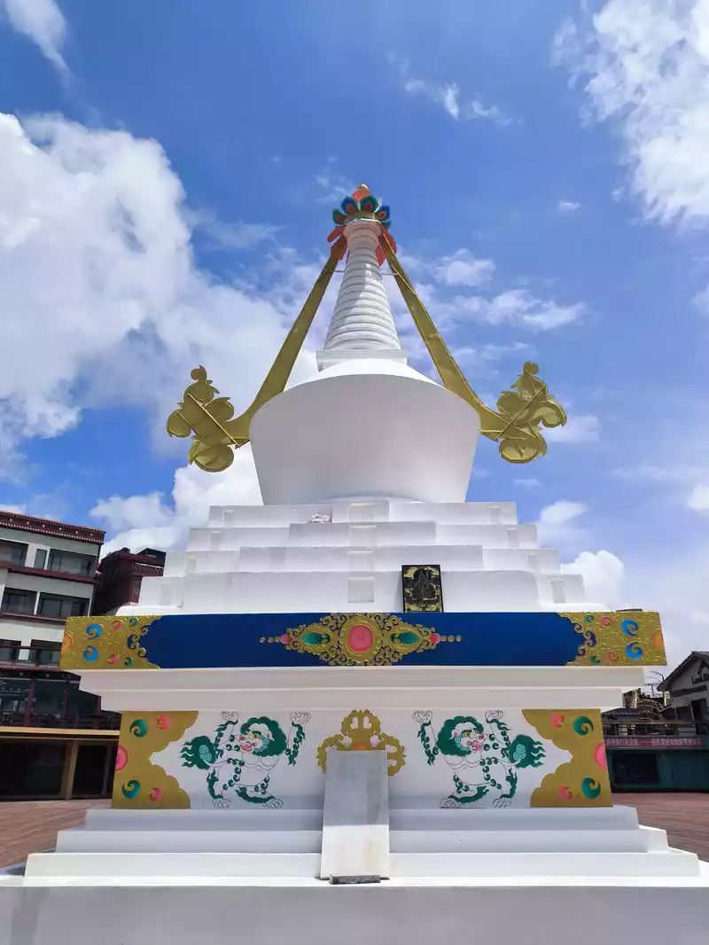 White Tower at the Observation Deck
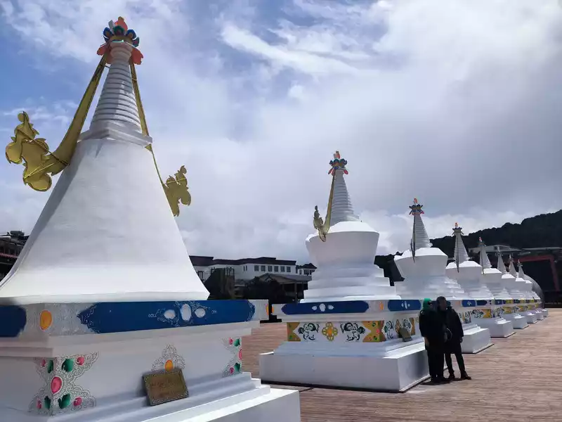 8 white towers on the observation deck
 Lancang River Grand Canyon
 Feilai Temple
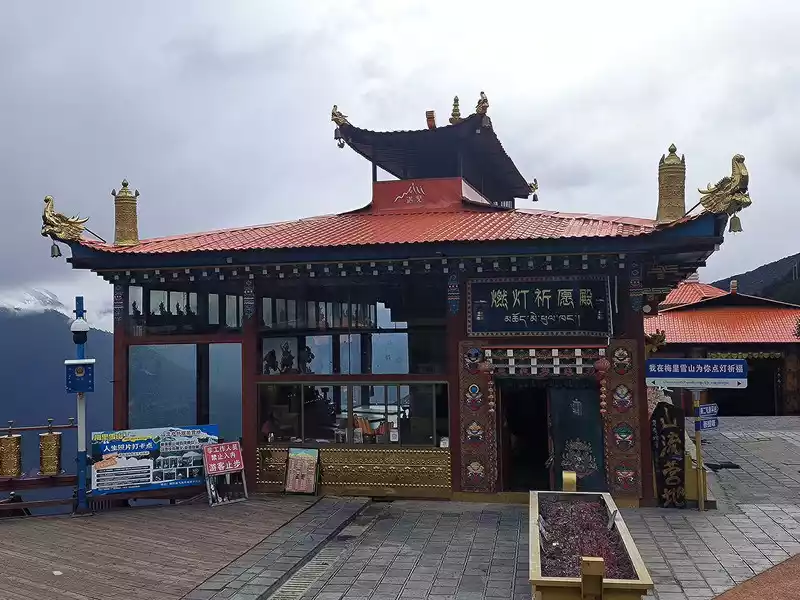 Feilai Temple
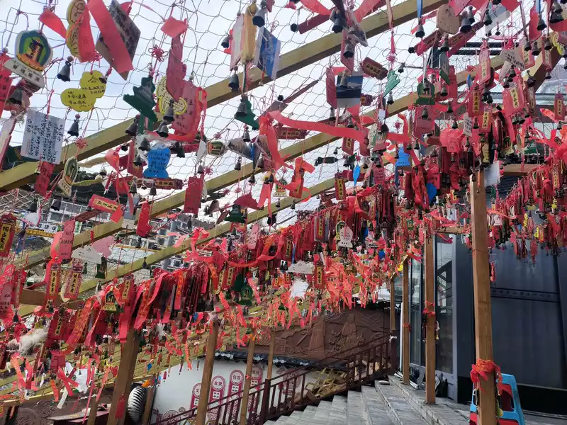 Feilai Temple
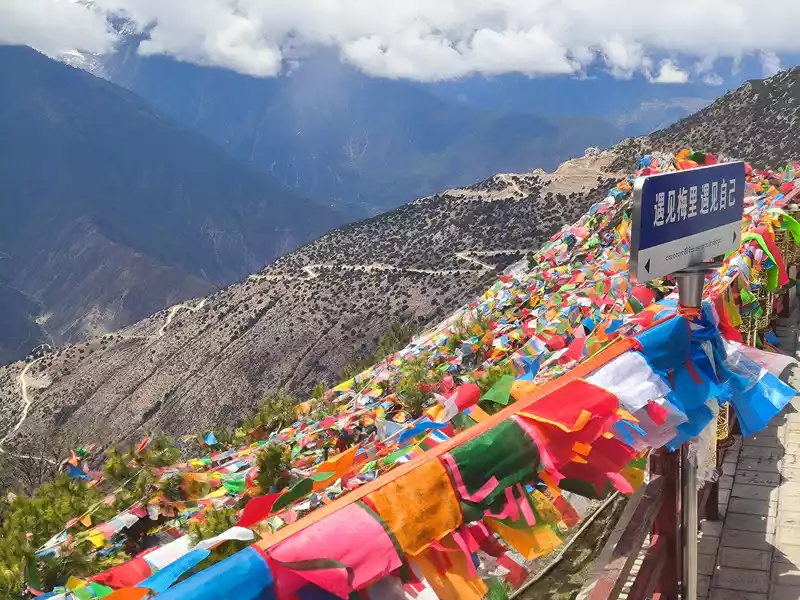 Feilai Temple
Although there were white clouds and blue sky above, Meili Snow Mountain was always covered by clouds and fog and refused to show up, and the mountain wind was biting on the observation deck. We could only wait in the restaurant for more than 2 hours. After 4 pm, Meili Snow Mountain and Mingyong Glacier finally revealed their true colors. At 4:30 pm, we set off on our way home, and it was already past 8 pm when we returned to Shangri-La.
 Above are white clouds and blue sky
 Above are white clouds and blue sky
 Opposite is the cloud cover
 Opposite is the cloud cover
 梅里雪山渐露真容
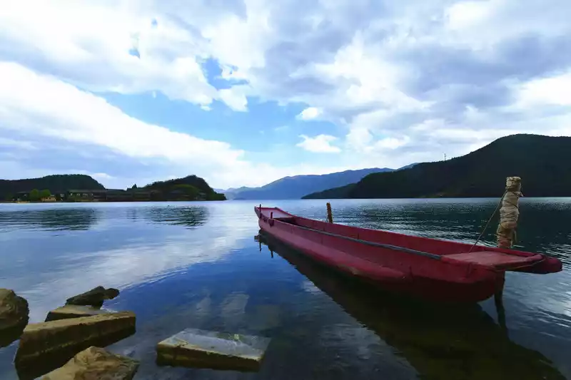
&n bsp;&nbs p; ;普达措
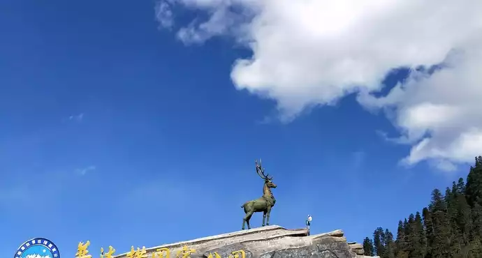
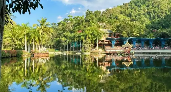
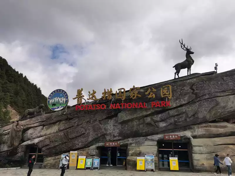
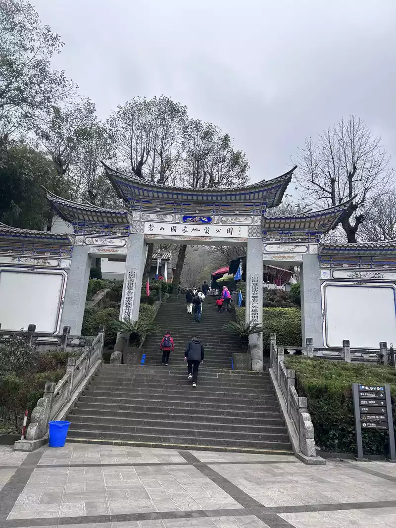
Pudacuo Forest Park is located 22 kilometers east of Shangri-La City, with an altitude of 3500 meters to 4159 meters. Among them, Pudacuo means "zhou lake" in Tibetan. It has lakes and wetlands, forest meadows, rare animals and plants, etc. The original ecological environment is well preserved. It is an important part of the world natural heritage "Three Parallel Rivers" and is mainly composed of two eco-tourism areas, Bitahai and Shudu Lake. I visited Pudacuo 20 years ago. It was snowing and the meadows were all yellow. This was my second visit. What I focused on was the first national park title it claimed. The concept of a national park originated from the United States. It is different from a strict nature reserve and a general tourist attraction. , but refers to natural areas delineated by the state that require special protection, management and utilization in order to protect the integrity of one or more typical ecosystems and provide venues for ecotourism, scientific research and environmental education. In 1872, the United States established the world's first national park, Yellowstone National Park.
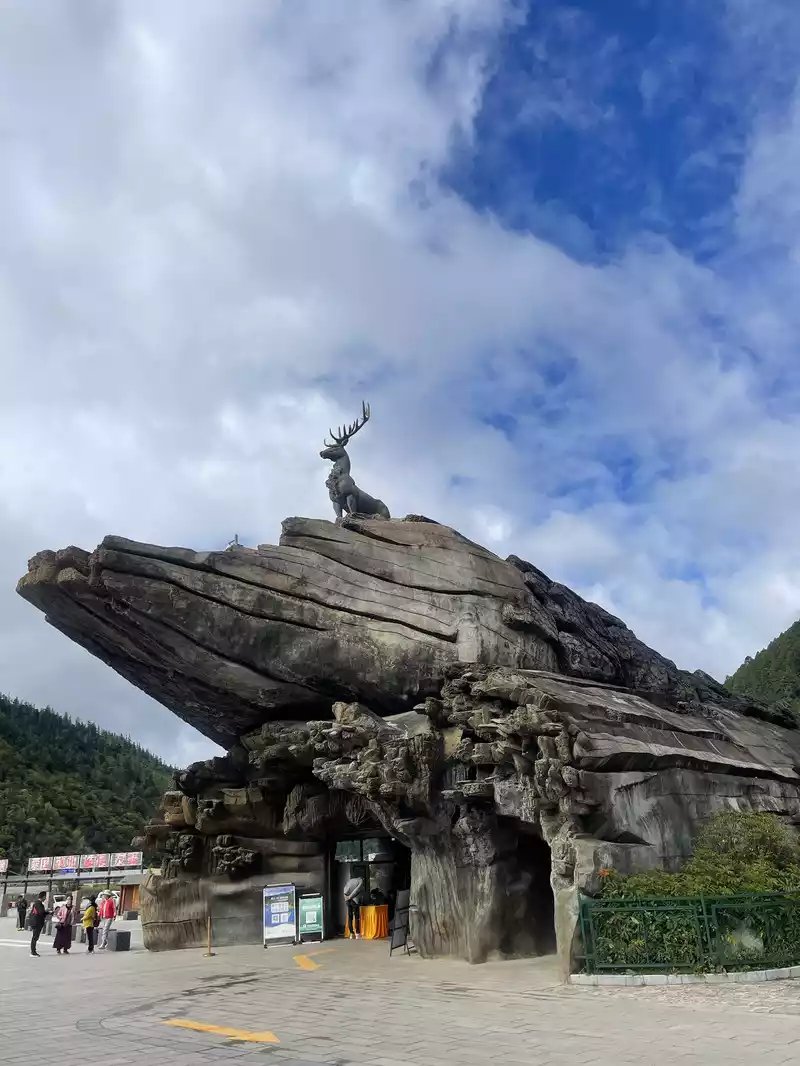
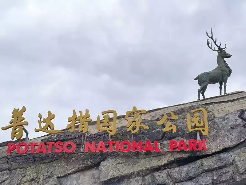 Entrance to Pudacuo Forest Park
In 2006, Diqing, Yunnan passed local legislation to establish Shangri-La Pudacuo National Park and claimed it to be China's first national park. In June of the following year, the Secretary of the Yunnan Provincial Party Committee and the governor came to unveil the park. However, the local legislature did not have the authority to approve a national park, so Pudacuo should not be regarded as China's first national park. Park, therefore, the title of Pudacuo, the first national park, is not worthy of its name. In fact, my country started relatively late in this regard. In 2008, the Ministry of Environmental Protection and the National Tourism Administration approved the construction of China’s first national park pilot—Heilongjiang Tangwanghe National Park. The park is located at the southern foot of the Xiaoxing’an Mountains and includes the Tangwang River Original Forest Area and the Tangwang River Stone Forest Area. In March 2014, with the approval of the Ministry of Environmental Protection and the Tourism Administration, Xianju County in Taizhou City and Kaihua County in Quzhou City, Zhejiang Province became one of the first two national park pilot counties. Therefore, these two places are currently regarded as the most official national parks in China. In October 2021, the first batch of national park lists was announced, with 5 places including Sanjiangyuan, Giant Panda, Siberian Tiger and Leopard, Hainan Tropical Rainforest, and Wuyi Mountain selected.
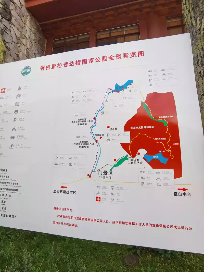
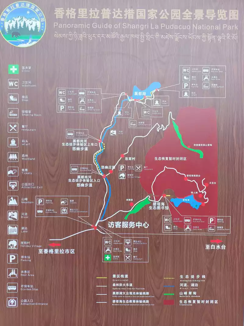 Schematic map of Pudacuo Forest Park
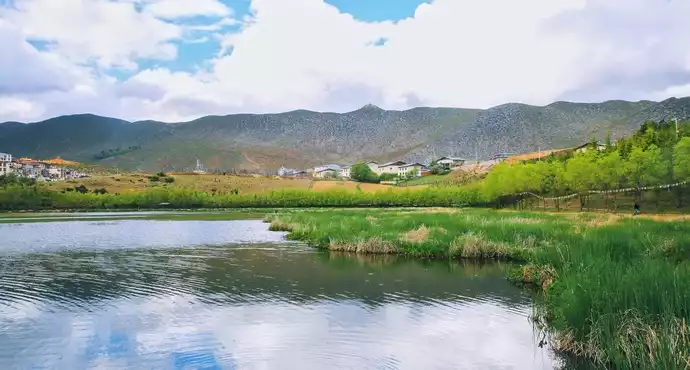
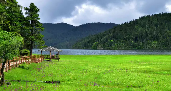
Transportation from Shangri-La city to Pudacuo is convenient. Special buses leave every half an hour. After entering the park, we took the scenic bus to Shudu Lake. "Shi" means cheese in Tibetan and "Du" means stone. Together they mean "cheese is as strong as stone". The lake covers an area of 120 hectares, with an average water depth of 20 meters and an altitude of 3595 meters. It is the highest lake in Yunnan Province and is surrounded by lush green mountains.
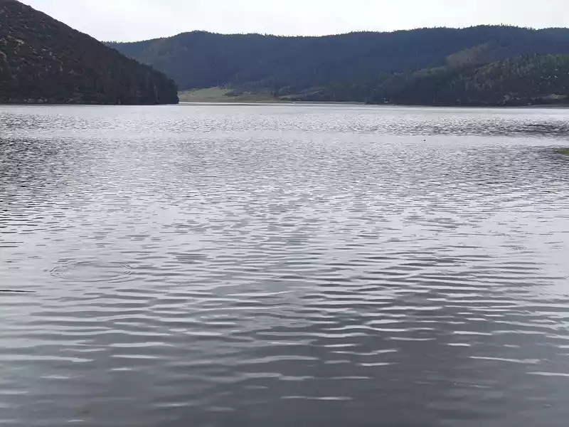 Shudu Lake
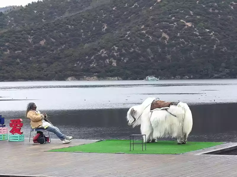 Shudu Lake
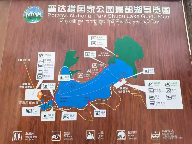 Schematic diagram of Shudu Lake
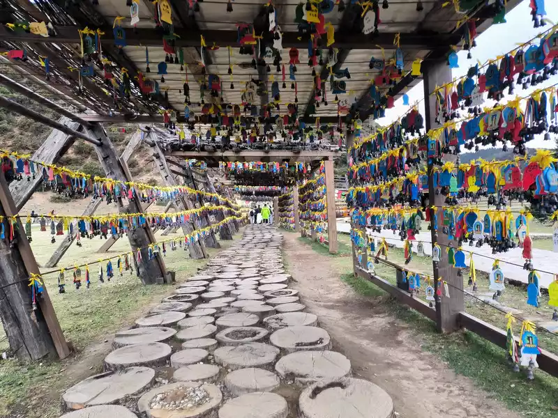 Shudu Lake
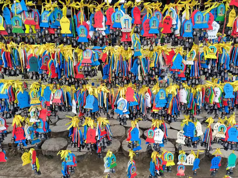 Shudu Lake
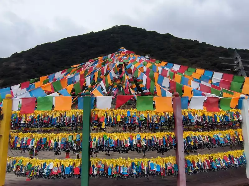 Shudu Lake
The primeval forest blocks out the sky and the sun. The spruce and fir trees are tall and strong, pointing straight into the sky. The squirrels under the trees by the lake do not shy away from people. The trees are hung with fluttering light green silk objects - usnea, which is a favorite food of Yunnan golden monkeys, so it is called the forest with long beards. There are many dead trees and old roots on the east bank. It is said that the drying of the bank foundation caused by the lake water has caused the tree trunks to die. This is a natural phenomenon. Shudu Lake is known as "the world's hiking holy land". It took us 2 hours to basically circle the lake.
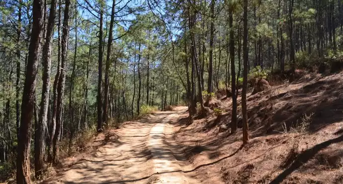
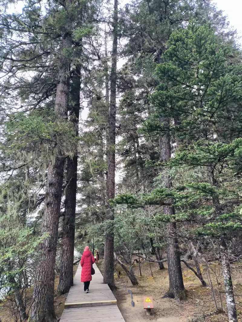 Lakeside Forest
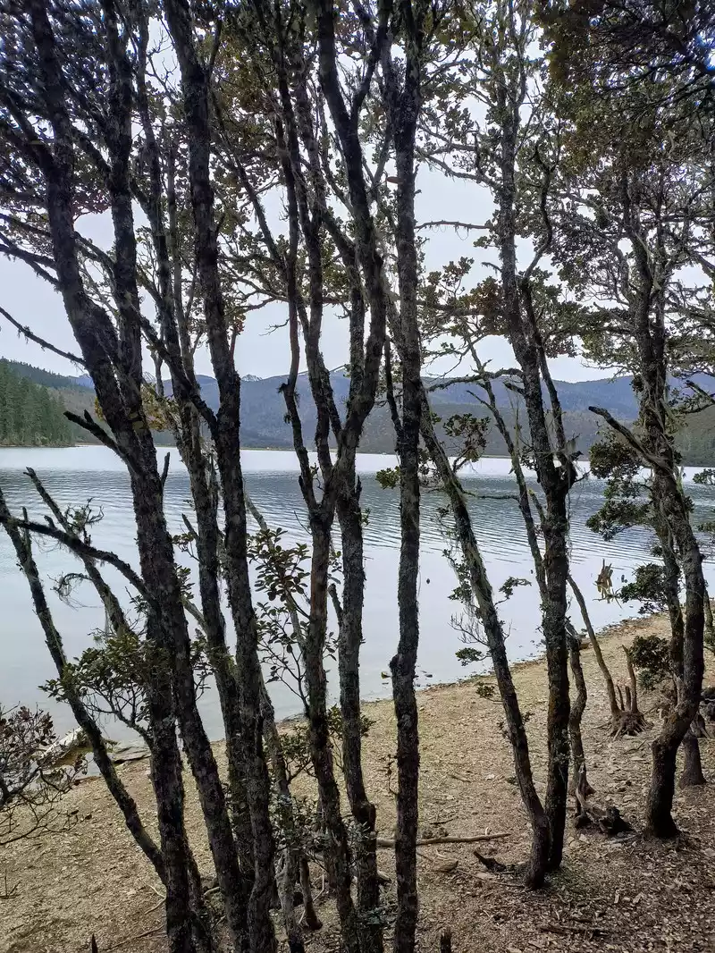 Lakeside Forest
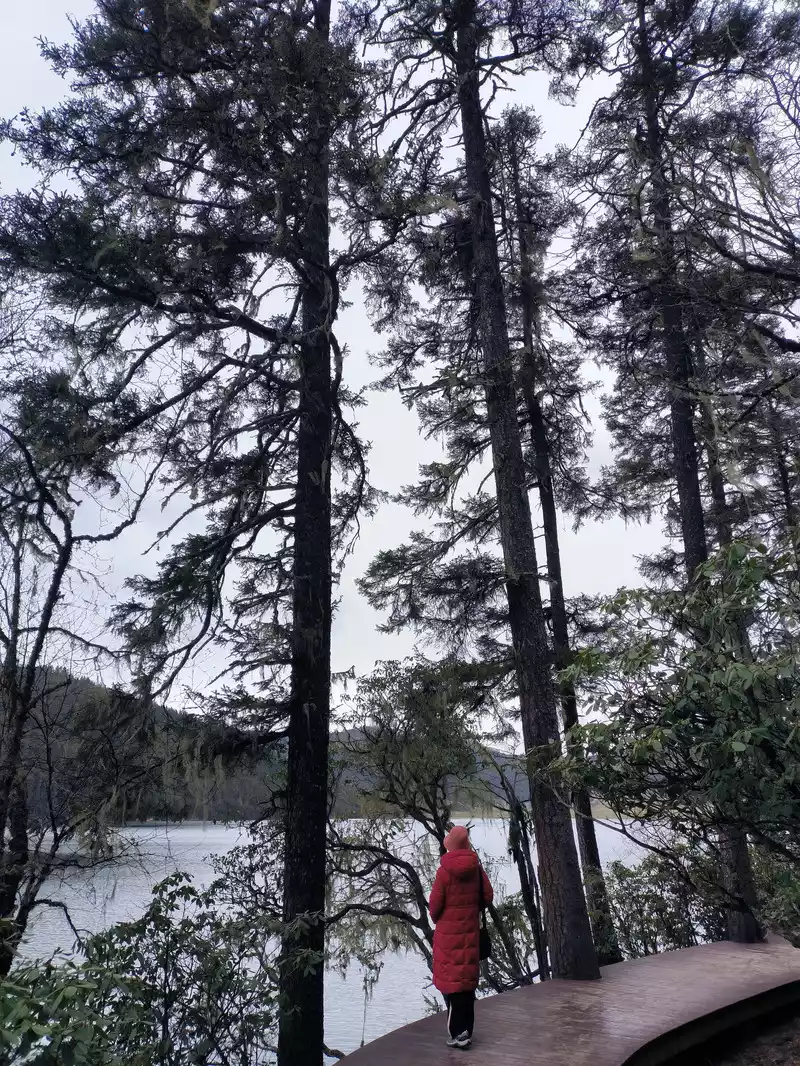 Lakeside Forest
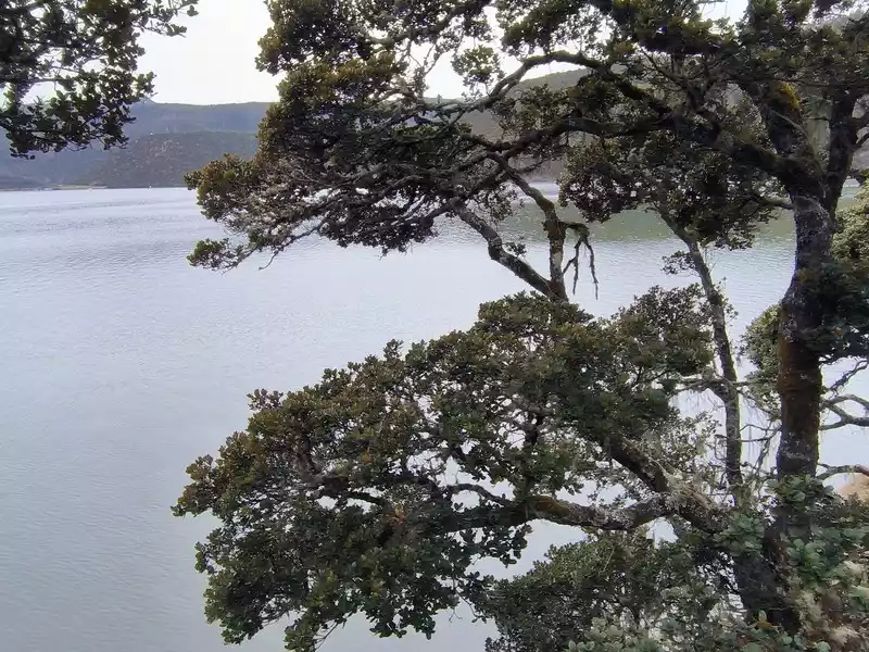 Lakeside Forest
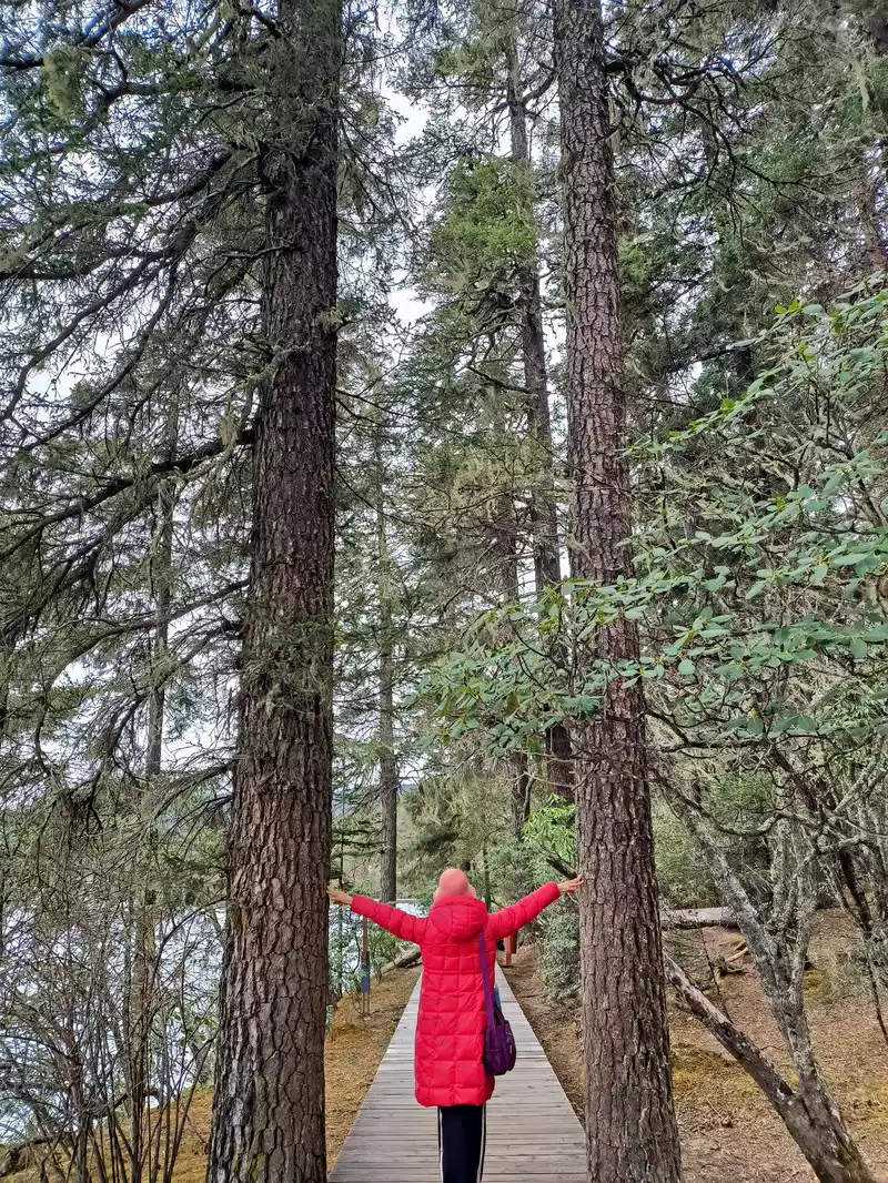 Lakeside Forest
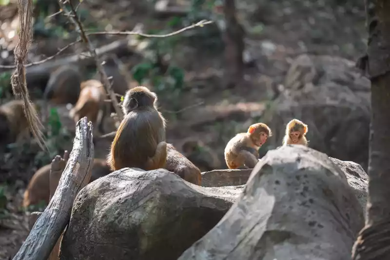
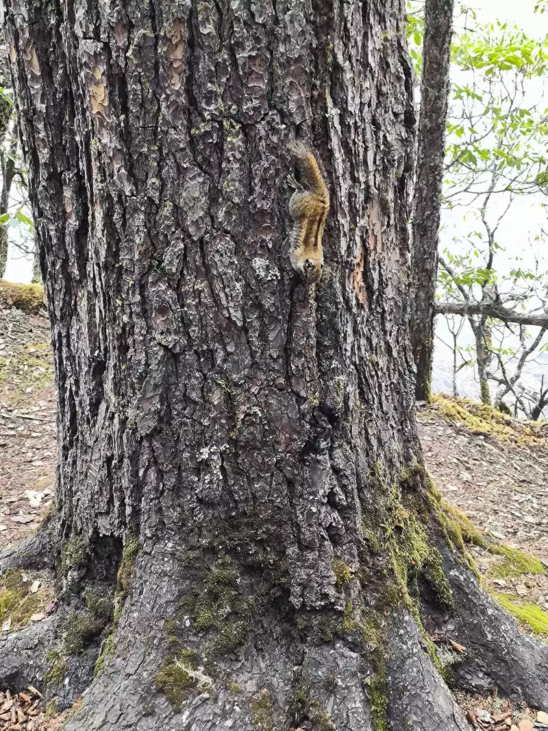 Squirrel under the tree
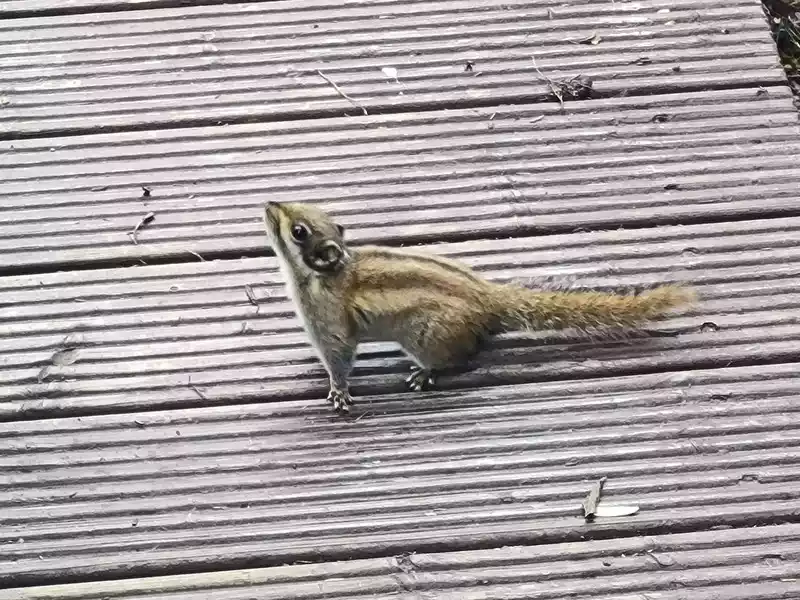 Squirrel under the tree
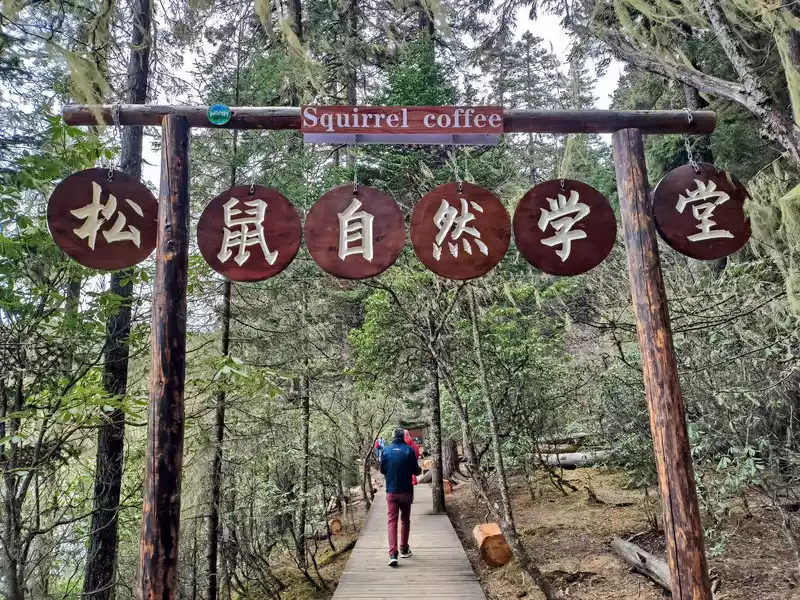 Squirrel Academy
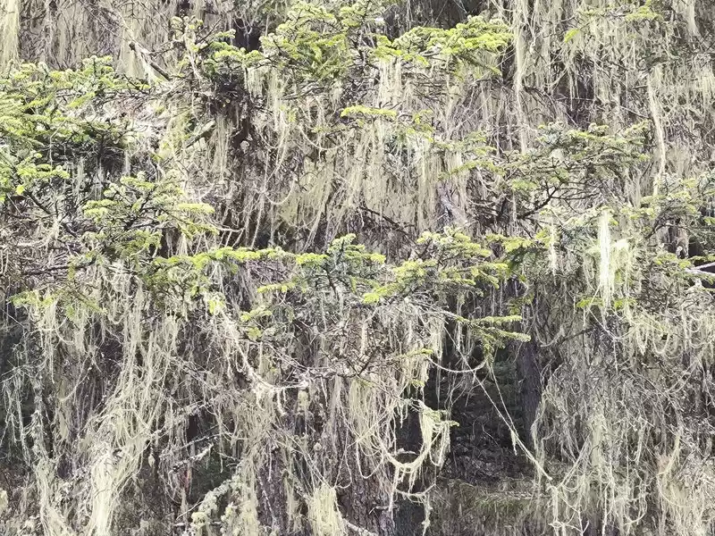 Usnea longa
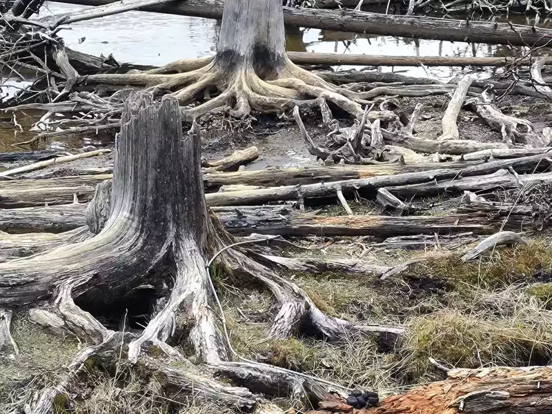 Lakeside dry roots
 Hiking Holy Land
At 1:00 pm, we took a scenic bus to Bita Lake, which is more than ten kilometers southeast. "Bita" in Tibetan means "a place full of oak trees". The water area is 159 hectares, and the altitude is slightly lower than Shudu Lake. The blue water in the lake is The Tachung-lip fish has three lips. May is the season when azaleas are in full bloom. The petals fall into the water one after another, attracting fish. After the fish eat the petals, they become drunk and float on the water. This is the so-called "Azalea Drunken Fish".
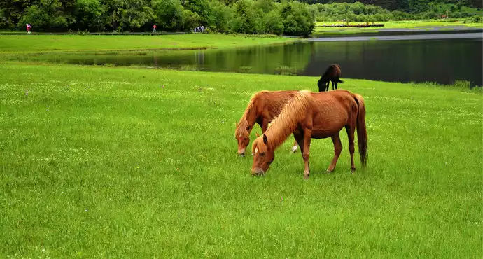
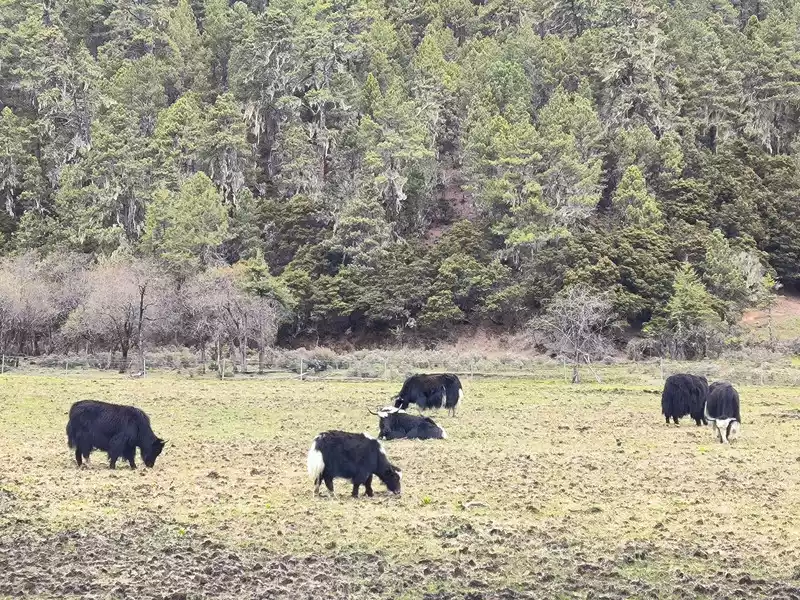
 Forest, meadow, yak
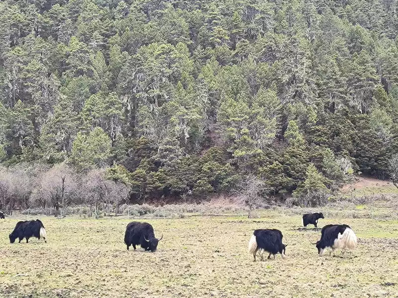 Forest, meadow, yak
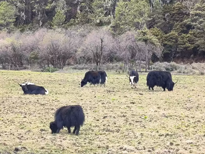 Forest, meadow, yak
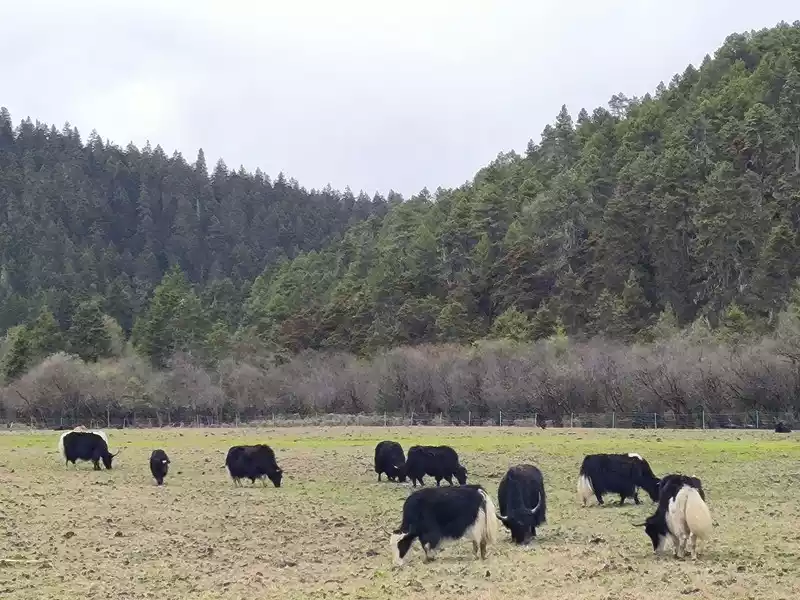 Forest, meadow, and yaks
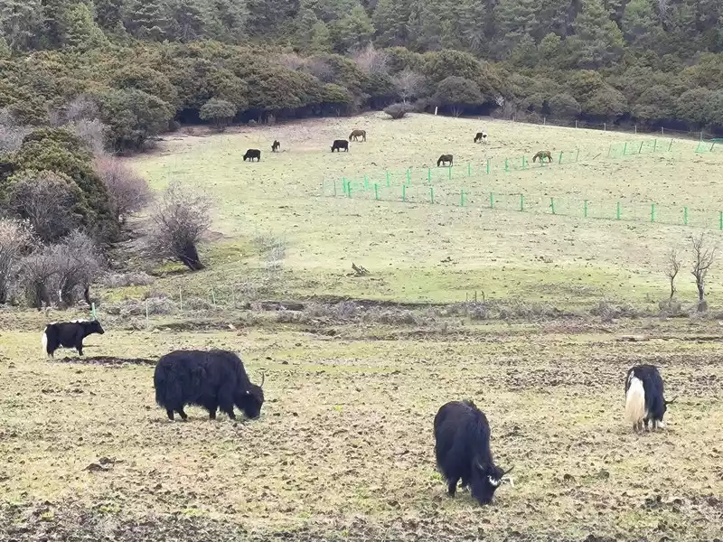
But it’s not the season of spring yet, and the rhododendrons haven’t bloomed yet, so we can’t see the unique sight of “cuckoo fish”, and the Bita Lake area is not open to tourists due to ecological restoration. Along the way, we mainly see forests, meadows, and yaks. It’s still a bit chilly, and the grassland has just sprouted some green buds. After more than 40 minutes, we returned to the same route.
 Forest, meadow, yak
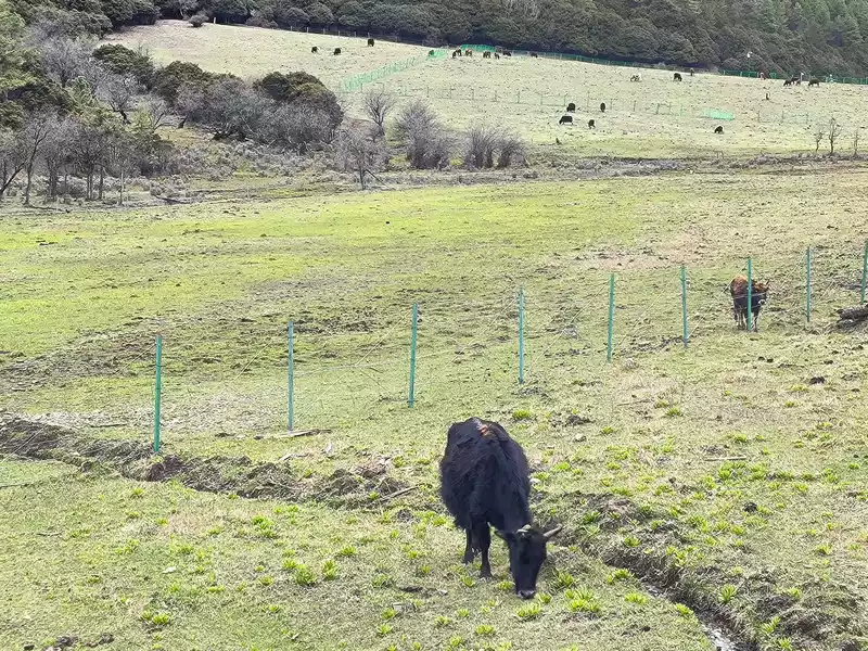 Forest, meadow, yak
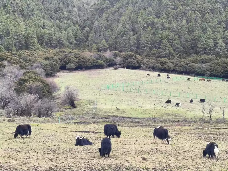 Forest, meadow, yak
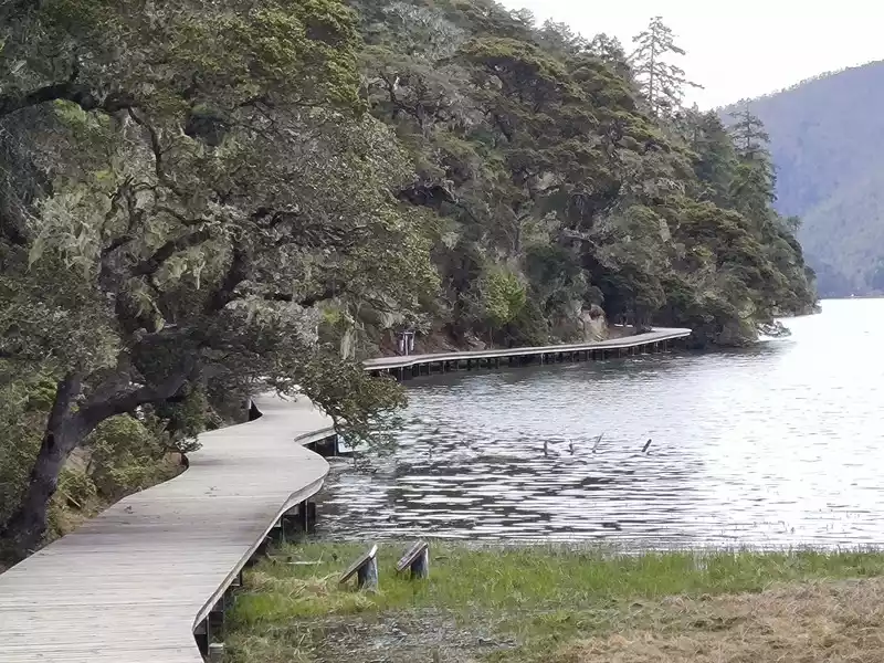 Entrance to Bita Lake Plank Road
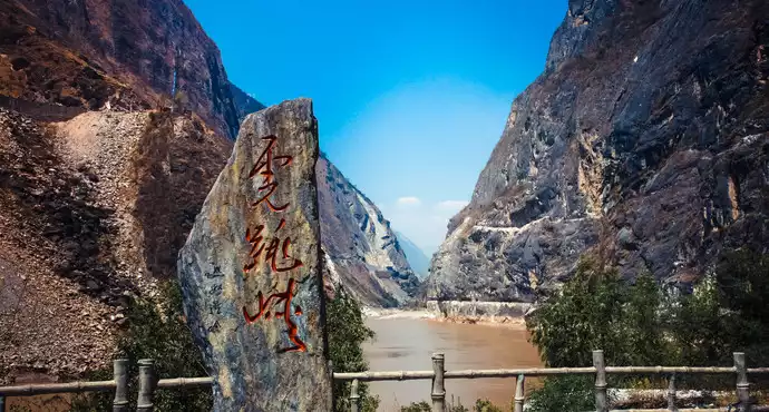
Leave Pudacuo at 2:30 pm, return to Shangri-La and go to the train station. Before arriving, the weather forecast said that there would be rain and snow in Shangri-La for 4 days, but in fact we did not encounter any rain or snow. There are still several scenic spots in Shangri-La that we have not visited. One is the Tiger Leaping Gorge at the junction of the south and Lijiang, which is twice as far as Baishuitai. There are 3 buses going there every day, but 20 years ago we I have already been there; the second is the Balagezong Canyon in the north, about 97 kilometers away from Shangri-La City, which is almost half of the Meili Snow Mountain. There is only one bus a day; the third is the Napa Sea in the northwest suburbs of the city. You can take the No. 12 bus to circle the lake, and you can also go to the Meili Snow Mountain and back. However, the Napa Sea is a seasonal lake, it is a grassland in April and May, and it becomes a lake during the rainy season in June. We took the high-speed train back to Kunming at 5:30 p.m. The next day we went to a nearby express station to send all our winter clothes home, and then packed lightly and headed for southeastern Guizhou.
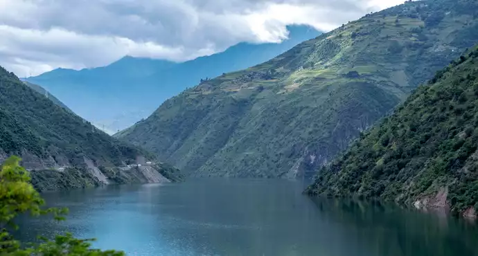
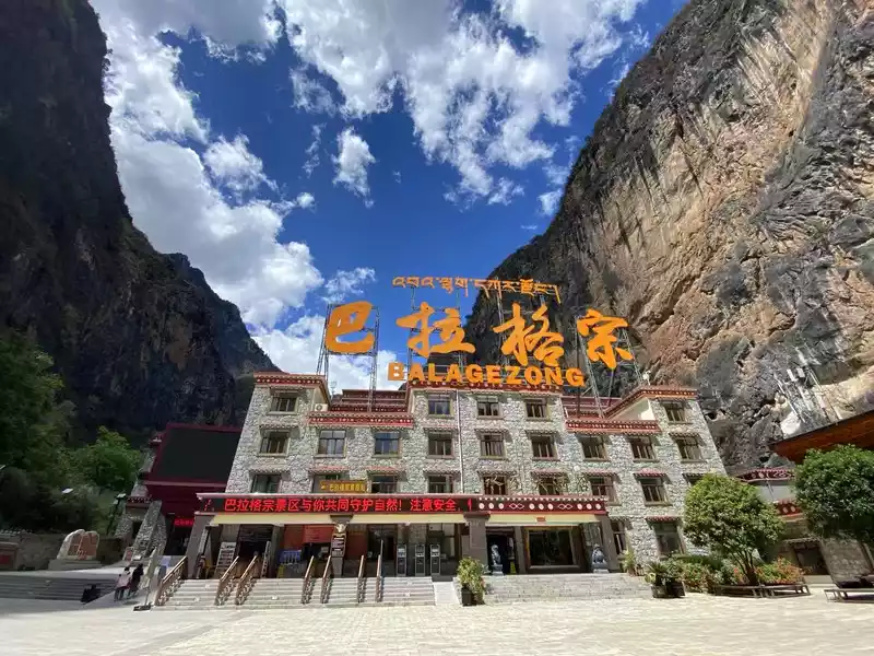 Balagezong Canyon
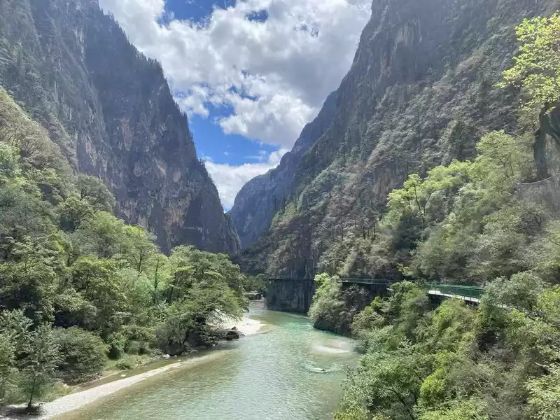 Balagezong Canyon
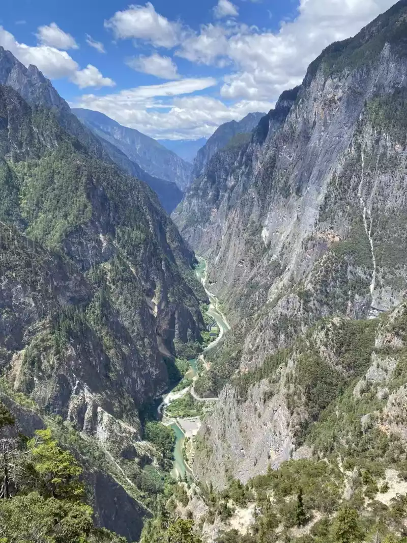 Balagezong Canyon
(To be continued, please stay tuned)
Number of days:6 days, Average cost: 4800 yuan, Updated: 2024.03.05
Number of days: 8 days, Average cost: 4000 yuan, Updated: 2021.03.15

Number of days: 12 days, Average cost: 2400 yuan, Updated: 2025.05.11

Number of days:28 days, Average cost: 11,500 yuan, Updated: 2023.04.22

Number of days:3 days, Average cost: 1,000 yuan, Updated: 2023.02.28
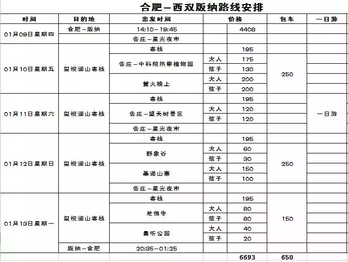
Number of days: 5 days, Average cost: 4500 yuan, Updated: 2021.02.23